Dhangadhi
| Dhangadhi Sub Metropolitan City धनगढी उपमहानगरपालिका Dhangadhi | |
|---|---|
| Sub-Metropolitan City | |
|
City at a Glance | |
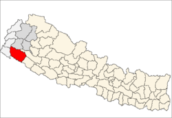
 Dhangadhi Sub Metropolitan City Location in Nepal | |
| Coordinates: 28°41′N 80°36′E / 28.683°N 80.600°ECoordinates: 28°41′N 80°36′E / 28.683°N 80.600°E | |
| Country |
|
| Region | Far Western Development Region |
| Zone | Seti Zone |
| District | Kailali District |
| Area | |
| • Total | 231.53 km2 (89.39 sq mi) |
| Elevation | 109 m (358 ft) |
| Population (2011 Census) | |
| • Total | 137,666 |
| • Density | 590/km2 (1,500/sq mi) |
| Time zone | NST (UTC+5:45) |
| Post code | 10900 |
| Area code(s) | 091 |
| Website | www.dhangadhi.gov.np |

Dhangadhi is a Sub Metropolitan city [1] in Far western Nepal. It is the headquater of Kailali District in the Seti zone located in the Far Western Development Region of Nepal on the border of Uttar Pradesh state, India near the village Gauriphanta. Dhangadhi was established in 1976 and is divided into 14 wards.
At the time of the 2011 Nepal census[2] it had a population of 104,047 (53,237 males and 50,810 females) residing in 21,059 individual households,[3] among which 12% belong to the Dalit caste, 36% are ethnic minorities and the remaining 52% compose of Brahmins, Kshetris and other castes.The annual population growth rate of Dhangadhi municipality is 5.16%. After being declared Sub Metropolitan City incorporating Fulbari and Urma VDCs,the population of the city reaches to 137,666 and number of wards have become 20.[4]
It is the 10th biggest city of Nepal by population. It is the major city of Far western region of Nepal along with Bhimduttanagar (Mahendranagar).[2][2] has an area of 231.53 km2 [5] and shares its boundary with Attaria Municipality in the north and west, Mohana River in the south and Khutiya River in the east.
Dhangadhi became the first sub-metropolitan city in the Far-West after government upgraded it from municipality status on 18 September 2015 and incorporated Fulbari and Urma VDCs. The 11th Municipal Council meeting of Dhangadhi had decided to fulfil all prerequisites for becoming a sub-metro. Last July, the former municipality and district-level political mechanism had endorsed the proposal for forming a sub-metro. Kailali District Administration Office had in turn endorsed the proposal and forwarded it to the Ministry of Federal Affairs and Local Development. [1]
Services
Dhangadhi is the main business centre of the Seti Zone. Dhangadhi is the major business hub for Far Western Region of Nepal and is the major provider of education, health and employment opportunities in the west Nepal. CP Hospital Private Limited, Seti Zonal Hospital, Navjeevan Hospital and other small scale hospitals provide health care. Similarly, Kailali Multiple Campus, Sudur Paschimanchal Campus, Bhageswor Academy for Health Science, Aishwarya Multiple Campus, Dhangadhi Engineering College, Western International Business School, Nepal Western Academy and other colleges provide advanced education.
Transportation
Road
Dhangadhi is well connected with other major cities of Nepal and the Indian state of Uttar Pradesh. Indian and Nepalese nationals may cross the international border without restrictions, however there is a customs checkpoint for goods and third country nationals. Local transport includes Cycle Rickshaws, Taxis and Public City Buses.
Air
Dhangadhi Airport is located 10 km from the administrative center and about 660 kilometers west of Kathmandu.[6] The runway has been extended to 1,524 metres (5,000 ft) length and blacktopped to accommodate Fokker 100 aircraft.
Airlines Serving Dhangadhi
Climate
The highest temperature ever recorded in Dhangadhi was 46.4 °C (115.5 °F) on the 5th June 1995, while the lowest temperature ever recorded was 0.0 °C (32.0 °F) on the 11th January 1985 .[7]
| Month | Jan | Feb | Mar | Apr | May | Jun | Jul | Aug | Sep | Oct | Nov | Dec | Year |
|---|---|---|---|---|---|---|---|---|---|---|---|---|---|
| Average high °C (°F) | 20.8 (69.4) |
24.8 (76.6) |
30.4 (86.7) |
35.9 (96.6) |
37.2 (99) |
36.3 (97.3) |
33.1 (91.6) |
32.8 (91) |
32.4 (90.3) |
31.5 (88.7) |
27.8 (82) |
23.3 (73.9) |
30.5 (86.9) |
| Daily mean °C (°F) | 14.0 (57.2) |
17.0 (62.6) |
21.7 (71.1) |
26.8 (80.2) |
29.8 (85.6) |
30.7 (87.3) |
29.4 (84.9) |
29.1 (84.4) |
28.3 (82.9) |
25.1 (77.2) |
20.1 (68.2) |
15.8 (60.4) |
24.0 (75.2) |
| Average low °C (°F) | 7.1 (44.8) |
9.3 (48.7) |
13.0 (55.4) |
17.6 (63.7) |
22.5 (72.5) |
25.2 (77.4) |
25.7 (78.3) |
25.5 (77.9) |
24.2 (75.6) |
18.7 (65.7) |
12.4 (54.3) |
8.2 (46.8) |
17.5 (63.5) |
| Average precipitation mm (inches) | 30.6 (1.205) |
39.1 (1.539) |
22.7 (0.894) |
21.3 (0.839) |
70.1 (2.76) |
301.5 (11.87) |
655.9 (25.823) |
674.7 (26.563) |
412.2 (16.228) |
55.4 (2.181) |
4.0 (0.157) |
15.4 (0.606) |
2,302.9 (90.665) |
| Source: Department of Hydrology and Meteorology (Nepal)[8] | |||||||||||||
Colleges in Dhangadhi
- Nav Jeewan Hospitel contact number, 091-521233
- Kailali Multiple Campus (Campus Road)
- Sudur Paschimanchal Campus (Sontoshi tole)
- Aishwarya Multiple Campus was established in 2063 B.S. & has been conditioning the bachelor level programs with affiliation to Tribhuwan University, Kirtipur, Kathmandu, Nepal. The programs currently offered are: B.Sc (Bachelor of Science), BBS (Bachelor of Business Studies).
- Dhangadhi Engineering College was established in 2000 B.C.E. & has been conducting the bachelor level programs with affiliation to Pokhara University, Nepal. The programs currently offered are: Bachelor of Computer Engineering (B.E Computer), Bachelor of Computer Application (B.C.A), Bachelor of Business Administration (B.B.A), and Bachelor of Civil Engineering (B.E Civil).
- Nepal Western Academy is another renown college located in Santoshi Tole. It is affiliated to Pokhara University. Currently it has been running BBA BI and BHM programs.
- National Academy of science and technology
- Schools
- Kailali Model Higher Secondary School, Uttarbehadi, Dhangadhi
- Panchodaya Higher Secondary School.
- Aishwarya Vidya Niketan - AVN
- Green Land Public School - Dhn
- Aristo English Boarding High School (Campus Road)
- STEPPING STONE ENGLISH SCHOOL
- Jyoti English Boarding High School
- Malika Higher Secondary English School
- Kailali vidya niketan (Campus Road )
- Shree Basu devi Higher Secondary school (dhangadhi,06,jali)
- Far-west Secondary school (jai)
- Galaxy Higher Secondary School (Hasanpur)
- Emerald Academy (Dhangadhi-3,Bishalnagar)
- Manilek International School, Dhangadhi-3, Chatakpur
- Doon Academy, Bhanshar Road, Dhangadhi-3, Kailali
Tourist site
- Air craft Museum (Bed Upreti)
- Dhangadhi Park
- Jokhar Lake (Jokhar tal)
- Shiv Puri Dham
- Godavari
- Naina Devi Temple
References
- 1 2 "The Kathmandu Post :: Govt declares 26 new municipalities". Retrieved 13 March 2016.
- 1 2 3 http://cbs.gov.np/wp-content/uploads/2012/11/National%20Report.pdf
- ↑ ^ http://errrp.org.np/document/study_report/Dhangadhi%20Vulnerability%20Profile.pdf
- ↑ http://onlinekhabar.com/2015/09/327611
- ↑ http://www.mld.gov.np/municipalities/dhangadhi.htm
- ↑ Dhangadhi Airport
- ↑ . Retrieved 27 February 2016.
- ↑ "NORMALS FROM 1981-2010" (PDF). Department of Hydrology and Meteorology (Nepal). Retrieved 20 October 2012.
External links
- Official website of ddc Kailali
- gorkhapatraonline:२६ नयाँ नगरपालिका थप, धनगढी उपमहानगरपालिका
- abhiyan.com.np: असोज १,शुक्रवार बसेको मन्त्रिपरिषद्को बैठकले धनगढी नगरपालिकालाई उपमहानगरपालिकामा विस्तार गर्दै थप २६ नयाँ नगरपालिका घोषणा गरेको छ ।
- कान्तिपुर दैनिक:धनगढी सुदूरपश्चिमकै अर्थात् प्रदेश नम्बर ७ को पहिलो उपमहानगर भएको छ
Headquarter: Dhangadhi | ||
|  | |