Derik, Turkey
- For the given name, see Derek.
| Derik | |
|---|---|
|
Derik Landscape | |
 Derik | |
| Coordinates: 37°21′57″N 40°16′11″E / 37.36583°N 40.26972°ECoordinates: 37°21′57″N 40°16′11″E / 37.36583°N 40.26972°E | |
| Country |
|
| Province | Mardin |
| Government | |
| • Mayor | Muhammed Fatih Safıtürk (Appointment by Government) |
| • Kaymakam | Hüseyin Avcı |
| Area[1] | |
| • District | 1,323.30 km2 (510.93 sq mi) |
| Elevation | 850 m (2,790 ft) |
| Population (2012)[2] | |
| • Urban | 20,668 |
| • District | 59,960 |
| • District density | 45/km2 (120/sq mi) |
| Post code | 47800 |
| Website |
www |

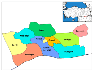
Derik (Syriac: ܖܪܝܟܐ Dêrike, Kurdish: Dêrika Çiyayê Mazî) is a district of the Mardin Province in the southeastern Anatolia region of Turkey. It has borders with Mazıdağı, Viranşehir and Kızıltepe.
History
The town is first mentioned in the late 14th century, however a Roman fort indicates that the area has been inhabited for longer. Prior to the Assyrian and Armenian genocide, Syriacs and Armenians formed the majority in the district.[3] The Armenian population of the county continued to form the majority even up until the 1930s, when systematic state persecution forced many to emigrate. One family continues to live here, and they maintain the old Armenian Church.[4][5] The Armenian church here is the only one in the province that is active, and one of only 7 in Anatolian Turkey that operates as a church.[6]
Geography
Geographically the town includes areas from Mazıdağı foot descending towards Ceylanpınar plains. Town area descends from the north to the south. The city center is surrounded by mountains from 3 sides and has a temperate climate with some mediterranean climate effects.
In the 1990s, the nearby forests were cleared as they offered PKK shelter from the Turkish authorities. Currently there is a campaign to reforest the mountains .
Economy
Agriculture is the main industry in the city center and in the lowlands. Agricultural products include cereals, grapes, fruit, and olives. Mountain villagers and those around Karacadağ (Xalîkan) province deal in livestock. The recent drilling of water wells and construction of irrigation ponds has allowed more industrial scale agriculture to blossom here as well.
References
- ↑ "Area of regions (including lakes), km²". Regional Statistics Database. Turkish Statistical Institute. 2002. Retrieved 2013-03-05.
- ↑ "Population of province/district centers and towns/villages by districts - 2012". Address Based Population Registration System (ABPRS) Database. Turkish Statistical Institute. Retrieved 2013-02-27.
- ↑ Gaunt, David; Bet̲-Şawoce, Jan (2006). Massacres, Resistance, Protectors: Muslim-Christian Relations in Eastern Anatolia During World War I. Gorgias Press LLC. p. 216. ISBN 978-1-59333-301-0. Retrieved 30 January 2013.
- ↑ http://www.bazaarbayar.com/2013/09/ghosts-in-the-doorways.html
- ↑ http://haberciniz.biz/derikteki-son-ermeni-cift-paskalya-bayramini-buruk-kutladi-2797574h.htm
- ↑ coords of the church-37.364993, 40.272356