Derawan Islands
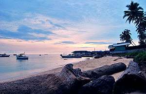
The Derawan Islands (Indonesian: Kepulauan Derawan) are in the province of East Kalimantan in Indonesia. They include Derawan, Sangalaki, Kakaban, Maratua, Panjang, and Samama Island and submerged reefs and islets. They are located in the Sulawesi Sea, on the coastal shelf of East Kalimantan (2°17′N - 118°13′E). The islands are part of the Berau Regency.
Biodiversity
Derawan islands is a part of Coral Triangle, which contains one of the richest marine biodiversity on earth. Located in a biodiversity hotspot, the Derawan Islands feature 872 species of reef fishes, 507 species of coral, and invertebrates, including protected species (5 giants clam species, 2 sea turtles, coconut crab, etc.). Some of the islands harbor the heavily exploited turtle eggs and yet the largest green turtle nesting site in Indonesia.
Unpoisoned jellyfish
Derawan Islands have at least two ponds contain unpoisoned jellyfish, one in Kakaban Island and the other in Maratua Island with Haji Buang Pond. Kakaban is more famous than the second which is also more difficult to access. Indonesia at least have 7 ponds with unpoisoned jellyfish, the others are 3 ponds in Raja Ampat, West Papua, one in Togean Island, Central Sulawesi and one in Rote Island, East Nusa Tenggara.[1]
Resources Use
There are two inhabited islands, namely Derawan (1 village of 1,259 people) and Maratua (4 villages of 2,704 people). Fishing is an important income-generating activity for the community. Since the early 1990s, people have caught live groupers, napoleon wrasse, and lobsters, to fill high demand. There are 3 dive resorts on Derawan Islands, while more additional resorts or facilities are in the planning process.
Caves
Maratua Island is 384.36 square kilometers and has at least 13 caves, but the prediction, more than a hundred caves are not yet explored. The caves usually have connection directly to the sea. These caves originated from reef which sea water infiltrated into, creating underground channels.[2]
Islands
There are 31 named islands (see table)
| No. | Island Name | Hectare (ha) |
|---|---|---|
| 1. | Semut island | 6.9 |
| 2. | Andongabu Island | 5.3 |
| 3. | Bakungan Island | 8.7 |
| 4. | Bantaian Island | 230.6 |
| 5. | Besing Island | 560.1 |
| 6. | Bonggong Island | 123.2 |
| 7. | Bulingisan Island | 4.5 |
| 8. | Derawan Island | 44.6 |
| 9. | Maratua Island | 2375.7 |
| 10. | Nunukan | 4.8 |
| 11. | Panjang Island | 565.4 |
| 12. | Rabu-rabu Island | 26.7 |
| 13. | Sangalaki Island | 15.9 |
| 14. | Sangalan Island | 3.5 |
| 15. | Sapinang Island | 241.3 |
| 16. | Semama Island | 91.1 |
| 17. | Sidau Island | 31.2 |
| 18. | Tiaung Island | 372.5 |
| 19. | Pabahanan Island | 2.0 |
| 20. | Kakaban | 774.2 |
| 21. | Sodang Besar Island | 6145.8 |
| 22. | Telasau Island | 1080.0 |
| 23. | Tempurung Island | 1291.2 |
| 24. | Bilang-bilangan Island | 25.2 |
| 25. | Manimbora Island | 2.0 |
| 26. | Blambangan Island | 22.0 |
| 27. | Sambit Island | 18.0 |
| 28. | Mataha Island | 25.8 |
| 29. | Kaniungan Besar Island | 73.3 |
| 30. | Kaniungan Kecil Island | 10.2 |
| 31. | Bali Kukup Island | 18.2 |
Airport and seaport
To boost tourism, local government will build an airport and a seaport at Maratua Island and both were predicted to operate in 2013. World Wildlife Fund and environmental activists are opposing it because the construction of the projects will surely affect the turtle habitat and coral reefs on Maratua Island, but the local government apparently focuses more on development projects instead of conservation.[3]
See also
References
- ↑ "Tujuh Danau Ubur-Ubur Unik di Indonesia". Retrieved November 5, 2014.
- ↑ Robby Irfany (August 26, 2015). "13 Prehistoric Caves Await Cavers in Derawan Islands".
- ↑ "Activists nix airport, seaport plans for Maratua Island". February 10, 2012.
| Wikivoyage has a travel guide for Derawan. |
Coordinates: 2°15′N 118°25′E / 2.250°N 118.417°E
Regencies and cities of East Kalimantan | ||
|---|---|---|
Capital: Samarinda | ||
| Regencies | ||
| Cities | ||