Della Pia Glacier
Location of Sentinel Range in Western Antarctica.

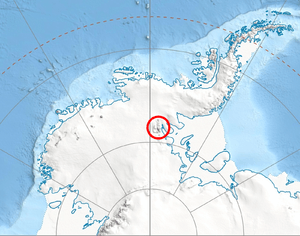
Central and southern Sentinel Range map.
Della Pia Glacier (78°34′S 85°03′W / 78.567°S 85.050°WCoordinates: 78°34′S 85°03′W / 78.567°S 85.050°W) is a glacier that descends the east slope of Craddock Massif and flows between Mount Mohl and Elfring Peak into Thomas Glacier in the Sentinel Range, Ellsworth Mountains in Antarctica.
The glacier was named by the Advisory Committee on Antarctic Names (US-ACAN) in 2006 after Col. Max Della Pia, Commander of the 109th Airlift Wing, New York Air National Guard, 1999–2006, which logistically supported the U.S. Antarctic Program.
See also
Maps
- Vinson Massif. Scale 1:250 000 topographic map. Reston, Virginia: US Geological Survey, 1988.
- Antarctic Digital Database (ADD). Scale 1:250000 topographic map of Antarctica. Scientific Committee on Antarctic Research (SCAR). Since 1993, regularly upgraded and updated.
References
-
 This article incorporates public domain material from the United States Geological Survey document "Della Pia Glacier" (content from the Geographic Names Information System).
This article is issued from Wikipedia - version of the 1/30/2016. The text is available under the Creative Commons Attribution/Share Alike but additional terms may apply for the media files.