Delingha Airport
| Delingha Airport 德令哈机场 Délìnghā Jīchǎng | |||||||||||
|---|---|---|---|---|---|---|---|---|---|---|---|
| IATA: HXD – ICAO: ZLDL | |||||||||||
| Summary | |||||||||||
| Airport type | Public | ||||||||||
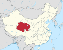
| Location | Delingha, Qinghai, China | ||||||||||
| Opened | 16 June 2014 | ||||||||||
| Elevation AMSL | 2,860 m / 9,383 ft | ||||||||||
| Coordinates | 37°07′30″N 097°16′07″E / 37.12500°N 97.26861°ECoordinates: 37°07′30″N 097°16′07″E / 37.12500°N 97.26861°E | ||||||||||
| Maps | |||||||||||
 Qinghai province in China | |||||||||||
 HXD Location of airport in Qinghai | |||||||||||
| Runways | |||||||||||
| |||||||||||
| Delingha Airport | |||||||
| Traditional Chinese | 德令哈機場 | ||||||
|---|---|---|---|---|---|---|---|
| Simplified Chinese | 德令哈机场 | ||||||
| |||||||
Delingha Airport (IATA: HXD, ICAO: ZLDL) is an airport serving Delingha City, the capital of the Haixi Mongol and Tibetan Autonomous Prefecture in Qinghai Province, China. The airport is located 29 kilometres (18 mi) southwest of the city center, on the south bank of Bayin River.[4]
Construction began on 27 May 2011, with a total investment of 630 million yuan. The airport was opened on 16 June 2014, with the inaugural flight China Eastern Airlines MU2241 from Xining Caojiabao Airport. Delingha is the fourth civil airport in Qinghai.[4]
Facilities
The airport has a 3,000-metre (9,800 ft) runway (class 4C), and a 4,000 square metres (43,000 sq ft) terminal building. It is projected to handle 200,000 passengers annually by 2020.[4][1]
Airlines and destinations
| Airlines | Destinations |
|---|---|
| China Eastern Airlines | Xining |
See also
References
- 1 2 青海省德令哈民用机场工程奠基仪式隆重举行. Xinhua (in Chinese). 2010-12-21.
- ↑ Airport information for HXD at Great Circle Mapper.
- ↑ Airport information for Delingha Airport at Search (for) Travel website.
- 1 2 3 "东航A319机型圆满完成德令哈机场首航" (in Chinese). Carnoc. 2014-06-18.