Deir El Bersha
| Deir El Bersha | |
|---|---|
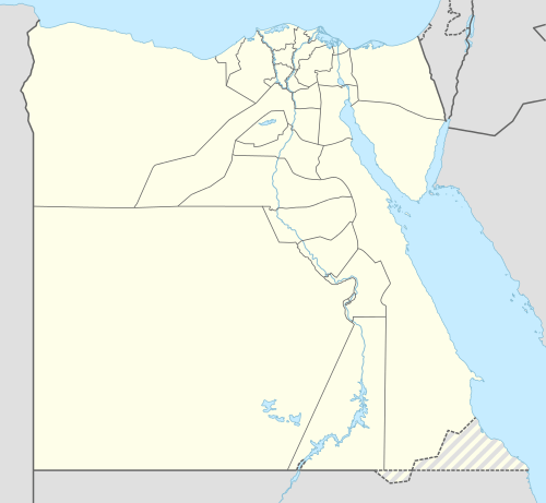 Deir El Bersha Location in Egypt | |
| Coordinates: 27°45′N 30°54′E / 27.750°N 30.900°E | |
| Country |
|
| Governorate | Minya |
| Time zone | EST (UTC+2) |
- For the communities in Dubai, see Al Barsha.
Deir El Bersha is a Coptic village in Middle Egypt. It is located on the east bank of the Nile in the Minya Governorate, to the south of Antinopolis and almost opposite the city of Mallawi.
Overview
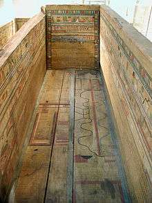
During the Middle Kingdom it was the chief cemetery of the governors ("nomarchs") of the 15th Upper Egyptian Nome, dating back to the Eleventh and Twelfth Dynasties. The most spectacular of the tombs is that of the Great Overlord of the Hare (15th) Nome' called Djehutihotep. He lived during the reigns of Amenemhat II, Senusret II and Senusret III. In the spring of 1915, the Harvard University-Museum of Fine Arts, Boston, expedition dug at Bersha. They excavated a tomb (designated number 10A) that belonged to an early Middle Kingdom nomarch named Djehutynakht. The tomb had been looted, but an enormous collection of wooden models representing scenes of daily life and boats remained. The tomb also contained the extraordinary painted coffins of Djehutynakht and his wife. The grave goods are now in the collection of the Museum of Fine Arts, Boston.
Deir El Bersha necropolis is near the Nile valley town of Minya, 225 km south of Cairo.
In 2007, the tomb of an Egyptian courtier was found. The tomb belonged to Henu, an estate manager and high-ranking official during the First Intermediate Period, which lasted from 2181 to 2050 BC and was a time of political chaos in ancient Egypt. The archaeologists found Henu's mummy wrapped in linen in a large wooden coffin and a sarcophagus decorated with hieroglyphic texts addressed to the gods Anubis and Osiris. The tomb contained well-preserved painted wooden statuettes of workers making bricks, women making beer and pounding cereal, and a model of a boat with rowers, Egyptian media said. (from a 2007-05-21 news article at www.chinaview.cn )
Gallery
_(17544956763).jpg)
Sources
Coordinates: 27°45′N 30°54′E / 27.750°N 30.900°E