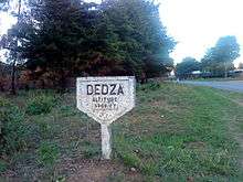
Dedza
| Dedza | |
|---|---|
 | |
 Dedza Location in Malawi | |
| Coordinates: 14°20′S 34°20′E / 14.333°S 34.333°E | |
| Country |
|
| Region | Central Region |
| District | Dedza District |
| Population (2008) | |
| • Total | 15,753 |
| Time zone | +2 |
| Climate | Cwb |
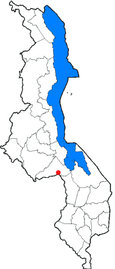
Dedza is the main township of Dedza District in the Central Region of Malawi.
Dedza is located about 85 km south of Malawi's capital, Lilongwe, off the M1 road to Blantyre at a point where a trans-African highway from Johannesburg enters the country.
At an altitude of 1590m it is the highest town in Malawi. In June and July it can be chilly, especially in the mornings and evenings.
The town is based around a bypass loop of tarmac road connected to the M1. At the northern end of the town centre there is a bus station, Town Assembly offices, sports stadium, police station, banks and petrol station. At the southern end there is a hospital and large market. There are many shops and businesses along the road and a parallel dirt road. Two other petrol stations are located on the M1.
Accommodation is available at the Dedza Pottery,[1] Panjira Lodge, Rainbow Resthouse and other local resthouses. There are a number of bars and cafes in the town centre, such as the Boiz Club and Golden Dish and a cyber-café – AY Business Cafe. The Dedza Pottery Coffee Shop is 1 km along a dirt road near the M1 northern junction.
The Dedza Pottery sells a wide range of ceramics and there are a number of craft shops along the dirt road to it. A walk up to the top of Dedza Mountain (2198m) is possible on a maintenance road for the communication aerials.
The main industries of the town are Paragon Ceramics, which makes floor and roof tiles, etc., located at the Dedza Pottery and the WICO Sawmill on the opposite side of the road.
The offices of the various departments of the Dedza District Assembly are located in the township. So also are offices for several NGOs operating in the district, such as Save the Children, Concern Universal and the Red Cross. The town has several primary schools, Mchisu day secondary school and Umbwi and Dedza Secondary boarding schools.
Dedza is linked with Norwich, UK by the Norwich-Dedza Partnership,[2] a UK-based charity. The partnership supports education, health, agriculture, tourism development and public sector organisations in Dedza District through volunteer workers, supply of computers and other materials and small scale funding.
Climate
Dedza has a subtropical highland climate (Köppen: Cwb).
| Climate data for Dedza | |||||||||||||
|---|---|---|---|---|---|---|---|---|---|---|---|---|---|
| Month | Jan | Feb | Mar | Apr | May | Jun | Jul | Aug | Sep | Oct | Nov | Dec | Year |
| Average high °C (°F) | 23.0 (73.4) |
23.0 (73.4) |
23.0 (73.4) |
22.5 (72.5) |
21.2 (70.2) |
19.4 (66.9) |
19.0 (66.2) |
20.5 (68.9) |
23.3 (73.9) |
24.9 (76.8) |
24.9 (76.8) |
23.5 (74.3) |
22.3 (72.1) |
| Daily mean °C (°F) | 18.7 (65.7) |
19.0 (66.2) |
18.5 (65.3) |
17.6 (63.7) |
15.9 (60.6) |
14.0 (57.2) |
13.6 (56.5) |
15.2 (59.4) |
17.8 (64) |
19.7 (67.5) |
20.0 (68) |
19.1 (66.4) |
17.4 (63.3) |
| Average low °C (°F) | 15.5 (59.9) |
15.4 (59.7) |
15.0 (59) |
13.9 (57) |
11.7 (53.1) |
9.5 (49.1) |
9.1 (48.4) |
10.6 (51.1) |
13.2 (55.8) |
15.0 (59) |
15.9 (60.6) |
15.7 (60.3) |
13.4 (56.1) |
| Average precipitation mm (inches) | 288.6 (11.362) |
233.9 (9.209) |
179.6 (7.071) |
67.0 (2.638) |
10.6 (0.417) |
4.1 (0.161) |
3.7 (0.146) |
1.3 (0.051) |
4.0 (0.157) |
11.9 (0.469) |
74.1 (2.917) |
231.0 (9.094) |
1,109.8 (43.693) |
| Average precipitation days (≥ 0.3 mm) | 20 | 17 | 13 | 6 | 2 | 2 | 3 | 2 | 1 | 2 | 6 | 15 | 89 |
| Average relative humidity (%) | 84 | 86 | 83 | 81 | 72 | 67 | 66 | 60 | 55 | 57 | 65 | 80 | 71 |
| Mean monthly sunshine hours | 151.9 | 142.8 | 182.9 | 213.0 | 248.0 | 246.0 | 241.8 | 269.7 | 288.0 | 288.3 | 225.0 | 164.3 | 2,661.7 |
| Mean daily sunshine hours | 4.9 | 5.1 | 5.9 | 7.1 | 8.0 | 8.2 | 7.8 | 8.7 | 9.6 | 9.3 | 7.5 | 5.3 | 7.28 |
| Source: NOAA[3] | |||||||||||||
Demographics
| Year | Population[4] |
|---|---|
| 1987 | 16,899 |
| 1998 | 15,259 |
| 2008 | 15,753 |
See also
References
Coordinates: 14°22′S 34°20′E / 14.367°S 34.333°E