Decimomannu Air Base
Decimomannu Air Base | |||||||||||||||
|---|---|---|---|---|---|---|---|---|---|---|---|---|---|---|---|
 | |||||||||||||||
| IATA: DCI – ICAO: LIED | |||||||||||||||
| Summary | |||||||||||||||
| Airport type | Military | ||||||||||||||
| Location | Decimomannu, Sardinia, Italy | ||||||||||||||
| Elevation AMSL | 100 ft / 30 m | ||||||||||||||
| Coordinates | 39°21′15″N 008°58′20″E / 39.35417°N 8.97222°E | ||||||||||||||
| Map | |||||||||||||||
 Decimomannu Location of airport in Italy | |||||||||||||||
| Runways | |||||||||||||||
| |||||||||||||||
Decimomannu Air Base (IATA: DCI, ICAO: LIED) is an Italian Air Force (Aeronautica Militare) air force base located approximately 5 km (2.7 NM) north of Decimomannu a comune in the Province of Cagliari on the island of Sardinia in Italy.
It is a military airport located northwest of the city of Cagliari, Sardinia, in a vast area between the towns of Decimomannu, Decimoputzu, San Sperate and Villasor.
The airport is named after Colonel pilot Giovanni Farina, Gold Medal for bravery, died in combat in the skies of Sardinia June 14, 1942.
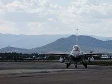
The base is a front-line NATO training facility primarily used since 1979 for Dissimilar Air Combat Training (DACT) of various NATO air force fighter aircraft. Decimonannu is also the Home Base for the Taktisches Ausbildungskommando der Luftwaffe Italien and the Base is used for Training flights.
History
Decimomannu became in effect a militar airport on June 3, 1940 with the transfer of the Italian 32º Wing from Cagliari Elmas.
During World War II the airport served both Axis powers and Allied forces.
Between 1941 and 1943 the airport hosted the 36th Wing, with Savoia-Marchetti SM79 bombers and Savoia-Marchetti SM84.
On September 27, 1941 the airport forces were involved in a bloody battle between the Royal Navy and the Royal Air Force in the central Mediterranean.
On February 17, 1943, the airport was bombed by the Anglo-American allies.
In 1943 following the Armistice of Cassibile, the airport came under the control of the United States Army who used it as a base for fighter Curtiss P-40 "Warhawk" in charge of the USAAF.
Decimomannu airfield was used by the United States Army Air Force Twelfth Air Force 319th Bombardment Group, which flew B-26 Marauder medium bombers from the field between 1 November 1943 and 21 September 1944.[3][4][5]
The American author Joseph Heller, while writing his novel Catch-22, was inspired by some events that happened in the Decimomannu airbase in 1944. [6]
In April 1957 a "Air Weapons Training Installation" (AWTI) unit was established by the Royal Canadian Air Force (RCAF).
In December 1959 an agreement was signed between Italy, Canada and West Germany, which regulated the use of the air base and firing ranges associated with it.
Over the years the base saw a growing increase in flights. Decimomannu during 1970 and 2000 was consecrated as the airport with the highest number of takeoffs and landings in Europe, with an average of about 60000 movements per year, equal to about 450 daily movements.
Currently the main users of the airport are the Italian Air Force and the German Air Force (Luftwaffe).
Facilities
The airport resides at an elevation of 100 feet (30 m) above mean sea level. It has two asphalt paved runways: 17L/35R measuring 2,990 by 45 metres (9,810 ft × 148 ft) and 17R/35L measuring 2,611 by 23 metres (8,566 ft × 75 ft).[1]
References
- 1 2 Airport information for LIED from DAFIF (effective October 2006)
- ↑ Airport information for DCI at Great Circle Mapper. Source: DAFIF (effective October 2006).
- ↑
 This article incorporates public domain material from the Air Force Historical Research Agency website http://www.afhra.af.mil/.
 - ↑ Maurer, Maurer. Air Force Combat Units of World War II. Maxwell AFB, Alabama: Office of Air Force History, 1983. ISBN 0-89201-092-4
- ↑ Maurer, Maurer, ed. (1982) [1969]. Combat Squadrons of the Air Force, World War II (PDF) (reprint ed.). Washington, DC: Office of Air Force History. ISBN 0-405-12194-6. LCCN 70605402. OCLC 72556.
- ↑ Maurer, Maurer, ed. (1969). Combat Squadrons of the Air Force, World War II. 320th group history.