Deadhorse Airport
| Deadhorse Airport Prudhoe Airport | |||||||||||
|---|---|---|---|---|---|---|---|---|---|---|---|
 | |||||||||||
| IATA: SCC – ICAO: PASC – FAA LID: SCC | |||||||||||
| Summary | |||||||||||
| Airport type | Public | ||||||||||
| Owner | State of Alaska DOT&PF - Northern Region | ||||||||||
| Location | Deadhorse, Alaska | ||||||||||
| Elevation AMSL | 64 ft / 20 m | ||||||||||
| Coordinates | 70°11′41″N 148°27′55″W / 70.19472°N 148.46528°W | ||||||||||
| Map | |||||||||||
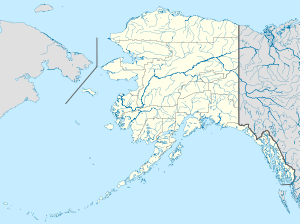
 PASC Location of Deadhorse Airport | |||||||||||
| Runways | |||||||||||
| |||||||||||
| Statistics (2003) | |||||||||||
| |||||||||||

Diagram of Deadhorse Airport. US FAA image. Not to be used for navigational purposes
Deadhorse Airport (IATA: SCC, ICAO: PASC, FAA LID: SCC) is a public airport located in Deadhorse on the North Slope of Alaska. It can be accessed from Fairbanks via the Elliott and Dalton highways. It is near Prudhoe Bay and is sometimes also called Prudhoe Airport.
Facilities and aircraft
Deadhorse Airport covers 6,506 acres (2,633 ha) and has one 6,500 x 150 ft. (1,981 x 46 m) paved runway (5/23).[1]
For the 12-month period ending August 22, 2008, the airport had 19,710 aircraft operations, averaging of 54 per day: 54% general aviation, 28% air taxi, 18% scheduled commercial and 1% military.[1]
Airlines and destinations
| Airlines | Destinations |
|---|---|
| Alaska Airlines | Anchorage, Barrow, Fairbanks |
| Alaska Airlines operated by Horizon Air | Anchorage, Fairbanks |
| Ravn Alaska | Anchorage, Atqasuk, Barrow, Barter Island/Kaktovik, Fairbanks, Nuiqsut, Point Lay, Wainwright |
- Bristow Helicopters provides helicopter transportation services to the Alaska oil and gas and related support industries.
Statistics
| Rank | City | Passengers | Carriers |
|---|---|---|---|
| 1 | |
30,000 | Alaska, Era Alaska |
| 2 | |
3,000 | Alaska, Era Alaska |
| 3 | |
2,000 | Alaska, Era Alaska |
| 3 | |
1,000 | Era Alaska |
| 5 | |
1,000 | Era Alaska |
References
- 1 2 3 FAA Airport Master Record for SCC (Form 5010 PDF), retrieved 2007-03-15
- ↑ http://www.transtats.bts.gov/airports.asp?pn=1&Airport=SCC&Airport_Name=Deadhorse,%20AK:%20Deadhorse%20Airport&carrier=FACTS
External links
| Wikimedia Commons has media related to Deadhorse Airport. |
- FAA Alaska airport diagram (GIF)
- Resources for this airport:
- FAA airport information for SCC
- AirNav airport information for PASC
- ASN accident history for SCC
- FlightAware airport information and live flight tracker
- NOAA/NWS latest weather observations for PASC
- SkyVector aeronautical chart for SCC
This article is issued from Wikipedia - version of the 11/4/2016. The text is available under the Creative Commons Attribution/Share Alike but additional terms may apply for the media files.