DeKalb County, Illinois
| DeKalb County, Illinois | ||
|---|---|---|
 DeKalb County's Legislative Center | ||
| ||
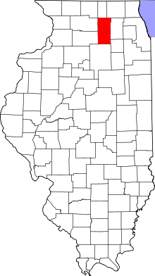 Location in the U.S. state of Illinois | ||
 Illinois's location in the U.S. | ||
| Founded | March 4, 1837 | |
| Named for | Johann de Kalb | |
| Seat | Sycamore | |
| Largest city | DeKalb | |
| Area | ||
| • Total | 635 sq mi (1,645 km2) | |
| • Land | 631 sq mi (1,634 km2) | |
| • Water | 3.4 sq mi (9 km2), 0.5% | |
| Population | ||
| • (2010) | 105,160 | |
| • Density | 167/sq mi (64/km²) | |
| Congressional districts | 14th, 16th | |
| Time zone | Central: UTC-6/-5 | |
| Website |
www | |

DeKalb County is a county located in the U.S. state of Illinois. As of the 2010 census, the population was 105,160.[1] Its county seat is Sycamore.[2]
DeKalb County is part of the Chicago-Naperville-Elgin, IL-IN-WI Metropolitan Statistical Area.
History
DeKalb County was formed on March 4, 1837,[3] out of Kane County, Illinois. The County was named in honor of Johann de Kalb,[4] a German (Bavarian) hero of the American Revolutionary War. DeKalb County is approximately 632.7 square miles, located 63 miles west of Chicago. There are 19 townships in the county with the county seat at Sycamore.
Between 1834 and 1837, early white men began to settle in DeKalb County along the streams and wooded areas because of the fertile soil, wild game, and food and water opportunities. Major growth stemmed from the introduction of the railroad which brought easier methods of transportation and opportunities for industrial growth. Some of the notable industries based in DeKalb County were: Sandwich Manufacturing Company, Marsh Harvester Company, Barbed Wire, Gurler Brothers Pure Milk and many more.
The county has always been noted for agriculture. In 1852, the first Agricultural Fair was held in Sycamore, under the supervision of the DeKalb Agricultural Society. Eventually farmers, businessmen, bankers and newspapermen organized to become the DeKalb County Soil Improvement Association. In later years the DeKalb County Soil Improvement Association would split into two and become DeKalb County Farm Bureau and DeKalb Agricultural Association (DEKALB AgResearch, Inc., Monsanto). DeKalb County is credited with being the birthplace of the Farm Bureau movement.
Education has played an important role in the area with Northern Illinois University located in DeKalb and Kishwaukee Community College located in Malta. A major fair has been held each year since 1887 at the Sandwich Fairgrounds in Sandwich.
-

DeKalb County at the time of its creation in 1837
Pronunciation
Unlike similarly spelled locations, such as DeKalb County, Georgia, DeKalb denizens from Illinois pronounce the county name /dᵻˈkælb/ di-KALB, with an L sound, as opposed to a silent "L."
Geography
According to the U.S. Census Bureau, the county has a total area of 635 square miles (1,640 km2), of which 631 square miles (1,630 km2) is land and 3.4 square miles (8.8 km2) (0.5%) is water.[5]
Climate and weather
| Sycamore, Illinois | ||||||||||||||||||||||||||||||||||||||||||||||||||||||||||||
|---|---|---|---|---|---|---|---|---|---|---|---|---|---|---|---|---|---|---|---|---|---|---|---|---|---|---|---|---|---|---|---|---|---|---|---|---|---|---|---|---|---|---|---|---|---|---|---|---|---|---|---|---|---|---|---|---|---|---|---|---|
| Climate chart (explanation) | ||||||||||||||||||||||||||||||||||||||||||||||||||||||||||||
| ||||||||||||||||||||||||||||||||||||||||||||||||||||||||||||
| ||||||||||||||||||||||||||||||||||||||||||||||||||||||||||||
In recent years, average temperatures in the county seat of Sycamore have ranged from a low of 10 °F (−12 °C) in January to a high of 84 °F (29 °C) in July, although a record low of −27 °F (−33 °C) was recorded in January 1985 and a record high of 103 °F (39 °C) was recorded in August 1988. Average monthly precipitation ranged from 1.40 inches (36 mm) in February to 4.49 inches (114 mm) in June.[6]
Adjacent counties
- Boone County - north
- McHenry County - northeast
- Kane County - east
- Kendall County - southeast
- LaSalle County - south
- Lee County - west
- Ogle County - west
- Winnebago County - northwest
Major highways
-
 Interstate 88
 -
 US Route 30
 -
 US Route 34
 -
 Illinois Route 23
 -
 Illinois Route 38
 -
 Illinois Route 64
 -
 Illinois Route 72
 -
 Illinois Route 110
Demographics
| Historical population | |||
|---|---|---|---|
| Census | Pop. | %± | |
| 1840 | 1,697 | — | |
| 1850 | 7,540 | 344.3% | |
| 1860 | 19,086 | 153.1% | |
| 1870 | 23,265 | 21.9% | |
| 1880 | 26,768 | 15.1% | |
| 1890 | 27,066 | 1.1% | |
| 1900 | 31,756 | 17.3% | |
| 1910 | 33,457 | 5.4% | |
| 1920 | 31,339 | −6.3% | |
| 1930 | 32,644 | 4.2% | |
| 1940 | 34,388 | 5.3% | |
| 1950 | 40,781 | 18.6% | |
| 1960 | 51,714 | 26.8% | |
| 1970 | 71,654 | 38.6% | |
| 1980 | 74,624 | 4.1% | |
| 1990 | 77,932 | 4.4% | |
| 2000 | 88,969 | 14.2% | |
| 2010 | 105,160 | 18.2% | |
| Est. 2015 | 104,352 | [7] | −0.8% |
| U.S. Decennial Census[8] 1790-1960[9] 1900-1990[10] 1990-2000[11] 2010-2013[1] | |||

As of the 2010 United States Census, there were 105,160 people, 38,484 households, and 23,781 families residing in the county.[12] The population density was 166.6 inhabitants per square mile (64.3/km2). There were 41,079 housing units at an average density of 65.1 per square mile (25.1/km2).[5] The racial makeup of the county was 85.1% white, 6.4% black or African American, 2.3% Asian, 0.3% American Indian, 3.9% from other races, and 2.0% from two or more races. Those of Hispanic or Latino origin made up 10.1% of the population.[12] In terms of ancestry, 32.6% were German, 17.5% were Irish, 8.7% were English, 7.0% were Polish, 6.4% were Italian, 6.3% were Swedish, and 3.8% were American.[13]
Of the 38,484 households, 31.9% had children under the age of 18 living with them, 47.2% were married couples living together, 10.2% had a female householder with no husband present, 38.2% were non-families, and 25.8% of all households were made up of individuals. The average household size was 2.56 and the average family size was 3.11. The median age was 29.3 years.[12]
The median income for a household in the county was $54,002 and the median income for a family was $70,713. Males had a median income of $50,192 versus $35,246 for females. The per capita income for the county was $24,179. About 7.7% of families and 14.6% of the population were below the poverty line, including 13.2% of those under age 18 and 4.5% of those age 65 or over.[14]
Communities
Cities
Town
Villages
Townships
DeKalb County is divided into nineteen townships:
See also
References
- 1 2 "State & County QuickFacts". United States Census Bureau. Retrieved July 4, 2014.
- ↑ "Find a County". National Association of Counties. Retrieved 2011-06-07.
- ↑ Illinois Regional Archives Depository System. "Name Index to Illinois Local Governments". Illinois State Archives. Illinois Secretary of State. Retrieved 30 August 2013.
- ↑ Gannett, Henry (1905). The Origin of Certain Place Names in the United States. Govt. Print. Off. p. 103.
- 1 2 "Population, Housing Units, Area, and Density: 2010 - County". United States Census Bureau. Retrieved 2015-07-11.
- 1 2 "Monthly Averages for Sycamore, Illinois". The Weather Channel. Retrieved 2011-01-27.
- ↑ "County Totals Dataset: Population, Population Change and Estimated Components of Population Change: April 1, 2010 to July 1, 2015". Retrieved July 2, 2016.
- ↑ "U.S. Decennial Census". United States Census Bureau. Retrieved July 4, 2014.
- ↑ "Historical Census Browser". University of Virginia Library. Retrieved July 4, 2014.
- ↑ "Population of Counties by Decennial Census: 1900 to 1990". United States Census Bureau. Retrieved July 4, 2014.
- ↑ "Census 2000 PHC-T-4. Ranking Tables for Counties: 1990 and 2000" (PDF). United States Census Bureau. Retrieved July 4, 2014.
- 1 2 3 "DP-1 Profile of General Population and Housing Characteristics: 2010 Demographic Profile Data". United States Census Bureau. Retrieved 2015-07-11.
- ↑ "DP02 SELECTED SOCIAL CHARACTERISTICS IN THE UNITED STATES – 2006-2010 American Community Survey 5-Year Estimates". United States Census Bureau. Retrieved 2015-07-11.
- ↑ "DP03 SELECTED ECONOMIC CHARACTERISTICS – 2006-2010 American Community Survey 5-Year Estimates". United States Census Bureau. Retrieved 2015-07-11.
References
- Forstall, Richard L. (editor) (1996). Population of states and counties of the United States: 1790 to 1990 : from the twenty-one decennial censuses. United States Department of Commerce, Bureau of the Census, Population Division. ISBN 0-934213-48-8.
- United States Census Bureau 2007 TIGER/Line Shapefiles
- U.S. Geological Survey Geographic Names Information System: DeKalb County, Illinois
- United States National Atlas
Further reading
- Eric W. Mogren. Native Soil: A History of the DeKalb County Farm Bureau (DeKalb: Northern Illinois University Press, 2005), 288 pp.
External links
- Official website
- History pages for DeKalb County towns and cities
- De Kalb County at DMOZ
- DeKalb County Youth Service Bureau
- Taming the Wild Prairie: A History of DeKalb County, Illinois, 1837-1900, Illinois Historical Digitization Projects at Northern Illinois University Libraries
- DeKalb County Online Newspaper
 |
Winnebago County | Boone County | McHenry County | |
| Lee County and Ogle County | |
Kane County | ||
| ||||
| | ||||
| LaSalle County | Kendall County |
Municipalities and communities of DeKalb County, Illinois, United States | ||
|---|---|---|
| Cities | ||
| Town | ||
| Villages | ||
| Townships | ||
| Unincorporated communities | ||
| Ghost towns | ||
| Footnotes | ‡This populated place also has portions in an adjacent county or counties | |
| Major city |  | |
|---|---|---|
| Cities (over 30,000 in 2010) | ||
| Towns and villages (over 30,000 in 2010) |
| |
| Counties | ||
| Regions | ||
| Sub-regions | ||

Coordinates: 41°53′37″N 88°46′13″W / 41.89361°N 88.77028°W