Davison Army Airfield
| Davison Army Airfield | |||||||||||
|---|---|---|---|---|---|---|---|---|---|---|---|
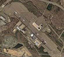 USGS aerial image as of 10 April 2002 | |||||||||||
| IATA: DAA – ICAO: KDAA – FAA LID: DAA | |||||||||||
| Summary | |||||||||||
| Airport type | Military | ||||||||||
| Owner | U.S. Army ATCA-ASO | ||||||||||
| Location | Fort Belvoir, Virginia | ||||||||||
| Elevation AMSL | 73 ft / 22 m | ||||||||||
| Coordinates | 38°42′54″N 077°10′52″W / 38.71500°N 77.18111°W | ||||||||||
| Map | |||||||||||
 DAA  DAA | |||||||||||
| Runways | |||||||||||
| |||||||||||
Davison Army Airfield or Davison AAF (IATA: DAA, ICAO: KDAA, FAA LID: DAA) is a military use airport serving Fort Belvoir, in Fairfax County, Virginia, United States.[1]
The airfield is located 15 miles (24 km) southwest of Washington, D.C. It was named for noted World War II aviation engineer Brig. Gen. Donald Angus Davison.[2]
The airfield provided support for Army One from 1957 to 1976 for presidents Dwight Eisenhower, John F. Kennedy, Lyndon Johnson, Richard Nixon, and Gerald Ford. Its role of support for the presidential helicopter ended in 1976 when responsibility for the helicopter was transferred entirely to the United States Marine Corps.[2]
Facilities
Davison AAF has one runway designated 14/32 with an asphalt surface measuring 5,618 by 74 feet (1,712 x 23 m).[1]
References
- 1 2 3 FAA Airport Master Record for DAA (Form 5010 PDF), effective 2009-07-02.
- 1 2 Davison Army Airfield at GlobalSecurity.org
External links
- Aerial photo as of 10 April 2002 from USGS The National Map
- FAA Terminal Procedures for DAA, effective November 10, 2016
- Resources for this U.S. military airport:
- FAA airport information for DAA
- AirNav airport information for KDAA
- ASN accident history for DAA
- NOAA/NWS latest weather observations
- SkyVector aeronautical chart for KDAA