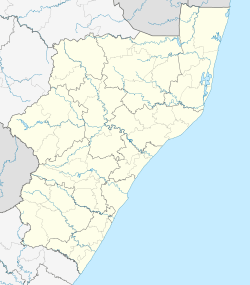
Dannhauser
| Dannhauser | |
|---|---|
 Dannhauser  Dannhauser  Dannhauser
| |
| Coordinates: 28°00′00″S 30°03′00″E / 28.00000°S 30.05000°ECoordinates: 28°00′00″S 30°03′00″E / 28.00000°S 30.05000°E | |
| Country | South Africa |
| Province | KwaZulu-Natal |
| District | Amajuba |
| Municipality | Dannhauser |
| Area[1] | |
| • Total | 8.9 km2 (3.4 sq mi) |
| Population (2011)[1] | |
| • Total | 5,389 |
| • Density | 610/km2 (1,600/sq mi) |
| Racial makeup (2011)[1] | |
| • Black African | 73.7% |
| • Coloured | 1.8% |
| • Indian/Asian | 22.0% |
| • White | 1.8% |
| • Other | 0.6% |
| First languages (2011)[1] | |
| • IsiZulu | 70.4% |
| • English | 23.7% |
| • Afrikaans | 1.8% |
| • Other | 4.1% |
| PO box | 3080 |
| Area code | 034 |
Dannhauser is a former coal mining town in KwaZulu-Natal, South Africa. Cattle and sheep farming take place in the district. The town of Dannhauser was named after Renier Dannhauser, a German settler, who purchased the farm Palmietfontein from the Natal Government in 1872. It was proclaimed a village in 1937.
Contemporary Dannhauser covers five farms, namely Tweediedale, Gleneagles, Rocky Branch, Cornwall and Klipkuil. Durnacol housing is relatively cheap now as the coal mines there are redundant.
The town consists of one main street, and the main shops are the post office, bank, pharmacy and some grocery and hardware stores.
References
- 1 2 3 4 Sum of the Subplaces Dannhauser SP and Emafusini SP from Census 2011.
This article is issued from Wikipedia - version of the 9/14/2014. The text is available under the Creative Commons Attribution/Share Alike but additional terms may apply for the media files.
.svg.png)