Dalton, Pennsylvania
| Borough of Dalton | |
| Settlement | |
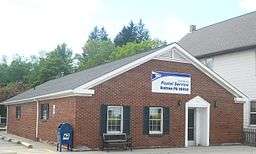 Post office | |
| Country | United States |
|---|---|
| State | Pennsylvania |
| County | Lackawanna |
| District | Lackawanna Trail School District |
| Elevation | 991 ft (302.1 m) |
| Coordinates | 41°32′08″N 75°44′06″W / 41.53556°N 75.73500°WCoordinates: 41°32′08″N 75°44′06″W / 41.53556°N 75.73500°W |
| Area | 3.2 sq mi (8.3 km2) |
| - land | 3.1 sq mi (8 km2) |
| - water | 0.1 sq mi (0 km2), 3.13% |
| Population | 1,234 (2010) |
| Density | 398.1/sq mi (153.7/km2) |
| Mayor | Aaron Holzman |
| Timezone | EST (UTC-5) |
| - summer (DST) | EDT (UTC-4) |
| Zip Code | 18414 |
| Area code | 570 |
| Code 2 | Mayo: Aaron Holzman |
 Location of Dalton in Pennsylvania
| |
 Location of Pennsylvania in the United States
| |
Dalton is a borough in Lackawanna County, Pennsylvania, USA. It is located approximately 8 miles north of the city of Scranton, Pennsylvania in a growing suburban area known as the "Abingtons." Dalton is also approximately 3 miles north of Clarks Summit, Pennsylvania, the hub of the Abington community. The population was 1,234 at the 2010 census.
Geography
Dalton is located at 41°32′8″N 75°44′6″W / 41.53556°N 75.73500°W (41.535597, -75.735090).[1]
According to the United States Census Bureau, the borough has a total area of 3.2 square miles (8.3 km2), of which, 3.1 square miles (8.0 km2) of it is land and 0.1 square miles (0.26 km2) of it (1.90%) is water.
Demographics
| Historical population | |||
|---|---|---|---|
| Census | Pop. | %± | |
| 1880 | 172 | — | |
| 1900 | 681 | — | |
| 1910 | 767 | 12.6% | |
| 1920 | 786 | 2.5% | |
| 1930 | 1,072 | 36.4% | |
| 1940 | 1,090 | 1.7% | |
| 1950 | 1,109 | 1.7% | |
| 1960 | 1,227 | 10.6% | |
| 1970 | 1,282 | 4.5% | |
| 1980 | 1,383 | 7.9% | |
| 1990 | 1,369 | −1.0% | |
| 2000 | 1,294 | −5.5% | |
| 2010 | 1,234 | −4.6% | |
| Est. 2015 | 1,209 | [2] | −2.0% |
| Sources:[3][4][5] | |||
As of the census[4] of 2000, there were 1,234 people, 502 households, and 357 families residing in the borough. The population density was 398.1 people per square mile (153.7/km²). There were 547 housing units at an average density of 176.5 per square mile (68.9/km²). The racial makeup of the borough was 97.6% White, 0.1% Black, 0.2% American Indian, 1.3% Asian, and 0.8% from two or more races. Hispanic or Latino of any race were 1% of the population.
There were 502 households, out of which 28.9% had children under the age of 18 living with them, 60.8% were married couples living together, 7.6% had a female householder with no husband present, and 28.9% were non-families. 25.1% of all households were made up of individuals, and 12.4% had someone living alone who was 65 years of age or older. The average household size was 2.46 and the average family size was 2.96.
In the borough the population was spread out, with 21.9% under the age of 18, 61.1% from 18 to 64, and 17% who were 65 years of age or older. The median age was 45.5 years.
The median income for a household in the borough was $47,625. The median family income in the borough was $65,577. Males had a median income of $41,964 versus $30,583 for females. The per capita income for the borough was $25,760. About 5.0% of families and 6.9% of the population were below the poverty line, including 8.8% of those under age 18 and 7.1% of those age 65 or over.
Notable places
Dalton is noted for having many business and community services centered in its downtown strip. Along Main Street in a small 0.1 mile location are located a fire station, police office, pizzeria, pub and eatery, library, pharmacy, post office, tanning salon, general and grocery store. Dalton was also the home to the Dalton House, which was part of the National Register of Historic Places. The building was torn down in the 1990s and a park is in its place.
Twin towns
Dalton is twinned with:
 Dalton-in-Furness, Cumbria, England
References
- ↑ "US Gazetteer files: 2010, 2000, and 1990". United States Census Bureau. 2011-02-12. Retrieved 2011-04-23.
- ↑ "Annual Estimates of the Resident Population for Incorporated Places: April 1, 2010 to July 1, 2015". Retrieved July 2, 2016.
- ↑ "Census of Population and Housing". U.S. Census Bureau. Archived from the original on May 11, 2015. Retrieved 11 December 2013.
- 1 2 "American FactFinder". United States Census Bureau. Archived from the original on September 11, 2013. Retrieved 2008-01-31.
- ↑ "Incorporated Places and Minor Civil Divisions Datasets: Subcounty Resident Population Estimates: April 1, 2010 to July 1, 2012". Population Estimates. U.S. Census Bureau. Archived from the original on June 17, 2013. Retrieved 11 December 2013.
External links
Municipalities and communities of Lackawanna County, Pennsylvania, United States | ||
|---|---|---|
| Cities | 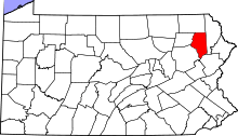 | |
| Boroughs | ||
| Townships | ||
| CDPs | ||
| Unincorporated communities |
| |