Dakhla Airport
| Dakhla Airport | |||||||||||
|---|---|---|---|---|---|---|---|---|---|---|---|
 | |||||||||||
| IATA: VIL – ICAO: GMMH/GSVO | |||||||||||
| Summary | |||||||||||
| Airport type | Public / Military | ||||||||||
| Operator |
Office National Des Aéroports (ONDA) / Royal Moroccan Air Force (RMAF) | ||||||||||
| Serves | Dakhla | ||||||||||
| Location | Western Sahara | ||||||||||
| Elevation AMSL | 36 ft / 11 m | ||||||||||
| Coordinates | 23°43′05″N 015°55′55″W / 23.71806°N 15.93194°W | ||||||||||
| Map | |||||||||||
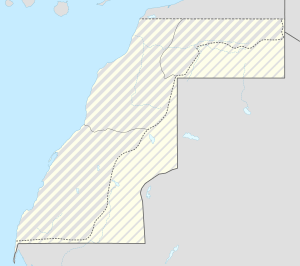 VIL Location of airport in Western Sahara | |||||||||||
| Runways | |||||||||||
| |||||||||||
| Statistics (2008, 2015) | |||||||||||
| |||||||||||
Dakhla Airport (IATA: VIL, ICAO: GMMH/GSVO) is an airport serving Dakhla (also known as Dajla or ad-Dakhla, formerly Villa Cisneros), a city in Western Sahara, disputed south province of Morocco. (See Political status of Western Sahara.)
The airport is operated by the Moroccan state-owned company ONDA.
History
During World War II, the airport was used by the United States Army Air Forces Air Transport Command as a stopover for cargo, transiting aircraft and personnel on the North African Cairo-Dakar transport route for cargo, transiting aircraft and personnel. It connected to Dakar Airport in the South and Agadir Airport to the north.[4]
Airport and facilities
The Dakhla airport is used as public airport and by the Royal Moroccan Air Force. The 3 km (1.9 mi) long runway can receive a Boeing 737 or smaller planes. Parking space of 18,900 square metres (203,000 sq ft) or one Boeing 737.
The passenger terminal covers 670 square metres (7,200 sq ft) and is capable to handle up to 55,000 passengers per year. Public facilities available include a medical post and a prayer room.
The airport offers the following radio-navigation aids: VOR and DME.
Airlines and destinations
The airport is used by Royal Air Maroc for domestic and international flights
| Airlines | Destinations |
|---|---|
| Royal Air Maroc | Agadir, Casablanca, Gran Canaria, Laayoune [5] |
Traffic statistics
| Item | 2008 | 2007 | 2006 | 2005 | 2004 | 2003 |
|---|---|---|---|---|---|---|
| Aircraft movements[6] | 1,574 | 1,492 | 839 | 674 | 606 | 492 |
| Passengers[7] | 42,066 | 36,354 | 21,253 | 21,442 | 11,670 | 12,149 |
| Cargo (tonnes)[8] | 34.43 | 48.63 | 59.77 | 61.06 | 140.96 | 107.81 |
References
![]() This article incorporates public domain material from the Air Force Historical Research Agency website http://www.afhra.af.mil/.
This article incorporates public domain material from the Air Force Historical Research Agency website http://www.afhra.af.mil/.
- ↑ Dakhla airport information from Office National Des Aéroports (ONDA)
- ↑ Airport information for GMMH from DAFIF (effective October 2006)
- ↑ Airport information for VIL at Great Circle Mapper. Source: DAFIF (effective October 2006).
- ↑ The airport was then paved over in the 1960s by Francoist Spain. File:Atcroutes-1sep1945.jpg
- ↑ http://airlineroute.net/2015/05/21/at-jun-jun15/
- ↑ Statistics until 2006 from Statistics Movements Archived 22 July 2011 at the Wayback Machine., PDF document
- ↑ Statistics until 2006 from Overview passengers stats MA Archived 27 September 2007 at the Wayback Machine., PDF document
- ↑ Statistics until 2006 from freight stats Archived 22 July 2011 at the Wayback Machine., PDF document