Daeunsan
| Daeunsan | |
|---|---|
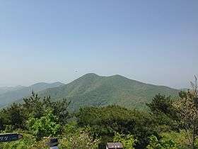 View of Daeunsan's summit | |
| Highest point | |
| Elevation | 742 m (2,434 ft) [1] |
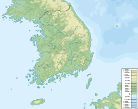
| Coordinates | 35°24′07″N 129°12′48″E / 35.402°N 129.2133°ECoordinates: 35°24′07″N 129°12′48″E / 35.402°N 129.2133°E |
| Geography | |
 Daeunsan | |
| Korean name | |
| Hangul | 대운산 |
|---|---|
| Hanja | 大雲山 |
| Revised Romanization | Dae-unsan |
| McCune–Reischauer | Taeunsan |
Daeunsan is a mountain located in Onyang, Ulju County, Ulsan, South Korea. It sits on the boundary between the districts of Oegwang-ri and Unhwa-ri in the province of Gyeongsangnam-do. Daeunsan has an elevation of 742 m (2,434 ft). The mountain was previously named Bulgwangsan.[1]
See also
- Geography of Korea
- List of South Korean tourist attractions
- List of mountains in Korea
- List of mountains by elevation
- Mountain portal
- South Korea portal
References
- 1 2 "Daeunsan". Invil.org. Retrieved 23 April 2013.
This article is issued from Wikipedia - version of the 12/6/2015. The text is available under the Creative Commons Attribution/Share Alike but additional terms may apply for the media files.