D21 road (Croatia)
| ||||
|---|---|---|---|---|
|
Map of Croatia with D21 highlighted in red | ||||
| Route information | ||||
|
| ||||
| Maintained by Hrvatske ceste | ||||
| Length: | 80.1 km (49.8 mi) | |||
| Major junctions | ||||
| North end: |
| |||
| South end: |
| |||
| Location | ||||
| Counties: | Istria | |||
| Major cities: | Buje, Vodnjan, Pula | |||
| Highway system | ||||
| ||||

D21 is a 80.1-kilometre-long (49.8 mi), north–south state road in Istria County, Croatia. A short section of D21 is a part of the European route E751. The northern terminus of the route is located at the Croatia–Slovenia border at the Dragonja River. There it connects to Koper, Slovenia, and Trieste, Italy, via the Slovene route G11 further north. D21 route is generally parallel to A9 motorway. The two form several junctions, either directly or via short connectors, at Buje, Bale and Vodnjan – towns served directly by D21. The southern terminus of the route is found in the city of Pula, at the southern tip of the Istrian Peninsula.
The road, as well as all other state roads in Croatia, is managed and maintained by Hrvatske ceste, a state-owned company. The road carries an annual average daily traffic of about 2,000 vehicles, and the traffic volume increases by up to 1,000 vehicles in summer as the road is used by tourists in the region. The southernmost portion of the road is significantly more congested as it carries Pula suburban traffic.
In classical antiquity, the western Istria route was first used by Via Flavia in the classical antiquity, but the roads in the area declined in the Middle Ages and subsequent division of the Istrian Peninsula by the Republic of Venice and the Habsburg Empire was not conductive to development of a road system. In the 19th century, the First French Empire started road construction, including the Trieste–Pula route now largely followed by D21. The present-day D21 route was a part of M2 Adriatic Highway route after the Second World War. It was made a separate state road and assigned its present route number in 1997.
Route description

D21 is an 80.1-kilometre (49.8 mi) state road situated in Istria County following a general north–south alignment. Most of the route runs through predominantly agricultural land and small settlements, except the route segment between Bale and Baderna, where the road is predominantly surrounded by forests. The southernmost 2.2 kilometres (1.4 miles) of the route runs through suburbs of Pula – the largest city in the region. D21 extends south from the Kaštel border crossing between Croatia and Slovenia situated at the Dragonja River.[1][2] To the north of the D21 terminus, the route – a part of the European route E751 – connects the cities of Koper, Slovenia,[3] and Trieste, Italy, via G11 in Slovenia.[4][5] The first section of the D21 route follows an overall eastern orientation. About 400 metres (1,300 feet) away from the borderline, it reaches the Kaštel border crossing, and after 800 metres (2,600 feet), there is an at-grade intersection where the traffic defaults to D510, which serves as a connector to the A9 motorway. D21 itself turns southwest towards the village of Kaštel, approximately two kilometres (1.2 mi) away.[1][6]
Just to the north of Kaštel, D21 turns south before proceeding to the city of Buje located about 3.5 kilometres (2.2 miles) down the road from Kaštel. In Buje, D21 forms at-grade intersections with D200 and D300. D200 provides a route to the Plovanija border crossing with Slovenia and D300 to the town of Umag and Umag interchange of A9 motorway. There are also at-grade intersections with the county roads Ž5007 and Ž5008 in the city. South of Buje, the route turns southeast across hilly terrain until it reaches Ponte Porton in the Mirna River valley approximately 11 kilometres (6.8 miles) away from Buje. There D21 forms a roundabout junction at the north bank of the river. The roundabout connects D21 to D44, which links the town of Buzet and D301 to Novigrad and another A9 interchange.[1][7]
After the route crosses the Mirna River, it continues about six kilometres (3.7 mi) southeast to Vižinada, where D21 forms an intersection with Ž5041 road to Brnobići village. In Vižinada, the route turns south once more as it reaches the Ž5042 intersection connecting Višnjan after another five kilometres (3.1 mi), and the village of Baderna 20.5 kilometres (12.7 miles) south of the Mirna River crossing. At Baderna, D21 connects with D302 extending to Poreč and the A9 motorway, located west of the road junction, as well as D48 leading to Pazin east of D21. The intersection is built as a partial cloverleaf interchange.[1][8]
Approximately four kilometres (2.5 mi) south of Baderna, the route reaches the village of Sveti Lovreč and proceeds due south to the Medaki interchange of the A9 – another partial cloverleaf interchange – about three kilometres (1.9 mi) south of Sveti Lovreč. D21 turns southwest at the Lim embayment of the Adriatic Sea after another two kilometres (1.2 mi). At that point, D21 forms an at-grade intersection with Ž5002 road to Vrsar situated further west. Following the Ž5002 junction, D21 turns southeast to follow the contours of the Lim embayment valley. After approximately five kilometres (3.1 mi), the route reaches a grade separated intersection, a two-ramp partial cloverleaf, with D303. D303, in turn, links to the Kanfanar interchange of the A9 motorway and the coastal city of Rovinj.[1][9]
South of the D303 intersection, D21 runs south along a generally flat terrain and consists of relatively straight sections compared to the northern parts of the route. About six kilometres (3.7 mi) south of the D303 junction, D21 forms an at-grade intersection with Ž5098 to Svetvinčenat. Three kilometres (1.9 mi) from there, D21 enters the town of Bale and intersects the Ž5095 road linking Rovinj. South of Bale, D21 turns southeast and approaches Vodnjan. It reaches a short connector to the Vodnjan-sjever (north) interchange of the A9 motorway eight kilometres (5.0 mi) down the road.[1][10]
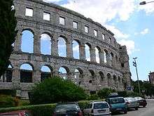
After another two kilometres (1.2 mi), D21 reaches the city of Vodnjan and the Ž5192 road junction connecting to Fažana. There are two further significant junctions of D21 in the next 1.5 kilometres (0.93 miles) – one with Ž5190 to Svetvinčenat and the other with the Vodnjan-jug (south) interchange of A9. South of Vodnjan, D21 route proceeds another 5.5 kilometres (3.4 miles) due south to reach Ž5117 connecting the village of Galižana, and reaches outskirts of Pula after another three kilometres (1.9 mi). Within Pula, D21 route forms an at-grade junction with the Ž5115 road to Fažana about 1.5 kilometres (0.93 miles) further along. The junction also serves the Brijuni National Park.[11] The southern terminus of the route is found at a roundabout 500 metres (1,600 feet) further south, where D21 connects to D400.[1][12]
History
In classical antiquity, the Via Flavia road built by the emperor Vespasian in 78 AD ran through the same area spanned by modern D21. The Via Flavia followed a north–south route in the western part of the Istrian Peninsula, connecting Tergeste, present-day Trieste, to Pula via Poreč. In Pula, the Roman road extended further to the northeast to Nesactium and Tarsatica – modern-day Trsat area of the city of Rijeka.[13]
Following the decline of the Roman Empire, roads in the region deteriorated. Only the Via Sclavonica is known to have existed in the region by year 1030. It was an east–west route spanning from Pazin to Poreč. Road transport in the region lost significance after the peninsula was divided between the Habsburg Monarchy and the Republic of Venice. From 1809–1813, the Trieste–Pula route was rebuilt by the First French Empire, after the French captured the entire region from Venice and the Habsburgs. Upgrades to the regional road network continued after the Austrian Empire acquired Istria at the 1814–1815 Congress of Vienna. By 1830, the road network in Istria had expanded to a degree that would not change for a century and a half. The only significant improvement of region's roads was paving of the Trieste–Pula road in 1930s.[14]
During the Second World War all the roads in Istria sustained significant damage.[14] After the war the road became a part of the Adriatic Highway – a trunk road tracing the Adriatic Sea coast within the SFR Yugoslavia,[15] signposted as M2 route.[16] The next major addition to the road network on the peninsula was completion of the first section of the Istrian Y expressway in 1981. The system was designed to replace M2 route as the main road route in Istria.[17] The Yugoslav M2 designation was retained after the independence of Croatia, until 1997, when the part of the Adriatic Highway spanning the Slovene border and Pula was designated as state road D21.[18] Since October 1991, Hrvatske ceste, a company owned by the Government of Croatia, has been tasked with maintenance of the road.[19]
Traffic volume
Volume of traffic flowing along D21 road is measured by Hrvatske ceste at six traffic counting stations distributed along the route. Three of the traffic counting stations work continuously, while the rest of them are operated intermittently. By 2002, the road lost a significant portion of its north–south traffic as A9 motorway was gradually extended since 1991,[17] running parallel to the route. At the Kaštel traffic counting site, the average summer traffic volume declined from 12,564 vehicles per day recorded in 2002, to just 2,989 vehicles in 2011.[20][21]
| Counting site | AADT | ASDT | Notes |
| 2702 Kaštel | 1,952 | 2,989 | Adjacent to the Kaštel border crossing |
| 2707 Sveti Ivan | 1,980 | 2,510 | Adjacent to the Ž5008 junction |
| 2719 Vižinada north | 1,414 | 2,262 | Between the D44 and the Ž5041 junctions |
| 2721 Baderna north | 1,925 | 2,478 | Adjacent to the D48 junction |
| 2717 Bale | 2,366 | 3,148 | Between the Ž5098 and the Ž5096 junctions |
| 3905 Pula north | 10,696 | 13,527 | Between the Ž5115 and the Ž5117 junctions |
Major intersections
The entire route is in Istria County.
| Location | km | mi | Destinations | Notes | |
|---|---|---|---|---|---|
| Kaštel border crossing | 0.0 | 0.0 | Kaštel border crossing to Slovenia[22] northern terminus of E751 concurrency | ||
| 1.2 | 0.75 | southern terminus of E751 concurrency | |||
| Buje | 6.4 | 4.0 | |||
| 6.6 | 4.1 | ||||
| 6.9 | 4.3 | ||||
| Ponte Porton | 18.0 | 11.2 | |||
| Vižinada | 24.0 | 14.9 | |||
| 29.6 | 18.4 | ||||
| Baderna | 38.7 | 24.0 | Grade separated | ||
| Medaki interchange | 45.6 | 28.3 | Grade separated | ||
| 47.4 | 29.5 | ||||
| 52.9 | 32.9 | Grade separated | |||
| 58.6 | 36.4 | ||||
| Bale | 61.5 | 38.2 | |||
| Vodnjan sjever (north) interchange | 69.7 | 43.3 | Via a connector road | ||
| Vodnjan | 71.7 | 44.6 | |||
| 72.6 | 45.1 | ||||
| Vodnjan jug (south) interchange | 73.1 | 45.4 | Via a connector road | ||
| 75.2 | 46.7 | ||||
| 79.4 | 49.3 | ||||
| Pula | 80.1 | 49.8 | Southern terminus of the road | ||
1.000 mi = 1.609 km; 1.000 km = 0.621 mi
| |||||
Sources: Public roads classification and Regulation on motorway markings in Croatia[1][23]
Sources
- 1 2 3 4 5 6 7 8 "Odluka o razvrstavanju javnih cesta u državne ceste, županijske ceste i lokalne ceste" [Decision on categorization of public roads as state roads, county roads and local roads]. Narodne novine (in Croatian). Narodne novine d.d. (17). 17 February 2010. ISSN 0027-7932. Retrieved 26 February 2013.
- ↑ Google (28 February 2013). "D21 road (Croatia)" (Map). Google Maps. Google. Retrieved 28 February 2013.
- ↑ "European Agreement on Main International Traffic Arteries (AGR)" (PDF). United Nations Economic Commission for Europe. 14 March 2008. p. 25. Retrieved 2 April 2013.
- ↑ "Seznam državnih cest" [List of public roads] (PDF) (in Slovenian). Slovenian Roads Agency. 31 December 2009. p. 12. Archived from the original (PDF) on 16 January 2014. Retrieved 2 April 2013.
- ↑ Google (2 April 2013). "G11/H5/S202 Dragonja-Trieste route" (Map). Google Maps. Google. Retrieved 2 April 2013.
- ↑ Google (26 February 2013). "D21 Kaštel Border crossing-Kaštel route" (Map). Google Maps. Google. Retrieved 26 February 2013.
- ↑ Google (26 February 2013). "D21 Kaštel-Ponte Porton route" (Map). Google Maps. Google. Retrieved 26 February 2013.
- ↑ Google (26 February 2013). "D21 Ponte Porton-Baderna route" (Map). Google Maps. Google. Retrieved 26 February 2013.
- ↑ Google (26 February 2013). "D21 Baderna-Brajkovići (D303) route" (Map). Google Maps. Google. Retrieved 26 February 2013.
- ↑ Google (26 February 2013). "D21 Brajkovići-Vodnjan route" (Map). Google Maps. Google. Retrieved 26 February 2013.
- ↑ "How to reach us". Brijuni National Park. 8 June 2010. Archived from the original on 2013-06-29.
- ↑ Google (26 February 2013). "D21 Vodnjan-Pula route" (Map). Google Maps. Google. Retrieved 26 February 2013.
- ↑ Romolo Augusto Staccioli (2003). The Roads of the Romans. Getty Publications. p. 82. ISBN 9780892367320. Retrieved 28 February 2013.
- 1 2 "Istarska Enciklopedija - Ceste" [Istrian Encyclopedia - Roads] (in Croatian). Miroslav Krleža Lexicographical Institute. Retrieved 28 February 2013.
- ↑ Kos, Lucijan (October 1988). "Promet i trgovina - osnova ekonomskog razvitka Senja" [Transport and trade - the base of the economic development of Senj]. Senjski zbornik (in Croatian). City Museum of Senj and Senj Museum Society. 15 (1): 145. ISSN 0582-673X. Retrieved 28 February 2013.
- ↑ "Odluka o razvrstavanju magistralnih cesta" [Decision on categorization of trunk roads] (in Croatian). Government of Croatia - HIDRA. 27 September 1991. Retrieved 28 February 2013.
- 1 2 Branko Nadilo (2010). "Druga faza Istarskog ipsilona" [Second phase of Istrian Upsilon] (PDF). Građevinar (in Croatian). Croatian Association of Civil Engineers. 62 (5): 424–427. ISSN 0350-2465. Retrieved 2 April 2013.
- ↑ "Odluka o razvrstavanju cesta u državne ceste" [Decision on categorization roads as state roads] (in Croatian). Government of Croatia - HIDRA. 16 May 1997. Retrieved 28 February 2013.
- ↑ "Zakon o cestama" [Roads Act] (in Croatian). Government of Croatia - HIDRA. 7 October 1991. Retrieved 28 February 2013.
- 1 2 "Traffic counting on the roadways of Croatia in 2011 - digest" (PDF). Hrvatske ceste. 2011. Retrieved 21 June 2013.
- ↑ "Traffic counting on the roadways of Croatia in 2002 - digest" (PDF). Hrvatske ceste. 2003. Retrieved 28 February 2013.
- ↑ "Map of border crossings and customs office areas" (PDF). Customs Administration of the Republic of Croatia (in Croatian). 6 March 2008.
- ↑ "Pravilnik o označavanju autocesta, njihove stacionaže, brojeva izlaza i prometnih čvorišta te naziva izlaza, prometnih čvorišta i odmorišta" [Regulation on motorway markings, chainage, interchange/exit/rest area numbers and names] (in Croatian). Narodne novine. 6 May 2003. Retrieved 28 February 2013.