D'Arros Island
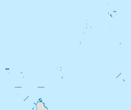
 Map of D'Arros Island and neighboring St. Joseph Atoll, part of the Amirante Islands group | |
 D'Arros Island | |
| Geography | |
|---|---|
| Location | Indian Ocean |
| Coordinates | 05°24′S 53°18′E / 5.400°S 53.300°ECoordinates: 05°24′S 53°18′E / 5.400°S 53.300°E |
| Archipelago | Seychelles |
| Adjacent bodies of water | Indian Ocean |
| Total islands | 1 |
| Major islands |
|
| Area | 1.71 km2 (0.66 sq mi) |
| Length | 2.0 km (1.24 mi) |
| Width | 1.0 km (0.62 mi) |
| Coastline | 5.1 km (3.17 mi) |
| Highest elevation | 3 m (10 ft) |
| Administration | |
| Group | Outer Islands |
| Sub-Group | Amirante Islands |
| Sub-Group | D'Arros and St. Joseph Atoll Special Reserve[1] |
| Districts | Outer Islands District |
Largest settlement |
D'Arros (population 42) |
| Demographics | |
| Demonym | Creole |
| Population | 42 (2014) |
| Pop. density | 24.5 /km2 (63.5 /sq mi) |
| Ethnic groups | Creole, French, East Africans, Indians. |
| Additional information | |
| Time zone | |
| Official website |
www |
| ISO Code = SC-26 | |
D'Arros Island is part of the Amirante Islands group, which are in the Outer Islands (Coralline Seychelles) coral archipelago of the Seychelles islands and nation. The island is located west of the granitic Inner Seychelles archipelago, with a distance of 255 km south of Victoria, Seychelles.
History
The island was discovered in 1770 by European sailors.[2] D'Arros Island bears the name of the Baron d'Arros, Marine Commandant at Mauritius, then Île de France, from 1770 to 1771.
- Private island
In 1975, The island became the property of prince Shahram Pahlavi Nia of Iran.[3] in 1998 it was bought by French billionaire Liliane Bettencourt (daughter of founder and main shareholder of L'Oreal) for US$18 million.[4][5]
- Nature preserve
In August 2012 it was revealed that the island had once more been sold, for US$60 million, to be managed by the Save Our Seas Foundation.[6][7]
Geography
D'Arros Island is located only 2.3 kilometres (1.4 mi) west of the northern part of St. Joseph Atoll, but it is a separate geographical unit, separated by 60–62 metres (197–203 ft) deep water of a 1 kilometre (0.62 mi) wide channel, which is deeper than much of the Amirantes Bank.
The land area of the island occupies 1.71 square kilometres (0.66 sq mi). D'Arros Island is an oval-shaped, flat coral sand cay, oriented northeast-southwest, 2 kilometres (1.2 mi) long and 1 kilometre (0.62 mi) wide, and nowhere higher than 3 metres (9.8 ft).
Coral reefs
The island stands on a detached patch coral reef similarly orientated, with maximum dimensions of 2.6 kilometres (1.6 mi) and 1.4 kilometres (0.87 mi). A shallow sand spit extends 0.2 kilometres (0.12 mi) northeast from it. The island stands on the northern sector of the reef atoll. There are drying reef flats 200–370 metres (660–1,210 ft) wide on its south side, but only a narrow fringing reef about 75 metres (246 ft) wide on its north side.
Administration
The island belongs to Outer Islands District.[8] Being an island with a small population, there are not any government buildings or services. For many services, people have to go to Victoria, which is a difficult task.
Demographics
The island has a population of 42. There are several buildings on the island, with one large house used by guests, who rented the island, and a number of smaller, permanently occupied houses for the staff. A small area of the island is cultivated for personal consumption of the residents. The small village is on the north coast. There is a swimming pool, a tennis court, a library and a video rental solution on the island[9]
Flora & Fauna
Much of the island area is covered by vegetation. The tree tops reach heights of 27 metres (89 ft). The vegetation is dominated by the native coconut palm (Cocos nucifera), and introduced horsetail beefwood (Casuarina equisetifolia) trees.
In 1965, five Seychelles fody (Foudia sechellarum) birds from Cousin Island were introduced to D'Arros and they have since increased to a population of a few hundred.[10] [11][12]
Transport
The island is bisected by a 975 metres (3,199 ft) unpaved airstrip (ICAO: FSDA) that bisects the island in the southwest. The island is occasionally serviced by an Island Development Company (IDC) aircraft from Mahé, or flights diverted from nearby Desroches.
Economics
The inhabitants on the island are engaged in very small scale farming and fishing which are mainly for the island consumption.
Image gallery
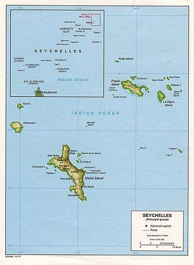 Map 1
Map 1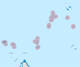 District Map
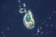 NASA-D'Arros Island
 D'Arros Island
External links
References
- ↑
- ↑ Info on Mauritius and its dependencies
- ↑ Ownership change
- ↑ Paris Match
- ↑ La republique
- ↑ "L'Oreal heiress Bettencourt sells Seychelles island". BBC News. August 1, 2012. They will manage it as a nature reserve.
- ↑ "The D'Arros Group of Island becomes a natural reserve managed by Save our Seas Foundation". Save Our Seas Foundation. August 1, 2012.
- ↑ District map
- ↑ Village Photo
- ↑ "D'Arros Island". BirdLife International.
- ↑ Article on nature reserve
- ↑ video
| Wikimedia Commons has media related to D'Arros Island (Arros island). |
Outer islands of Seychelles / Coralline Seychelles (Zil Elwannyen Sesel) | |||||||||||||||||||
|---|---|---|---|---|---|---|---|---|---|---|---|---|---|---|---|---|---|---|---|
| Outer island Groups |  | ||||||||||||||||||
| Islands and Atolls |
| ||||||||||||||||||
| Wikimedia Commons has media related to D'Arros Island. |