Curral Velho, Paraíba
| Curral Velho | |
|---|---|
| Municipality | |
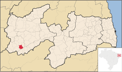 Location in Paraíba state | |
 Curral Velho Location in Brazil | |
| Coordinates: 07°34′51″S 38°11′52″W / 7.58083°S 38.19778°WCoordinates: 07°34′51″S 38°11′52″W / 7.58083°S 38.19778°W | |
| Country |
|
| Region | Northeast Region |
| State | Paraíba |
| Microregion | Itaporanga |
| Area | |
| • Total | 222.96 km2 (86.09 sq mi) |
| Elevation | 338 m (1,109 ft) |
| Population (2015) | |
| • Total | 2,523 |
| • Density | 11/km2 (29/sq mi) |
| Time zone | BRT (UTC-3) |
| Postal code | 58990-xxx |
| Area code | +55-83 |
Curral Velho is a municipality in the micro-region of Itaporanga in the Brazilian state of Paraíba. The population is 2,523 (2015 est.) in an area of 222.96 km².[1] The elevation is 338 m.
References
External links
- http://www.citybrazil.com.br/pb/curralvelho (in Portuguese)
This article is issued from Wikipedia - version of the 5/12/2016. The text is available under the Creative Commons Attribution/Share Alike but additional terms may apply for the media files.