Cumbal Volcano
| Cumbal | |
|---|---|
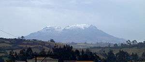
 Cumbal in 1989 | |
| Highest point | |
| Elevation | 4,764 m (15,630 ft) |
| Prominence | 1,575 m (5,167 ft) |
| Listing | Ultra |
| Coordinates | 0°56′56″N 77°53′17″W / 0.949°N 77.888°WCoordinates: 0°56′56″N 77°53′17″W / 0.949°N 77.888°W |
| Geography | |
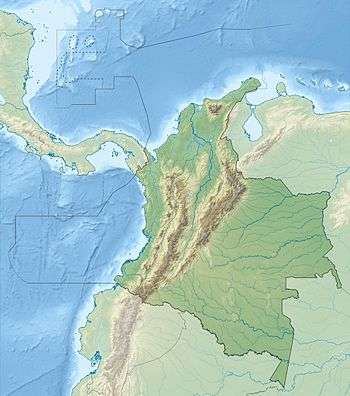 Cumbal Location in Colombia | |
| Location | Colombia |
| Parent range | Cordillera Central |
| Geology | |
| Mountain type | Stratovolcano |
| Last eruption | December 1926 |
Cumbal Volcano
Cumbal is a stratovolcano located in Nariño Department, Colombia. It is the southernmost historically active volcano of Colombia.
The volcano was the crash site of TAME Flight 120, which crashed in one of its hills while approaching Tulcán on January 28, 2002. There were no survivors.
See also
References
Treasures of Colombia | |||||||||||||||||||||||||||||||||||||||||||||||||||||
|---|---|---|---|---|---|---|---|---|---|---|---|---|---|---|---|---|---|---|---|---|---|---|---|---|---|---|---|---|---|---|---|---|---|---|---|---|---|---|---|---|---|---|---|---|---|---|---|---|---|---|---|---|---|
Archaeological sites · Colombia magia salvaje · National monuments · National parks · World Heritage sites | |||||||||||||||||||||||||||||||||||||||||||||||||||||
| |||||||||||||||||||||||||||||||||||||||||||||||||||||
| |||||||||||||||||||||||||||||||||||||||||||||||||||||
| |||||||||||||||||||||||||||||||||||||||||||||||||||||
Source: Wills, Fernando et al. 2001. Nuestro patrimonio - 100 tesoros de Colombia - Our heritage - 100 treasures of Colombia, 1-311. El Tiempo. | |||||||||||||||||||||||||||||||||||||||||||||||||||||
This article is issued from Wikipedia - version of the 11/16/2016. The text is available under the Creative Commons Attribution/Share Alike but additional terms may apply for the media files.