Crystal, Minnesota
| Crystal | |
|---|---|
| City | |
| Crystal, Minnesota | |
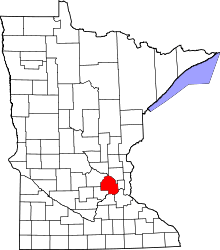
 Location of the city of Crystal within Hennepin County, Minnesota | |
| Coordinates: 45°2′14″N 93°21′34″W / 45.03722°N 93.35944°W | |
| Country | United States |
| State | Minnesota |
| County | Hennepin |
| Founded | 1866 |
| Government | |
| • Mayor | Jim Adams |
| Area[1] | |
| • Total | 5.88 sq mi (15.23 km2) |
| • Land | 5.78 sq mi (14.97 km2) |
| • Water | 0.10 sq mi (0.26 km2) |
| Elevation | 892 ft (272 m) |
| Population (2010)[2] | |
| • Total | 22,151 |
| • Estimate (2015)[3] | 22,943 |
| • Density | 3,832.4/sq mi (1,479.7/km2) |
| Time zone | Central (UTC-6) |
| • Summer (DST) | Central (UTC-5) |
| ZIP codes | 55422, 55427, 55428, 55429 |
| Area code(s) | 763 |
| FIPS code | 27-14158[4] |
| GNIS feature ID | 0642518[5] |
| Website | Official website |
Crystal is an intersection in Hennepin County, Minnesota, United States. The population was 22,151 at the 2010 census.[6]
History
In 2015, the city council voted to fund a $27 million public works building from reserves instead of issuing bonds. This reduced the city's reserve to $37 million. The building opened in the fourth quarter 2015.[7]
The council was overhauling the city code by removing outdated provisions which critics charges this cost the city with little benefit. With a split in the Libertarian bloc in September 2016, the council raised property taxes by 8%, while the whole bloc supported a 25% increase in water and sewer charges.[7]
Geography
According to the United States Census Bureau, the city has a total area of 5.88 square miles (15.23 km2), of which 5.78 square miles (14.97 km2) is land and 0.10 square miles (0.26 km2) is water.[1]
Minnesota State Highway 100 and County Road 81 are two of the main routes in the city. Other routes include Douglas Drive North, 36th Avenue North, 42nd Avenue North, and Bass Lake Road.
Crystal Airport, a small general aviation field, is located within the city limits.
The city is bordered on the north by the city of Brooklyn Park, on the northeast by Brooklyn Center, on the east by Robbinsdale, on the south by Golden Valley, and on the west by New Hope.
Crystal has been awarded the "Minnesota Star City" designation for economic development.
Demographics
| Historical population | |||
|---|---|---|---|
| Census | Pop. | %± | |
| 1920 | 814 | — | |
| 1930 | 1,865 | 129.1% | |
| 1940 | 2,373 | 27.2% | |
| 1950 | 5,713 | 140.8% | |
| 1960 | 24,283 | 325.0% | |
| 1970 | 30,925 | 27.4% | |
| 1980 | 25,543 | −17.4% | |
| 1990 | 23,788 | −6.9% | |
| 2000 | 22,698 | −4.6% | |
| 2010 | 22,151 | −2.4% | |
| Est. 2015 | 22,943 | [8] | 3.6% |
| U.S. Decennial Census[9] 2015 Estimate[3] | |||
2010 census
As of the census[2] of 2010, there were 22,151 people, 9,183 households, and 5,640 families residing in the city. The population density was 3,832.4 inhabitants per square mile (1,479.7/km2). There were 9,634 housing units at an average density of 1,666.8 per square mile (643.6/km2). The racial makeup of the city was 78.1% White, 10.5% African American, 0.7% Native American, 3.9% Asian, 3.0% from other races, and 3.8% from two or more races. Hispanic or Latino of any race were 6.5% of the population.
There were 9,183 households of which 28.5% had children under the age of 18 living with them, 43.8% were married couples living together, 12.7% had a female householder with no husband present, 5.0% had a male householder with no wife present, and 38.6% were non-families. 30.3% of all households were made up of individuals and 10.3% had someone living alone who was 65 years of age or older. The average household size was 2.39 and the average family size was 2.97.
The median age in the city was 38.1 years. 21.6% of residents were under the age of 18; 7.8% were between the ages of 18 and 24; 30.7% were from 25 to 44; 26.5% were from 45 to 64; and 13.7% were 65 years of age or older. The gender makeup of the city was 49.2% male and 50.8% female.
2000 census
As of the census[4] of 2000, there were 22,698 people, 9,389 households, and 6,102 families residing in the city. The population density was 3,929.3 people per square mile (1,516.2/km²). There were 9,481 housing units at an average density of 1,641.3 per square mile (633.3/km²). The racial makeup of the city was 88.34% White, 4.20% African American, 0.59% Native American, 3.44% Asian, 0.02% Pacific Islander, 1.03% from other races, and 2.39% from two or more races. Hispanic or Latino of any race were 2.51% of the population.
There were 9,389 households out of which 28.3% had children under the age of 18 living with them, 49.9% were married couples living together, 11.1% had a female householder with no husband present, and 35.0% were non-families. 27.5% of all households were made up of individuals and 8.9% had someone living alone who was 65 years of age or older. The average household size was 2.39 and the average family size was 2.92.
In the city the population was spread out with 22.4% under the age of 18, 7.2% from 18 to 24, 34.6% from 25 to 44, 21.6% from 45 to 64, and 14.1% who were 65 years of age or older. The median age was 37 years. For every 100 females there were 97.3 males. For every 100 females age 18 and over, there were 93.8 males.
The median income for a household in the city was $48,736, and the median income for a family was $54,738. Males had a median income of $39,494 versus $29,673 for females. The per capita income for the city was $23,163. About 2.5% of families and 4.4% of the population were below the poverty line, including 5.7% of those under age 18 and 3.6% of those age 65 or over.
Government
The city of Crystal has a Council–Manager form of government. Under this plan, the elected members of the council set the policies for the operation of the city. The council hires a City Manager, who is responsible for the administration of all city business.
The City Council consists of seven members,[7] which include a Mayor and six council members. The current Mayor is Jim Adams.[7] Current council members include Olga Parsons, Casey Peak,[7] Laura Libby, Elizabeth Dahl, Jeff Kolb and Julie Deshler.
The city council members are official elected on a nonpartisan basis. After a single member of the Libertarian Party of Minnesota], Casey Peak, was elected in 2012, additional members and Libertarian leaning candidates were elected in 2014 giving the Libertarian bloc control of city council. Other wise, the community votes Democratic nationally and Minnesota Democratic–Farmer–Labor Party for statewide offices.[7]
Currently, the human rights commission is defunct due to lack of interest of residents in serving on the commission with the currently council considering it not to have much relevance to the city.[7]
Crystal is located in Minnesota's 5th congressional district, represented by Minneapolis lawyer Keith Ellison, a Democratic.
Education
Crystal is serviced by the Robbinsdale School District.
Lionsgate Academy (School District 4183) is a grade 7–12 public charter school, serving students with high-functioning autism and students on the autism spectrum.
Notable people
- Tom Dooher – former president of Education Minnesota, was born in Crystal.
- Todd Richards – head coach of the Columbus Blue Jackets of the National Hockey League.
- Travis Richards - former NHL player.
- Jeff Schuh – former NFL player, was born in Crystal.
References
- 1 2 "US Gazetteer files 2010". United States Census Bureau. Archived from the original on 2012-01-24. Retrieved 2012-11-13.
- 1 2 "American FactFinder". United States Census Bureau. Retrieved 2012-11-13.
- 1 2 "Population Estimates". United States Census Bureau. Retrieved June 8, 2016.
- 1 2 "American FactFinder". United States Census Bureau. Archived from the original on 2013-09-11. Retrieved 2008-01-31.
- ↑ "US Board on Geographic Names". United States Geological Survey. 2007-10-25. Retrieved 2008-01-31.
- ↑ "2010 Census Redistricting Data (Public Law 94-171) Summary File". American FactFinder. U.S. Census Bureau, 2010 Census. Archived from the original on 21 July 2011. Retrieved 23 April 2011.
- 1 2 3 4 5 6 7 Karnowski, Steve (October 31, 2016). "Cash, no credit: Libertarians shake up Minneapolis suburb". The Big Story. AP. Retrieved November 1, 2016.
- ↑ "Annual Estimates of the Resident Population for Incorporated Places: April 1, 2010 to July 1, 2015". Retrieved July 2, 2016.
- ↑ United States Census Bureau. "Census of Population and Housing". Archived from the original on May 11, 2015. Retrieved November 2, 2014.
External links
Municipalities and communities of Hennepin County, Minnesota, United States | ||
|---|---|---|
| Cities |
|  |
| Unorganized territory | ||
| Footnotes | ‡This populated place also has portions in an adjacent county or counties | |
Coordinates: 45°01′58″N 93°21′37″W / 45.03278°N 93.36028°W