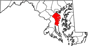
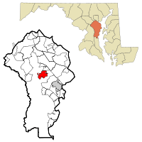
Crownsville, Maryland
| Crownsville, Maryland | |
|---|---|
| Census-designated place | |
 Location of Crownsville, Maryland | |
| Coordinates: 39°1′27″N 76°35′54″W / 39.02417°N 76.59833°WCoordinates: 39°1′27″N 76°35′54″W / 39.02417°N 76.59833°W | |
| Country |
|
| State |
|
| County |
|
| Area | |
| • Total | 5.1 sq mi (13.2 km2) |
| • Land | 5.1 sq mi (13.2 km2) |
| • Water | 0.0 sq mi (0.0 km2) |
| Elevation | 121 ft (37 m) |
| Population (2010) | |
| • Total | 1,757 |
| • Density | 346/sq mi (133.5/km2) |
| Time zone | Eastern (EST) (UTC-5) |
| • Summer (DST) | EDT (UTC-4) |
| ZIP code | 21032 |
| Area code(s) | 410 |
| FIPS code | 24-21075 |
| GNIS feature ID | 0590052 |
Crownsville is a census-designated place (CDP) in Anne Arundel County, Maryland, United States. The population was 1,757 at the 2010 census.[1] It hosts the Anne Arundel County Fair each September, as well as the annual Maryland Renaissance Festival for several summer weekends. A state psychiatric hospital was formerly in Crownsville. The area offers waterfront scenery and easy access to urban metropolitan areas and culture.
Geography
Crownsville is located at 39°1′27″N 76°35′54″W / 39.02417°N 76.59833°W (39.024149, -76.598295),[2] 7 miles (11 km) northwest of Annapolis, the state capital. Maryland Route 178 (Generals Highway) runs through the center of the CDP, and Interstate 97 forms the southwestern edge of the CDP, with access from the north via Exit 5.
According to the United States Census Bureau, the CDP has a total area of 5.1 square miles (13.2 km2), all of it land.[1] However, waterfront communities such as Arden On The Severn and Herald Harbor have Crownsville addresses.
Demographics
As of the census[3] of 2000, there were 1,670 people, 485 households, and 392 families residing in the CDP. The population density was 300.7 people per square mile (116.2/km²). There were 516 housing units at an average density of 92.9/sq mi (35.9/km²). The racial makeup of the CDP was 80.36% White, 15.45% African American, 0.78% Native American, 1.50% Asian, 0.06% Pacific Islander, 0.66% from other races, and 1.20% from two or more races. Hispanic or Latino of any race were 1.62% of the population.
In 2000, 4% of Crownsville residents identified as being of Lebanese heritage. This was the highest percentage of Lebanese Americans outside of Michigan.[4]
There were 485 households out of which 31.5% had children under the age of 18 living with them, 70.5% were married couples living together, 7.6% had a female householder with no husband present, and 19.0% were non-families. 14.6% of all households were made up of individuals and 4.1% had someone living alone who was 65 years of age or older. The average household size was 2.65 and the average family size was 2.90.
In the CDP the population was spread out with 19.4% under the age of 18, 7.4% from 18 to 24, 32.0% from 25 to 44, 32.6% from 45 to 64, and 8.6% who were 65 years of age or older. The median age was 41 years. For every 100 females there were 111.9 males. For every 100 females age 18 and over, there were 110.3 males.
The median income for a household in the CDP was $91,180, and the median income for a family was $99,553. Males had a median income of $87,035 versus $32,344 for females. The per capita income for the CDP was $37,509. About 4.3% of families and 11.2% of the population were below the poverty line, including none of those under age 18 and 18.1% of those age 65 or over.
Local schools
Schools located in Crownsville and the surrounding area are:
- South Shore Elementary School (K through 5th grade) (Anne Arundel County Public School)
- Millersville Elementary (K through 5th grade) (Anne Arundel County Public School)
- Indian Creek School (Pre-K through 12th grade) (private)
- Mary E. Moss Academy (9th grade-10th grade, alternative high school) (Anne Arundel County Public Schools)
- Arundel High School (9th grade-12th grade) (Anne Arundel County Public Schools)
- Old Mill High School (9th grade-12th grade) (Anne Arundel County Public Schools)
Parks and recreation facilities
The Anne Arundel County Department of Recreation and Parks maintains the Generals Highway Corridor Park in Crownsville. Facilities include a nature trail and playing fields.[5]
The Eisenhower Golf Course was Anne Arundel County's first public golf course, built in 1969. The 6,659-yard, 18-hole course was designed by golf architect Ed Ault on more than 220 acres (0.89 km2; 0.34 sq mi).[6]
The Bacon Ridge Natural Area[7][8] is 630 acres of protected land, including forests and marshes, which is open to the public for hiking and nature observation. There is currently a 2.5 mile figure-eight trail accessible from the parking area off Hawkins Rd. and further trails are planned for the coming years.[9]
Government
State government
The Maryland Department of Housing and Community Development is headquartered at 100 Community Place in Crownsville.[10]
Points of interest
Every autumn, Crownsville hosts the popular Maryland Renaissance Festival.
The grounds and buildings of the former Crownsville Hospital Center are still in Crownsville. Tenants include the Anne Arundel County Food Bank, which provides no-cost food assistance programs, a soup kitchen, distribution of medical equipment, and other aid programs through referrals from the county Department of Social Services and other service-oriented agencies.[11]
References
- 1 2 "Geographic Identifiers: 2010 Demographic Profile Data (G001): Crownsville CDP, Maryland". U.S. Census Bureau, American Factfinder. Retrieved May 30, 2013.
- ↑ "US Gazetteer files: 2010, 2000, and 1990". United States Census Bureau. 2011-02-12. Retrieved 2011-04-23.
- ↑ "American FactFinder". United States Census Bureau. Archived from the original on 2013-09-11. Retrieved 2008-01-31.
- ↑ "Ancestry Map of Lebanese Communities". Epodunk.com. Retrieved 2015-04-16.
- ↑ "General's Highway Corridor Park". Anne Arundel County Department of Recreation & Parks. Retrieved 8 October 2012.
- ↑ "Eisenhower Golf Course". Retrieved 8 October 2012.
- ↑ "Bacon Ridge Natural Area". www.srlt.org. Retrieved 2016-09-01.
- ↑ "Bacon Ridge Natural Area | Anne Arundel County, MD". www.aacounty.org. Retrieved 2016-09-01.
- ↑ "The Bacon Ridge Project - About | Facebook". www.facebook.com. Retrieved 2016-09-01.
- ↑ Home page. Maryland Department of Housing and Community Development. Retrieved on March 23, 2009.
- ↑ "Our Programs". Anne Arundel County Food Bank. Retrieved 8 October 2012.