Creswell, North Carolina
| Creswell, North Carolina | |
|---|---|
| Town | |
|
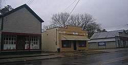
Downtown Creswell | |
 Location of Creswell, North Carolina | |
| Coordinates: 35°52′13″N 76°23′38″W / 35.87028°N 76.39389°WCoordinates: 35°52′13″N 76°23′38″W / 35.87028°N 76.39389°W | |
| Country | United States |
| State | North Carolina |
| County | Washington |
| Area | |
| • Total | 0.4 sq mi (1.1 km2) |
| • Land | 0.4 sq mi (1.1 km2) |
| • Water | 0.0 sq mi (0.0 km2) |
| Elevation | 7 ft (2 m) |
| Population (2010) | |
| • Total | 276 |
| • Density | 666.0/sq mi (257.2/km2) |
| Time zone | Eastern (EST) (UTC-5) |
| • Summer (DST) | EDT (UTC-4) |
| ZIP code | 27928 |
| Area code(s) | 252 |
| FIPS code | 37-15420[1] |
| GNIS feature ID | 1019859[2] |
Creswell is a town in Washington County, North Carolina, United States. The population was 276 at the 2010 census.
Geography
Creswell is located at 35°52′13″N 76°23′38″W / 35.870190°N 76.393791°W (35.870190, -76.393791).[3]
The town is located in the North Carolina Inner Banks on the north-central portion of the Albemarle-Pamlico Peninsula, and along the western edge of the southern portions of the Scuppernong River.
According to the United States Census Bureau, the town has a total area of 0.4 square miles (1.0 km2), all of it land.
Demographics
| Historical population | |||
|---|---|---|---|
| Census | Pop. | %± | |
| 1880 | 145 | — | |
| 1890 | 202 | 39.3% | |
| 1900 | 224 | 10.9% | |
| 1910 | 329 | 46.9% | |
| 1920 | 393 | 19.5% | |
| 1930 | 350 | −10.9% | |
| 1940 | 459 | 31.1% | |
| 1950 | 425 | −7.4% | |
| 1960 | 402 | −5.4% | |
| 1970 | 633 | 57.5% | |
| 1980 | 426 | −32.7% | |
| 1990 | 361 | −15.3% | |
| 2000 | 278 | −23.0% | |
| 2010 | 276 | −0.7% | |
| Est. 2015 | 261 | [4] | −5.4% |
As of the census[1] of 2000, there were 278 people, 118 households, and 86 families residing in the town. The population density was 666.0 people per square mile (255.6/km2). There were 141 housing units at an average density of 337.8 per square mile (129.6/km2). The racial makeup of the town was 50.00% White, 39.93% African American, 0.36% Native American, 0.36% Asian, 1.80% Pacific Islander, 4.68% from other races, and 2.88% from two or more races. Hispanic or Latino of any race were 6.83% of the population.
There were 118 households out of which 28.0% had children under the age of 18 living with them, 40.7% were married couples living together, 27.1% had a female householder with no husband present, and 27.1% were non-families. 24.6% of all households were made up of individuals and 13.6% had someone living alone who was 65 years of age or older. The average household size was 2.36 and the average family size was 2.77.
In the town the population was spread out with 22.3% under the age of 18, 10.4% from 18 to 24, 19.1% from 25 to 44, 24.1% from 45 to 64, and 24.1% who were 65 years of age or older. The median age was 43 years. For every 100 females there were 78.2 males. For every 100 females age 18 and over, there were 77.0 males.
The median income for a household in the town was $20,833, and the median income for a family was $23,750. Males had a median income of $25,000 versus $16,500 for females. The per capita income for the town was $11,769. About 18.3% of families and 26.1% of the population were below the poverty line, including 41.1% of those under the age of eighteen and 20.3% of those sixty five or over.
History
Creswell was incorporated in 1874, and named for John Angel James Creswell,[6] the United States Postmaster General at that time. The structures in downtown Creswell are some of North Carolina's best remaining examples of downtown architecture from the late 19th century.
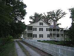
The Belgrade and St. David's Church, Creswell Historic District, Davenport House, and Somerset Place State Historic Site are listed on the National Register of Historic Places.[7]
Transportation
Highways and Roads
The town can be accessed from the east or west by U.S. Highway 64, and from the north or south by North Carolina Highway 94.
Creswell is within 300 miles (480 km) of these destinations:
Airports
Air travel is best served through the Norfolk International Airport (ORF) in Norfolk, Virginia or the Pitt-Greenville Airport (PGV) in Greenville, North Carolina
Politics
Town Government
The Mayor of Creswell is Ray Blount.
Elected members to the Town Council:
- Syble J. Spruill
- Gerald Woodley
- Ann Cheryl Swain
- J.D Melton
State Government
Creswell is served in the North Carolina General Assembly by State Senator Stan White (Democrat) and State Representative Tim Spear (Democrat).
Federal Government
The town is also served in the United States Congress by U.S. Senator Richard Burr (Republican), U.S. Senator Kay Hagan (Democrat) and U.S. Representative G.K. Butterfield (Democrat).
Recent Issues
The Town of Creswell is aligned with a group called North Carolinians Opposed to the Outlying Landing Field. This group opposes a United States Navy proposal to construct an outlying landing field near the Pocosin Lakes National Wildlife Refuge in Washington County, North Carolina.
Attractions
- Gravesite of J. Johnston Pettigrew - famous Civil War general that lived in the area.
- Somerset Place - former plantation home that now operates as a state historic site
- Pettigrew State Park
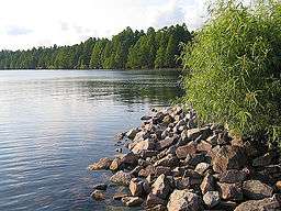
- Lake Phelps
- Albemarle Sound
- Pocosin Lakes National Wildlife Refuge
- Davenport Homestead
The town symbol, an artesian well hand-pump, can be found on Main Street in heart of downtown.
Notable people
- Elmo Langley - race car driver and owner, NASCAR pace car driver
- J. Johnston Pettigrew
Education
- Creswell Elementary School
- Creswell High School
Media
Newspaper
Creswell is served by the weekly Roanoke Beacon newspaper from Plymouth, NC, and the daily Washington Daily News from Washington, NC.
Television
Creswell is part of the Greenville-Washington-New Bern-Morehead City market, which is the 107th largest in 2006, according to Nielsen Media Research. Broadcast television stations serving the market include:
- WUND-TV the (2) Columbia PBS affiliate, (part of the UNC-TV Network)
- WITN-TV the (7) Washington/Greenville/New Bern NBC affiliate
- WFXI-TV the (8) Morehead City Fox affiliate
- WNCT-TV the (9) Greenville CBS affiliate
- WCTI-TV the (12) New Bern ABC affiliate
References
| Wikimedia Commons has media related to Creswell, North Carolina. |
- 1 2 "American FactFinder". United States Census Bureau. Archived from the original on 2013-09-11. Retrieved 2008-01-31.
- ↑ "US Board on Geographic Names". United States Geological Survey. 2007-10-25. Retrieved 2008-01-31.
- ↑ "US Gazetteer files: 2010, 2000, and 1990". United States Census Bureau. 2011-02-12. Retrieved 2011-04-23.
- ↑ "Annual Estimates of the Resident Population for Incorporated Places: April 1, 2010 to July 1, 2015". Retrieved July 2, 2016.
- ↑ "Census of Population and Housing". Census.gov. Archived from the original on May 11, 2015. Retrieved June 4, 2015.
- ↑ Gannett, Henry (1905). The Origin of Certain Place Names in the United States. Govt. Print. Off. p. 96.
- ↑ National Park Service (2010-07-09). "National Register Information System". National Register of Historic Places. National Park Service.
Municipalities and communities of Washington County, North Carolina, United States | ||
|---|---|---|
| Towns |  | |
| Unincorporated communities | ||