Crawford Plains, Edmonton
| Crawford Plains | |
|---|---|
| Neighbourhood | |
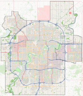
 Crawford Plains Location of Crawford Plains in Edmonton | |
| Coordinates: 53°26′20″N 113°24′25″W / 53.439°N 113.407°W | |
| Country |
|
| Province |
|
| City | Edmonton |
| Quadrant[1] | NW |
| Ward[1] | 12 |
| Sector[2] | Southeast |
| Area[3][4] Community |
Mill Woods Southwood |
| Government[5] | |
| • Mayor | Don Iveson |
| • Administrative body | Edmonton City Council |
| • Councillor | Moe Banga |
| Area[6] | |
| • Total | 0.59 km2 (0.23 sq mi) |
| Elevation | 716 m (2,349 ft) |
| Population (2012)[7] | |
| • Total | 4,394 |
| • Density | 7,447.5/km2 (19,289/sq mi) |
| • Change (2009–12) |
|
| • Dwellings | 1,477 |
Crawford Plains is a residential neighbourhood located in the Mill Woods area of south Edmonton, Alberta, Canada. It is a part of the Mill Woods community of Southwood.
According to the 2001 federal census, Development of the neighbourhood began during the 1970s when two out of every four (26.4%) of the residences in the neighbourhood were constructed. Most of the residences in the neighbourhood were constructed during the 1980s when another three out of five (58.2%) were built. The remaining 14.4% were built during the 1990s.[8]
According to the 2005 municipal census, the neighbourhood is predominantly single-family dwellings, which account for four out of every five (77%) of all the residences in the neighbourhood. Row houses account for another one in six (17%) of the residences. The remaining 6% of the residences are duplexes.[9] Four out of five residences (84%) are owner occupied.[10]
There is a single school in the neighbourhood, Crawford Plains School, operated by the Edmonton Public School System.
Residents have good access to shopping with the Mill Woods Town Centre shopping centre located nearby.
The neighbourhood is bounded on the west by 50 Street, the north by Mill Woods Road East and 16A Avenue, on the east by 34 Street, and on the south by Anthony Henday Drive.
Demographics
In the City of Edmonton's 2012 municipal census, Crawford Plains had a population of 4,394 living in 1,477 dwellings,[7] a -0.4% change from its 2009 population of 4,410.[11] With a land area of 0.59 km2 (0.23 sq mi), it had a population density of 7,447.5 people/km2 in 2012.[6][7]
Surrounding neighbourhoods
 |
Meyokumin | Daly Grove, Pollard Meadows | Meadows Area |  |
| Sakaw | |
Meadows Area | ||
| ||||
| | ||||
| Anthony Henday Drive, Charlesworth | Anthony Henday Drive | Anthony Henday Drive |
References
- 1 2 "City of Edmonton Wards & Standard Neighbourhoods" (PDF). City of Edmonton. Archived from the original (PDF) on May 3, 2014. Retrieved February 13, 2013.
- ↑ "Edmonton Developing and Planned Neighbourhoods, 2011" (PDF). City of Edmonton. Archived from the original (PDF) on September 4, 2013. Retrieved February 13, 2013.
- ↑ "The Way We Grow: Municipal Development Plan Bylaw 15100" (PDF). City of Edmonton. 2010-05-26. Archived from the original (PDF) on May 2, 2015. Retrieved February 13, 2013.
- ↑ "City of Edmonton Plans in Effect" (PDF). City of Edmonton. November 2011. Archived from the original (PDF) on October 17, 2013. Retrieved February 13, 2013.
- ↑ "Mayor and City Council". City of Edmonton. Retrieved February 26, 2016.
- 1 2 "Neighbourhoods (data plus kml file)". City of Edmonton. Retrieved February 13, 2013.
- 1 2 3 "Municipal Census Results – Edmonton 2012 Census". City of Edmonton. Retrieved February 22, 2013.
- ↑ http://censusdocs.edmonton.ca/DD23/FEDERAL%202001/Neighbourhood/CRAWFORD%20PLAINS.pdf
- ↑ Includes triplexes and quadruplexes.
- ↑ http://censusdocs.edmonton.ca/C05002/MUNICIPAL%202005/Neighbourhood/CRAWFORD%20PLAINS.pdf
- ↑ "2009 Municipal Census Results". City of Edmonton. Retrieved February 22, 2013.