County Route 501 (New Jersey)
| ||||
|---|---|---|---|---|
|
CR 501 highlighted in red | ||||
| Route information | ||||
| Length: | 40.24 mi[1] (64.76 km) | |||
| Middlesex County section | ||||
| Length: | 10.12 mi[1] (16.29 km) | |||
| West end: |
| |||
| Major junctions: |
| |||
| East end: |
| |||
| Hudson / Bergen County section | ||||
| Length: | 30.12 mi[1] (48.47 km) | |||
| South end: |
| |||
| Major junctions: |
| |||
| North end: |
| |||
| Location | ||||
| Counties: | Middlesex, Hudson, Bergen | |||
| Highway system | ||||
| ||||

_map.svg.png)
County Route 501, abbreviated CR 501, is a county highway in New Jersey in two segments spanning Middlesex, Hudson and Bergen Counties. The southern section runs from South Plainfield to Perth Amboy, the northern section runs from Bayonne to Rockleigh, and the two sections are connected by New York State Route 440 across Staten Island.
The New Jersey Department of Transportation lists CR 501 as a single highway with a length of 53.07 miles (85.41 km), which includes both road sections as well as the connection along NY 440.
Route description
Middlesex County
County Route 501 is signed east-west in Middlesex County. The western (southern) terminus of County Route 501 is at CR 529 in South Plainfield. From there, the route heads east to Metuchen, where it has a short concurrency with Route 27. It then continues east, crossing the Garden State Parkway between Exits 127 and 129 in Woodbridge, following concurrencies with Route 184 and Route 440 to the southern section's eastern terminus at the Outerbridge Crossing.
Hudson County (John F. Kennedy Boulevard)
The northern section of CR 501 starts at the Route 440/Bayonne Bridge junction in Bayonne, making its way north to Route 63 in North Bergen. The highway crosses Route 139 to the Holland Tunnel and Route 495 to the Lincoln Tunnel.
At its junction with Route 63 in North Bergen, CR 501 begins a concurrency with Route 63 into Bergen County, while John F. Kennedy Boulevard loops around the northern end and heads south to Guttenberg, West New York and Weehawken.
Major points on CR 501/Kennedy Boulevard include Marist High School, New Jersey City University, Saint Peter's University, Journal Square, Union City High School, and four County parks: Stephen R. Gregg (Bayonne) Park and Mercer Park in Bayonne, Lincoln Park in Jersey City and James J. Braddock (North Hudson) Park in North Bergen.
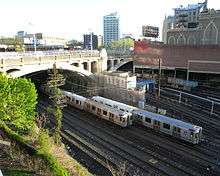
Immediately northeast of Journal Square, CR 501/Kennedy Boulevard crosses over Port Authority Trans-Hudson (PATH) railroad tracks on an open-spandrel concrete arch bridge completed in 1926. The bridge is a pared-down version of a more ambitious elevated plaza scheme proposed by consulting engineer Abraham Burton Cohen. Cohen's office constructed a model using slot cars to demonstrate traffic flow through the plaza.[2]
Prior to being renamed in honor of John F. Kennedy in the 1960s, the street was known as Hudson Boulevard. While there was discussion of building a county long road as early as the 1870s,[3] parts of Hudson County Boulevard were officially opened in 1896.[4][3][5] By 1913 it was completed, and considered to be fine for "motoring",[6] and included Boulevard East. Taken as a single road, the circuitous route of west and east sections of the entire boulevard runs from the southern tip of the county at Bergen Point to its northern border with Bergen County and south again to the Hoboken city line.[7]
The Boulevard was named the fifth most dangerous road for pedestrians in New Jersey, and the most dangerous road in Hudson County for pedestrians in a February 2011 report by the non-profit Tri-State Transportation Campaign. The road was the location of six pedestrian fatalities between 2007 and 2009, which account for a little more than a fifth of Hudson County's 29 pedestrian deaths in the three-year period.[8] County officials had expressed interest in building a pedestrian bridge that crosses Kennedy Boulevard at 32nd Street, at the Union City-North Bergen border at least since 2001.[9] The two cities contracted a company to build the bridge for just over $4 million in November 2010.[10] Construction plans began in May 2011, and field work began later that August.[11]

In 2013 Kennedy Boulevard was one of two main thoroughfares in Hudson County (the other being Route 1 & 9) that were listed among the Tri-State Transportation Campaign's list of the top ten most dangerous roads for pedestrians in New Jersey, New York and Connecticut. The Boulevard, which ranked #6 on the list, was cited for the six pedestrian fatalities that occurred on it from 2009 to 2011.[12]
Bergen County
In Bergen County, CR 501 leaves its concurrency with Route 63 in Palisades Park, using Central Boulevard to connect to the US 1/9/46 concurrency and Route 93. It is then concurrent with Route 93 until it reaches that route's northern terminus at Route 4 in Englewood. CR 501 continues north from this junction through Rockleigh, crossing the New York State Line and becoming New York State Route 340.
Major intersections
| County | Location | mi[1] | km | Destinations | Notes |
|---|---|---|---|---|---|
| Middlesex | South Plainfield | 0.00 | 0.00 | ||
| Edison | 2.03 | 3.27 | Exit 3 on I-287 | ||
| Metuchen | 3.36 | 5.41 | Western terminus of concurrency with Route 27 | ||
| 3.61 | 5.81 | Eastern terminus of concurrency with Route 27 | |||
| 3.81 | 6.13 | ||||
| Edison | 4.68 | 7.53 | Interchange | ||
| 5.70 | 9.17 | ||||
| 6.23 | 10.03 | Western terminus of CR 616 | |||
| Woodbridge Township | 6.99 | 11.25 | Western terminus of Route 184 | ||
| 7.10 | 11.43 | Exit 129 on Garden State Parkway | |||
| 7.33 | 11.80 | Interchange | |||
| Perth Amboy | 7.74 | 12.46 | |||
| 8.22 | 13.23 | Eastern terminus of concurrency with Route 184 | |||
| Western terminus of freeway section | |||||
| Western terminus of concurrency with Route 440 | |||||
| 8.38 | 13.49 | Westbound exit only | |||
| 8.65 | 13.92 | Amboy Avenue (CR 653) | Northbound exit is via Route 440 exit | ||
| 9.23 | 14.85 | State Street (CR 611) / High Street – Perth Amboy | Northbound exit and southbound entrance | ||
| Arthur Kill | 9.45 | 15.21 | Outerbridge Crossing (toll plaza on Staten Island) | ||
| 10.12 | 16.29 | Continuation into New York at the river's center | |||
| Connection made via NY 440 (12.73 miles or 20.49 kilometres) | |||||
| Kill van Kull | 22.85 | 36.77 | Continuation from New York at river's center | ||
| 23.24 | 37.40 | Bayonne Bridge (toll plaza on Staten Island) | |||
| Hudson | Bayonne | 23.71 | 38.16 | Avenue A | Southbound exit and entrance |
| 23.73 | 38.19 | Northern terminus of concurrency with Route 440 | |||
| Northern terminus of freeway section | |||||
| 27.12 | 43.65 | ||||
| Jersey City | 29.37 | 47.27 | |||
| 31.11 | 50.07 | One-way ramp to Tonnele Circle | |||
| 31.15 | 50.13 | Western terminus of the upper level of Route 139 | |||
| North Bergen | 34.03 | 54.77 | Interchange | ||
| Union City | 34.35– 34.39 | 55.28– 55.35 | Southern terminus of CR 505 | ||
| North Bergen | 37.21 | 59.88 | Southern terminus of Route 63 | ||
| Bergen | Fort Lee | 39.13 | 62.97 | Interchange via local roads | |
| Palisades Park | 39.62 | 63.76 | Northern terminus of concurrency with Route 63 | ||
| 39.90 | 64.21 | Interchange via 5th and 6th Streets | |||
| 40.52 | 65.21 | Southern terminus of concurrency with Route 93 | |||
| Englewood | 42.78 | 68.85 | Interchange | ||
| 42.86 | 68.98 | Northern terminus of Route 93; one-way pair begins | |||
| 43.86 | 70.59 | ||||
| 45.05 | 72.50 | Northern terminus of one-way pair | |||
| Closter | 49.61 | 79.84 | |||
| Rockleigh | 53.07 | 85.41 | Continuation into New York | ||
1.000 mi = 1.609 km; 1.000 km = 0.621 mi
| |||||
See also
 U.S. Roads portal
 New Jersey portal
References
- 1 2 3 4 New Jersey County Route 501 Straight Line Diagram from the New Jersey Department of Transportation
- ↑ Cohen, A. Burton. "Hudson County Boulevard Bridge Plaza." Purdue Engineering Review 21, No. 4 (May 1926): 3-6, 22.
- 1 2 "The Hudson Boulevard: The Old and New Commissions—The Opposition, The Proposed Route". The New York Times. August 12, 1873. p. 8. Retrieved March 29, 2010.
- ↑ "Jersey City's Bicycle Parade: It Was Held Yesterday on the Hudson Boulevard and Was a Big Thing". The New York Times. August 30, 1896. p. 6. Retrieved March 26, 2010.
- ↑ "Opening the Boulevard: Wheelmen Parade Along Hudson County's New Driveway". The New York Times. November 29, 1895. p. 10. Retrieved 2010-07-02.
- ↑ "Short Runs Near Town Pleasant Now". The New York Times. March 23, 1913. Part Nine, p. 9. Retrieved 2016-06-20.
- ↑ "Preserve the Palisades: Cyclists to work for this purpose and the Hudson County Boulevard". The New York Times. November 11, 1895. p. 8. Retrieved 2010-12-06.
- ↑ "Kennedy Boulevard named fifth most dangerous road in New Jersey for pedestrians", The Hudson Reporter, March 21, 2011
- ↑ Hague, Jim (August 19, 2011). "Pedestrian bridge set for North Bergen-Union City? County officials receive grant that will check feasibility of overpass". The Hudson Reporter.
- ↑ "BOARD OF CHOSEN FREEHOLDERS COUNTY OF HUDSON: CAUCUS AGENDA". HudsonCountyNJ.com. November 22, 2010.
- ↑ Pope, Gennarose (March 25, 2012). "Bridge of troubled Kennedy Boulevard". The Union City Reporter. pp. 1 and 12.
- ↑ Zeitlinger, Ron; Machcinski, Anthony J. (March 1, 2013). "6th and 10th Most Fatalities". The Jersey Journal. p. 5.
External links
| Wikimedia Commons has media related to County Route 501 (New Jersey). |
- An enlarged view of road jurisdiction at the Fort Lee approaches to the George Washington Bridge
- New Jersey Roads: County Route 501 and NJ 63, NJ 93
- NJ State Highways: CR 200-514