County Cavan
| County Cavan Contae an Chabháin | ||
|---|---|---|
| ||
| Nickname(s): 'The Drumlin County' | ||
|
Motto: Feardhacht is Fírinne (Irish) "Manliness and Truth" | ||
 | ||
| Country | Ireland | |
| Province | Ulster | |
| Dáil Éireann | Cavan–Monaghan | |
| EU Parliament | Midlands–North-West | |
| County town | Cavan | |
| Government | ||
| • Type | County Council | |
| Area | ||
| • Total | 1,932 km2 (746 sq mi) | |
| Area rank | 19th | |
| Population (2016)[1] | 76,092 | |
| • Rank | 25th | |
| Vehicle index mark code | CN | |
| Website |
www | |

County Cavan (Irish: Contae an Chabháin) is a county in Ireland. It is in the province of Ulster and is part of the Border Region. It is named after the town of Cavan and is based on the historic Gaelic territory of East Breffny (Bréifne).[2][3] Cavan County Council is the local authority for the county, which has a population of 76,092 according to the 2016 census.
Geography and political subdivisions
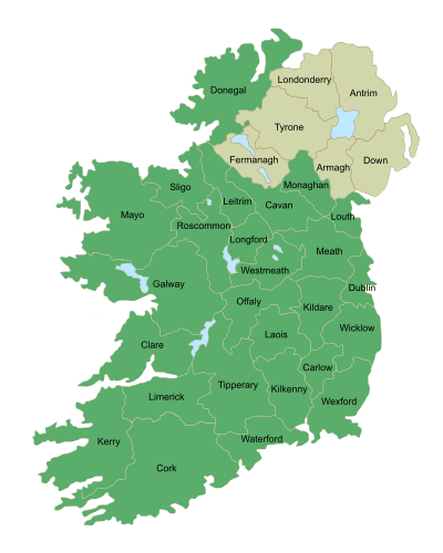
Cavan borders six counties: Leitrim to the west, Fermanagh and Monaghan to the north, Meath to the south-east, Longford to the south-west and Westmeath to the south. Cavan shares a 70 km (43 mi) border with County Fermanagh in Northern Ireland. Cavan is the 19th largest of the 32 counties in area and the 25th largest by population.[4] It is also the sixth largest of Ulster's nine counties in size and the seventh largest by population.
Baronies
There are eight historic baronies in the county. While baronies continue to be officially defined units, they are no longer used for many administrative purposes. Their official status is illustrated by Placenames Orders made since 2003, where official Irish names of baronies are listed under "Administrative units".
- Castlerahan (Caisleán Raithin) see Virginia, County Cavan
- Clankee (Clann Chaoich)
- Clanmahon (Clann Mhathúna)
- Loughtee Lower (Lucht Tí Íochtarach)
- Loughtee Upper (Lucht Tí Uachtarach) – whose chief town, Cavan, is also the county town
- Tullygarvey (Teallach Ghairbhíth)
- Tullyhunco (Teallach Dhúnchadha)
- Tullyhaw (Teallach Eathach) – the largest in the county at 89,852 acres (363.62 km2)
Civil parishes and townlands
Townlands are the smallest officially defined geographical divisions in Ireland, there are approximately 1979 townlands in the county.
Towns and villages
Geography

The county is characterised by drumlin countryside dotted with many lakes and hills. The north-western area of the county is sparsely populated and mountainous. The Breifne mountains contain the highest point, Cuilcagh, at 665 metres (2,182 feet).
Cavan is the source of many rivers. Shannon Pot on the slopes of Cuilcagh is the source of the River Shannon, the longest river in Ireland at 386 km (240 mi). The River Erne is a major river which rises from Beaghy Lough, two miles (3 km) south of Stradone in Cavan and flows for 120 km (75 mi) to Lough Erne. Other rivers in the county include the Blackwater River from Lough Ramor which joins the River Boyne at Navan; the Dee which springs near Bailieborough; the River Annalee which flows from Lough Sillan and joins the Erne; and the Cladagh river which rises from Cuilcagh and flows into Fermanagh. The Glyde and the Owenroe also source in Cavan.
Cavan is known as 'The Lakeland County' and is reputed to contain 365 lakes.[5] At 18.8 km2 (7.3 sq mi), Lough Sheelin is the county's largest lake; it is situated in the south of the county and forms a three way border on its waters between counties Meath, Westmeath and Cavan.[6] A large complex of lakes form in the north and west of Cavan into designated Specially Protected Areas (SPA); an example is Lough Oughter. Other important wildlife protected lakes such as Lough Gowna and Lough Ramor are in the south and east of the county. Cavan has a mainly hilly (drumlin) landscape and contains just under 7,000 hectares (17,000 acres) of forested area, 3.6% of Cavan's total land area. The county contains forests such as Bellamont Forest near Cootehill, Killykeen Forest Park at Lough Oughter (a Coillte state forest concern), Dún na Rí Forest Park and the Burren Forest.
Climate
| Ballyhaise, Cavan | ||||||||||||||||||||||||||||||||||||||||||||||||||||||||||||
|---|---|---|---|---|---|---|---|---|---|---|---|---|---|---|---|---|---|---|---|---|---|---|---|---|---|---|---|---|---|---|---|---|---|---|---|---|---|---|---|---|---|---|---|---|---|---|---|---|---|---|---|---|---|---|---|---|---|---|---|---|
| Climate chart (explanation) | ||||||||||||||||||||||||||||||||||||||||||||||||||||||||||||
| ||||||||||||||||||||||||||||||||||||||||||||||||||||||||||||
| ||||||||||||||||||||||||||||||||||||||||||||||||||||||||||||
Met Éireann records the climate data for Cavan from their station at Ballyhaise. Under Köppen climate classification, Cavan experiences a maritime temperate oceanic climate with cold winters, mild humid summers, and a lack of temperature extremes. The average maximum January temperature is 8.2 °C (47 °F), while the average maximum July temperature is 19.8 °C (68 °F). On average, the sunniest months are May and June, while the wettest month is October with 104.4 mm (4 in) of rain, and the driest months are May and June with 67.8 mm (3 in) and 67.9 mm (3 in) respectively. Humidity is high year round and rainfall is evenly distributed throughout the year, with the annual precipitation at Ballyhaise being 1,006 mm (40 in)
On average, snow showers occur between November and March. In 2010, record low temperatures for November, December and January were recorded in Cavan. In late December, the temperature at the station fell to −15.4 °C (4 °F), its lowest ever. On Tuesday 21 December 2010, a daily maximum of −9.4 °C (15 °F) was recorded at Ballyhaise, the lowest daily maximum ever recorded in Ireland. Summer daytime temperatures range between 15 °C (59 °F) and 22 °C (72 °F), with temperatures rarely going beyond 25 °C (77 °F).[7] The average annual sunshine hours range between 1,300 hours in the north to 1,500 hours in the south.[8]

History
In medieval times, the area of Cavan was part of the petty kingdom of East Bréifne or Brefney O'Reilly after its ruling Gaelic family. This in turn was a division of the 11th century Kingdom of Bréifne. For this reason the county is colloquially known as the Breffni County.[9] A high degree of defence was achieved by using the natural landscape of drumlin hills and loughs. The poorly drained heavy clay soils contributed as an obstacle against invasion.
Historically, Cavan was part of the western province of Connacht, but was transferred to Ulster in 1584 when Bréifne was shired and became the county of Cavan. In the south, the Lough Sheelin area was part of Leinster until the late 14th century.
Parts of Cavan were subjected to Norman influence from the twelfth century and the remains of several motte and bailie fortifications are still visible mainly in the east of the county, as well as the remains of stronger works such as Castlerahan and Clogh Oughter castle. The influence of several monastic orders also owes its origins to around this time with abbey remains existent in locations such as Drumlane and Trinity Island.
The Plantation of Ulster from 1610 saw the settlement and origins of several new towns within the county that include Bailieborough, Cootehill, Killeshandra and Virginia. Existing towns such as Cavan and Belturbet became over time more important as trading centres. Wars during the mid-seventeenth century aimed at trying to unsettle the Plantation only led to further plantations of English and Scottish settlers into the county and the beginnings of a thriving flax and linen industry.
Some areas of Cavan were hard hit by the Great Famine potato blight between 1845–49. The winter of 1847 is particularly noted for the high levels of deaths nationally caused by diseases such as typhus and cholera. Several instances of eviction also occurred during the nineteenth century, with one such story where the local landlord in Mountnugent parish decided to evict over 200 people. The famous ballad "By Lough Sheelin Side" is based on this event witnessed by the local Catholic priest.
Edward Saunderson, founder of the Ulster Unionist Council, was born in the County. However, when the Irish Unionist Party met on 9 June 1916, the delegates from Cavan learnt that they would not be included in any "temporary exclusion of Ulster" from Home Rule; they agreed only with very great reluctance.[10]
Local government and politics
| Party | Seats | % of votes | |
|---|---|---|---|
| Fianna Fáil | 7 | 40.6% | |
| Fine Gael | 7 | 36.8% | |
| Sinn Féin | 4 | 18.2% | |
| Labour Party | 0 | 0.69% | |
| Other | 0 | 3.7% | |
Cavan is divided into three local district council areas: Bailieborough-Cootehill, Ballyjamesduff-Virginia and Cavan-Belturbet, which hold 18 county council seats in total. There were also three town Councils: Cavan, Belturbet and Cootehill but these were disbanded during the 2014 local elections.[11] The 2014 Cavan local elections had an average voter turnout of 56.42%, almost 10% lower than the turnout in 2009. The highest turnout for an electoral area was Bailieborough-Cootehill with 60.39%.
For the purposes of elections to Dáil Éireann, the county is divided across two east/west constituencies Cavan–Monaghan constituency which returns four deputies, while West Cavan (since the 2015 General Election) is part of the Sligo, Leitrim, South Donegal & West Cavan constituency, and has no sitting West Cavan TD's or Senators at present(TDs) to the Dáil. In the 2011 general election, there was a voter turnout of 72.7%.[12]
The county is part of the Border Region - a NUTS II entity - which is in turn part of the level III NUTS entity - Border, Midland and Western.
For elections to the European Parliament, the county is part of the North–West constituency (formerly Connacht–Ulster).
Places of interest
- Magh Slécht
- Castle Saunderson
- Cabra Castle
- Cloughoughter Castle
- Drumlane Monastery
- Saint Kilian Heritage Centre
- Killeshandra Church of the Rath
- Cavan County Museum
Natural attractions
- Killeshandra Loop Walk[13]
- Dún na Rí Forest Park
- Killykeen Forest Park
- Marble Arch Caves Global Geopark
- Lough Sheelin
- Cuilcagh
- Shannon-Erne Waterway
Transport
Road
Two national primary routes pass through the county, The N3 road and the N16 road. The N3 is the longest route in Cavan, crossing the county for 60 km (37 mi) from the Meath border at Whitegate near Virginia and through Belturbet into Fermanagh. The N16 begins in Sligo and ends at Blacklion in the far northwestern tip of Cavan, it crosses the county for roughly 7 km (4.3 mi).
Three national secondary routes pass through the county. The N87 road begins in Belturbet and passes through Ballyconnell and Swanlinbar before crossing into County Fermanagh where it becomes the A32. The N54 route from Monaghan and Clones joins the N3 at Butlersbridge. The N55 links Cavan to Athlone via Ballinagh and Granard.
Bus Éireann provide bus services to villages and towns across the county, including a direct route from Cavan to Dublin Airport.
Rail
In the mid-1850s the Midland Great Western Railway built a line between the Inny Junction in Co. Westmeath (along their expanding network which was eventually to reach Sligo) and Cavan town. The first railway station to open in Cavan, was Cavan railway station in 1856. Many notable railway stations were built in the 19th century such as Kingscourt railway station and the Cavan and Leitrim Railway. The railways were an important part of the economic development of Cavan and carried passengers and freight to all over Ireland. The railways also helped the popularity of GAA in Cavan grow, spectators could travel easily between towns.
After World War II, due to the shortage of coal in the country, uneconomic lines were terminated. In 1947 all passenger services were terminated though the transport of freight and livestock continued. The Great Northern Railway (G.N.R.) continued to serve the Cavan and Leitrim Railway. However, in 1959 all services along the remaining rail lines were terminated and the stations along their routes were closed.
Belturbet railway station is open as a railway museum.
Water
In the historical context and before water levels in lakes were lowered, water transport in the region was once very important through the complex of lakes and waterways that fed into the major river systems such as the Erne, Shannon and Boyne. Today however this is mainly confined to leisure craft on the River Erne and Shannon-Erne Waterway from Belturbet and Ballyconnell as well as for angling activities. Cavan also has 365 lakes all around, one for everyday of the year.
Sport
In Gaelic football,the dominant sport in the county, Cavan GAA competes annually in the All-Ireland Senior Football Championship, which it has won 5 times, between 1933 and 1952. The team is currently in division 2 of the National Football League and will be competing in division 2 in 2016. Cavan is the only county in Ireland without a senior hurling team, the county board having discontinued the team in 2011. The sport was on the decline and the senior team was disbanded to promote Hurling at junior level.[14] GAA football player Seanie Johnston was born in the county.
The first GAA club founded in Cavan was Ballyconnell in 1885. However the club didn’t affiliate to GAA Central Council until March 1886 so that can be taken as the founding of the GAA in Cavan and Ulster.[15] The most successful club in Cavan is Cornafean with 20 Senior Football Championship titles, their last title was won in 1956. The most successful club in recent years has been Cavan Gaels GAA which has won 6 of the last 10 Senior Football Championships. Kingscourt Stars are the current senior football champions, having defeated Castlerahan in the 2015 decider. No team from Cavan has ever won a national or provincial title.
There is a strong history of athletics in Cavan, with a 300m Tartan track in Shercock and other athletics facilities throughout the county. There are five athletics clubs in the county at present, but there have been many more over the years. The current athletics clubs are Annalee AC, Bailieborough AC, Innyvale AC, Laragh AC and Shercock AC.
Cavan has two rugby football clubs, Co. Cavan R.F.C. and Virginia R.F.C., both teams compete in the Ulster qualifying leagues.
Fishing is a very popular activity in Cavan because of its complex of large rivers and lakes.

Below is a list of various sporting clubs in Cavan:
| Club | Sport | League |
|---|---|---|
| Cavan Gaels GAA | Gaelic Football | Cavan Senior Football Championship |
| Killinkere | Basketball | North East League[16] |
| Bailieboro Celtic FC | Football | Meath & District League |
| Mullahoran GFC | Hurling | Cavan Senior Hurling Championship |
| County Cavan R.F.C. | Rugby | Ulster Rugby |
| Bailieborough AC | Athletics | Cavan County Championships |
| Cornafean GAA | Gaelic football | Cavan Junior Football Championship |
Demographics
| Historical population | ||
|---|---|---|
| Year | Pop. | ±% |
| 1600 | 4,665 | — |
| 1610 | 8,911 | +91.0% |
| 1653 | 12,001 | +34.7% |
| 1659 | 14,703 | +22.5% |
| 1821 | 195,076 | +1226.8% |
| 1831 | 227,933 | +16.8% |
| 1841 | 243,158 | +6.7% |
| 1851 | 174,071 | −28.4% |
| 1861 | 153,906 | −11.6% |
| 1871 | 140,735 | −8.6% |
| 1881 | 129,476 | −8.0% |
| 1891 | 111,917 | −13.6% |
| 1901 | 97,541 | −12.8% |
| 1911 | 91,173 | −6.5% |
| 1926 | 82,452 | −9.6% |
| 1936 | 76,670 | −7.0% |
| 1946 | 70,355 | −8.2% |
| 1951 | 66,377 | −5.7% |
| 1956 | 61,740 | −7.0% |
| 1961 | 56,594 | −8.3% |
| 1966 | 54,022 | −4.5% |
| 1971 | 52,618 | −2.6% |
| 1979 | 53,720 | +2.1% |
| 1981 | 53,855 | +0.3% |
| 1986 | 53,965 | +0.2% |
| 1991 | 52,796 | −2.2% |
| 1996 | 52,944 | +0.3% |
| 2002 | 56,546 | +6.8% |
| 2006 | 64,003 | +13.2% |
| 2011 | 73,183 | +14.3% |
| 2016 | 76,092 | +4.0% |
| [17] | ||
As of 2011, Cavan has a population of 73,183 making it the 25th largest county by population, ahead of Sligo and behind Offaly.[18] In 2011, Cavan (according to CSO statistics) had a natural population increase of 742 people (1,286 births minus 544 deaths).[18] Cavan has a higher percentage than the state average of people in the dependency age, 0-14 and over 65 with 34.7% in 2006, which is a drop from 36.6% in 2002. Cavan had a high age dependency ratio in 2002 of 66.91%, this was due to the migration of people who went for third level education elsewhere or who looked for work, most likely in the Greater Dublin Area. The language spoken in the county is predominantly English, with just 35% of the Cavan population also Irish speaking. The national census of April 2011 shows net migration slowing to a rate of 16.2% over that of previous periods. Between 2002 and 2006 Cavan had a population increase of 13.2%, and of this growth 83.4% was due to inward migration.
The 2011 Census results (published in April 2012) show a County Cavan population increase of 14.34%, the largest population growth in Ireland after County Laois. The population rose from 64,003 to 73,183 persons with an average increase of 15% seen in electoral areas in the southeast of the county. This increase is due to the continued population growth of N3/M3 proximity commuter towns such as Virginia, Ballyjamesduff, Bailieborough and Mullagh. Virginia is now the second largest populated town in the county. However, a continued decrease as seen from earlier census results in areas of the north and west of the county, including urban areas such Cavan and Cootehill towns. The 2011 preliminary census results also listed the highest percentage of partially constructed and vacant houses situated in the north and west of the county, representing over 20% of its dwellings vacant.[19]
The county's largest town is Cavan and the population density is 37 persons/km2 (96 persons/sq mi)
Religion
The 2011 Census results, published by CSO,[20] reported that of Cavan's 73,183 residents, 85% of people identified as Roman Catholic, 5.8% (4,230 people) were affiliated with the Church of Ireland, and 1.4% (1,030 people) identified as either Presbyterian, Methodist or Wesleyan. Other stated religions made up 3.4% of the population and 0.02% (17 people) identified as Jewish. 2,276 people were irreligious, an increase of 56.1% from the 2006 Census, and up from just 291 people twenty years earlier in the 1991 census. 1.3% of people did not state their religion.
The Cathedral of Saint Patrick and Saint Felim in Cavan town, is the seat of the Bishop of Kilmore and the mother church of the Roman Catholic Diocese of Kilmore. St Fethlimidh's Cathedral, also in Cavan town, is one of two cathedral churches in the Diocese of Kilmore, Elphin and Ardagh in the Church of Ireland. The Cavan Baptist Church is located in Oldtown and the Islamic Cultural Centre, which is primarily used as a mosque, is located in Cavan town. There are two Methodist churches located in Ballyconnell and Corlespratten. There are a number of Presbyterian churches throughout the county and a restored 1800's Wesleyan Chapel in Bailieborough.
Nationalities
| Nationality 2011 | Irish | UK | Polish | Lithuanian | Other EU | Rest of World | Not Stated | Total |
|---|---|---|---|---|---|---|---|---|
| Number | 63,106 | 2,118 | 1,889 | 1,326 | 1,429 | 1,647 | 1,017 | 72,532 |
| Percentage | 87% | 2.92% | 2.6% | 1.83% | 1.97% | 2.27% | 1.4% | 100% |

Economy
Agriculture is the largest industry in the county, especially dairy milk processing as well as pig and beef farming. Much of Cavan's land consists of clay soils, which are rich in minerals, but heavy and poorly drained, making pasture farming the dominant farming system in the county.[21] There is a total farmed area of 144,269 hectares (356,500 acres) in the county, and there are approximately 219,568 cattle in Cavan. Lakeland Dairies Group, which is based in Killeshandra and has manufacturing sites located throughout Cavan, is Ireland's second largest dairy co-operative with an annual revenue of €545 million.[22]
Cavan is one of Ireland's leading counties for pig production, with the county's farms raising a fifth of the national pig herd. Pig farming regulations have put pressure on the industry, which is highly dependent on affordable credit.[23] Traditionally an agricultural economy, Cavan has since expanded in other industries, chiefly quarrying, energy production and manufacturing facilities. As of April 2012, Cavan produces 122.02 megawatts of wind energy. The largest wind farm is at Bindoo, which produces 48 megawatts of energy.[24] Peat cutting exists in the northwest of the county, in the Cuilcagh range. Major industries such as Quinn Quaries and Gypsum Industries are also important employers within the county. There are a number of quarries located in the county and the Quinn cement facility is located in Ballyconnell.[25]
Average Disposable Income per Person in Cavan is €17,251, roughly €4,000 behind Dublin, Ireland's richest county and 89.3% of the state average. The county has seen a significant drop in average disposable income since the 2006 Census.[26][27]
As of February 2016 there are 5,692 people on live register in the county. With an unemployment rate of 7.8%, Cavan is roughly 1% below the national average.[18]
Notable people
- Timothy J. Campbell 1840-1904), Cavan-born American lawyer and politician from New York
- Marcus Daly (1841–1900), Cavan-born American businessman known as one of the three "Copper Kings" of Butte, Montana, United States
- Séamus Dolan (1914–2010), Fianna Fáil politician, Cathaoirleach (chairman) of Seanad Éireann from 1977 to 1981
- Cathal Buí Mac Giolla Ghunna ("Yellow Cathal McElgunn"), poet, wrote the famous poem "An Bonnán Buí" ("The Yellow Bittern"), which laments the fate of the bird and notes wryly that the bird had died for want of a drink while he himself was dying because of too much of it
- Neven Maguire (born 1974), chef and television personality; born in Blacklion; head chef and proprietor of his family's restaurant in the village
- Owen Roe McGovern, former Cavan Gaelic footballer
- Thomas McGovern, former Roman Catholic Bishop of Harrisburg, Pennsylvania
- James Owens, recipient of the Victoria Cross
- Edward James Saunderson MP (1837–1906), born in County Cavan; Irish Unionist and Privy Councillor
Surnames
Most common surnames in County Cavan at the time of the United Kingdom Census of 1901,[28] by order of incidence:
See also
- List of abbeys and priories in Ireland (County Cavan)
- Lord Lieutenant of Cavan
- High Sheriff of Cavan
- Ralaghan Man
References
- ↑ "County Cavan". Central Statistics Office. 2011.
- ↑ Hayward, Richard. Ulster and the City of Belfast. A Barker, 1949. p.234
- ↑ Shearman, Hugh. Ulster. R Hale, 1949. p.393
- ↑ Corry, Eoghan (2005). The GAA Book of Lists. Hodder Headline Ireland. pp. 186–191.
- ↑ "Knocknalosset – it stays with you!". thisiscavan.ie.
- ↑ Shannon regional Fishers Board
- ↑ "Tuesday coldest day ever recorded in Ireland".
- ↑ Met Éireann - Monthly Weather Bulletin
- ↑ Cumann Lúthchleas Gael Uladh. Ulster.gaa.ie. Retrieved on 23 July 2013.
- ↑ p154 WS Ref #: 687 , Witness: M.J. Curran, Rector, Irish College, Rome, 1921, Bureau of Military History
- ↑ "Cavan County Council website".
- ↑ Election 2011 Cavan–Monaghan
- ↑ Tibus, Website design and development by. "Killeshandra Loop - Activities - Walking - Looped Walks - All Ireland - Republic of Ireland - Cavan - Killeshandra - Discover Ireland".
- ↑ Cavan County Board
- ↑ - Cavan GAA
- ↑ North East League
- ↑ http://www.cso.ie/census/
- 1 2 3 http://www.cso.ie/en/studentscorner/statisticalfactsaboutyourcounty/cavan/
- ↑ "Archived copy" (PDF). Archived from the original (PDF) on 30 November 2011. Retrieved 2011-08-19.
- ↑ "Population by Province or County, Religion, CensusYear and Statistic - StatBank - data and statistics".
- ↑ Cavan Co. Council, Soils
- ↑ Lakeland Dairies Annual Report
- ↑ "Anglo Celt - Pig farmers face 'worrying times'".
- ↑ "Irish Wind Energy Association - Wind Farm Details by County".
- ↑ "Quinn Building Products - Construction - Therm Insulation - BIM Objects - Derrylin - Enniskillen - Co. Fermanagh".
- ↑ Irish Counties by Disposable Income (2014)
- ↑ "Dublin €3k ahead of average income". 27 January 2012.
- ↑ "Cavan Genealogy Resources & Parish Registers - Ulster". forebears.co.uk.
External links
| Wikimedia Commons has media related to County Cavan. |
| Wikivoyage has a travel guide for County Cavan. |
| Wikisource has the text of the 1911 Encyclopædia Britannica article Cavan (county). |
- Scott, B. & Cavan (Ireland). Town Council 2012, Cavan town, 1610-2010: a brief history, Cavan Town Council, Cavan.
- Official website
- Cavan County Museum
- Cavan Heritage website
- Cavan County Council Retail Strategy 2008-2014
- Development plans for County Cavan and Cavan Town and Environs
- Central Statistics Office statistics
 |
County Fermanagh |
|
County Monaghan | |
| County Leitrim |
|
|||
| ||||
| | ||||
| County Longford | County Westmeath | County Meath |
The counties are listed per province | ||
 | ||
| ||
Places in County Cavan | ||
|---|---|---|
| Towns | | |
| Villages |
| |
| Townlands | ||
| Landforms | ||
| ||
Coordinates: 53°55′N 7°15′W / 53.917°N 7.250°W