Cortland, New York
| Cortland, New York | |
|---|---|
| City | |
|
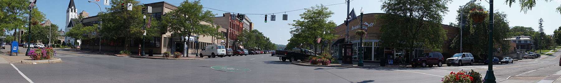
Downtown Cortland in 1906 | |
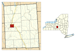 Location in Cortland County and the state of New York. | |
| Coordinates: 42°36′2″N 76°10′53″W / 42.60056°N 76.18139°WCoordinates: 42°36′2″N 76°10′53″W / 42.60056°N 76.18139°W | |
| Country | United States |
| State | New York |
| County | Cortland |
| Government | |
| • Type | Mayor-Council |
| • Mayor | Brian Tobin (D) |
| • Common Council |
Members' List
|
| Area | |
| • Total | 3.92 sq mi (10.14 km2) |
| • Land | 3.90 sq mi (10.09 km2) |
| • Water | 0.02 sq mi (0.05 km2) |
| Elevation | 1,129 ft (344 m) |
| Population (2010) | |
| • Total | 19,204 |
| • Density | 4,932/sq mi (1,904.1/km2) |
| Time zone | Eastern (EST) (UTC-5) |
| • Summer (DST) | EDT (UTC-4) |
| ZIP code | 13045 |
| Area code(s) | 607 |
| FIPS code | 36-18388 |
| GNIS feature ID | 0947499 |
| Website |
cortland |

Cortland is a city in Cortland County, New York, United States of America. Cortland is in New York's Southern Tier region. As of the 2010 census, the city had a population of 19,204.[1] It is the county seat of Cortland County.[2]
The city of Cortland, near the west border of the county, is surrounded by the town of Cortlandville.
History
The city is within the former Central New York Military Tract. The city is named after Pierre Van Cortlandt, the first lieutenant governor of the state of New York.[3]
Cortland, settled in 1791, was made a village in 1853 (rechartered in 1864), and was incorporated as a city in 1900 as the 41st city in New York state. When the county was formed in 1808, Cortland vied with other villages and won the status of becoming the county seat. Known as the "Crown City" because of its location on a plain formed by the convergence of seven valleys, Cortland is situated at 1,130 feet (340 m) above sea level. Forty stars representing the 40 cities incorporated before Cortland circle the State of New York and Crown on the city's official seal. The seven points of the crown create seven valleys depicting Cortland's seven surrounding valleys. The 41st star in the center of the crown illustrates Cortland as the closest incorporated city to the geographic center of New York.
The leading industry in Cortland in the late nineteenth and early twentieth century was the Wickwire Brothers wire drawing mill, noted for its production of wire hardware cloth for use as window screens. The extent of their wealth is commemorated in a pair of magnificent mansions. The Victorian Chateauesque style home of Chester Wickwire is now the 1890 House Museum & Center for Victorian Arts, while the 1912 home of Charles Wickwire is now owned and operated by the SUNY Cortland Alumni Association.[4] It is open to the public as well as being used by the Alumni Association to host college-related events and house visiting dignitaries.[5]
Cortland was also home to Brockway Motor Company, a pioneering truck maker. Begun in 1875 as Brockway Carriage Works, it was taken over by Mack Trucks in 1956, and survived until 1977. The city continues to host an annual show of Brockway trucks.[6]
Cortland also boasts a classic octagon house[7] and the still-operating, garden-type Cortland Rural Cemetery.
In 1868 Cortland became the home of the Cortland Normal School, now the State University of New York at Cortland.
From 1960 to 1992, Smith Corona typewriters were manufactured in Cortland.[8]
In 2006, Cortland's historic clock tower burned down. It was later re-built, with spaces for both businesses and apartment style housing.[9]
The Cortland County Courthouse, Cortland County Poor Farm, Cortland Fire Headquarters, Cortland Free Library, First Presbyterian Church Complex, William J. Greenman House, Randall Farm, Tompkins Street Historic District, Unitarian Universalist Church, and United States Post Office are listed on the National Register of Historic Places.[10][11]
Notable people
John Eaton- Mayor of Cuyler
- Catherine Bertini, longtime global leader in food aid distribution
- Carl Carmer, author
- Charles Henry De Groat, Union Army brigadier general
- William Dillon, composer, lyricist, and vaudevillian
- Ronnie James Dio, former frontman for Rainbow and Black Sabbath. A street in Cortland is named for him (Dio Way).
- Nancy Duffy, Syracuse news personality and founder of the Syracuse St. Patrick's Day Parade
- Chester Gillette, convicted of the 1906 murder of his girlfriend, Grace Brown of Cortland, in a highly publicized and controversial trial. He was executed by electrocution in 1908.
- Milo Goodrich, former US congressman
- Charles W. Goodyear, prominent businessman and railroad owner.
- Raymond A. Johnson, first recipient of the US Coast Guard Medal
- Dennis Mepham, retired soccer player
- Nathan Lewis Miller, former governor of New York
- Mark Nauseef, musician
- Alton B. Parker, Democratic candidate for president in 1904
- Sime Silverman, publisher
- Eric Soderholm, former professional baseball player
- Elmer Ambrose Sperry, prolific inventor who invented the gyroscopic compass and held over 400 patents. The USS Sperry is named after him.
- Raymond Gram Swing, journalist
- Samuel Ringgold Ward, African American who escaped enslavement to become an abolitionist, newspaper editor and Congregational minister
- Spiegle Willcox, jazz trombone player, composer, and singer
- Gary Wood, former NFL quarterback
Geography
Cortland is located in west-central Cortland County at 42°36′2″N 76°10′53″W / 42.60056°N 76.18139°W (42.600658, −76.181284).[12] Cortland lies between Syracuse, New York and Binghamton, New York. It is surrounded by the town of Cortlandville.
According to the United States Census Bureau, the city has a total area of 3.92 square miles (10.14 km2), of which 3.90 square miles (10.09 km2) is land and 0.02 square miles (0.05 km2), or 0.51%, is water.[1]
The Tioughnioga River, a tributary of the Susquehanna River, flows southward past the city.
Transportation
Roads and highways
Interstate 81, U.S. Route 11, and New York State Route 281 are north-south highways servicing the city. New York State Route 13 and New York State Route 41 also serve the city. Via I-81 it is 40 miles (64 km) north to Syracuse and 40 miles (64 km) south to Binghamton. NY-13 leads southwest 18 miles (29 km) to Ithaca.
Bus
Local public transportation by bus is provided by Cortland Transit.[13] Greyhound provides the city with intercity bus service with connections to Syracuse, Binghamton, and points beyond. The closest Amtrak train station is in Syracuse.
Air
Air service is provided by Cortland County Airport located west of the city.
Climate
| Climate data for Cortland, New York | |||||||||||||
|---|---|---|---|---|---|---|---|---|---|---|---|---|---|
| Month | Jan | Feb | Mar | Apr | May | Jun | Jul | Aug | Sep | Oct | Nov | Dec | Year |
| Record high °F (°C) | 68 (20) |
65 (18) |
85 (29) |
90 (32) |
93 (34) |
96 (36) |
100 (38) |
98 (37) |
100 (38) |
90 (32) |
81 (27) |
68 (20) |
100 (38) |
| Average high °F (°C) | 30.6 (−0.8) |
32.8 (0.4) |
41.9 (5.5) |
54.1 (12.3) |
67.6 (19.8) |
76.3 (24.6) |
81.0 (27.2) |
79.4 (26.3) |
70.7 (21.5) |
59.0 (15) |
46.2 (7.9) |
35.1 (1.7) |
56.23 (13.45) |
| Average low °F (°C) | 15.2 (−9.3) |
15.7 (−9.1) |
24.1 (−4.4) |
34.4 (1.3) |
45.3 (7.4) |
54.3 (12.4) |
58.8 (14.9) |
56.9 (13.8) |
49.3 (9.6) |
39.3 (4.1) |
31.7 (−0.2) |
21.5 (−5.8) |
37.21 (2.89) |
| Record low °F (°C) | −25 (−32) |
−26 (−32) |
−13 (−25) |
11 (−12) |
23 (−5) |
32 (0) |
39 (4) |
35 (2) |
27 (−3) |
18 (−8) |
2 (−17) |
−17 (−27) |
−26 (−32) |
| Average precipitation inches (mm) | 2.74 (69.6) |
2.49 (63.2) |
3.12 (79.2) |
3.22 (81.8) |
3.28 (83.3) |
4.08 (103.6) |
3.37 (85.6) |
2.98 (75.7) |
3.97 (100.8) |
3.17 (80.5) |
3.49 (88.6) |
3.41 (86.6) |
39.32 (998.7) |
| Average snowfall inches (cm) | 19.7 (50) |
19.2 (48.8) |
13.2 (33.5) |
4.0 (10.2) |
0 (0) |
0 (0) |
0 (0) |
0 (0) |
0 (0) |
.3 (0.8) |
8.2 (20.8) |
22.3 (56.6) |
86.9 (220.7) |
| Average precipitation days (≥ 0.01 in) | 17.4 | 14.3 | 14.3 | 13.4 | 12.1 | 11.8 | 10.6 | 10.2 | 11.5 | 12.6 | 15.2 | 16.8 | 160.2 |
| Average snowy days (≥ 0.1 in) | 9.1 | 7.0 | 4.5 | 1.7 | 0 | 0 | 0 | 0 | 0 | .1 | 3.2 | 7.6 | 33.2 |
| Source #1: NOAA (normals 1971–2000),[14] | |||||||||||||
| Source #2: The Weather Channel (extremes)[15] | |||||||||||||
Demographics
| Historical population | |||
|---|---|---|---|
| Census | Pop. | %± | |
| 1870 | 3,066 | — | |
| 1880 | 4,050 | 32.1% | |
| 1890 | 8,590 | 112.1% | |
| 1900 | 9,014 | 4.9% | |
| 1910 | 11,504 | 27.6% | |
| 1920 | 13,294 | 15.6% | |
| 1930 | 15,043 | 13.2% | |
| 1940 | 15,881 | 5.6% | |
| 1950 | 18,152 | 14.3% | |
| 1960 | 19,181 | 5.7% | |
| 1970 | 19,621 | 2.3% | |
| 1980 | 20,138 | 2.6% | |
| 1990 | 19,801 | −1.7% | |
| 2000 | 18,740 | −5.4% | |
| 2010 | 19,204 | 2.5% | |
| Est. 2015 | 18,907 | [16] | −1.5% |
As of the census[18] of 2000, there were 18,740 people, 6,922 households, and 3,454 families residing in the city. The population density was 4,778.6 people per square mile (1,845.8/km²). There were 7,550 housing units at an average density of 1,925.2 per square mile (743.6/km²). The racial makeup of the city was 95.72% White, 1.56% African American, 0.25% Native American, 0.57% Asian, 0.02% Pacific Islander, 0.56% from other races, and 1.33% from two or more races. Hispanic or Latino of any race were 1.72% of the population.
There were 6,922 households out of which 24.8% had children under the age of 18 living with them, 34.7% were married couples living together, 11.4% had a female householder with no husband present, and 50.1% were non-families. 36.0% of all households were made up of individuals and 13.0% had someone living alone who was 65 years of age or older. The average household size was 2.28 and the average family size was 2.95.
In the city the population was spread out with 18.3% under the age of 18, 28.4% from 18 to 24, 23.6% from 25 to 44, 16.8% from 45 to 64, and 12.9% who were 65 years of age or older. The median age was 28 years. For every 100 females there were 88.4 males. For every 100 females age 18 and over, there were 84.5 males.
The median income for a household in the city was $26,478, and the median income for a family was $39,167. Males had a median income of $29,857 versus $21,614 for females. The per capita income for the city was $14,267. About 13.9% of families and 24.7% of the population were below the poverty line, including 24.8% of those under age 18 and 15.2% of those age 65 or over.
Government
The government of Cortland consists of a mayor, who is elected at large, and a city council consisting of eight members. One member is elected from each of the eight voting wards.
Sports
In summer 2009, the New York Jets training camp was moved to Cortland from its traditional home at Hofstra University in Hempstead. The team located their operations at the State University of New York, Cortland campus. The camp drew in 34,000 visitors and brought nearly $4.26 million to the local economy.[19] In 2010, the Jets signed a 3-year contract with SUNY Cortland to continue their partnership.
See also
References
- 1 2 "Geographic Identifiers: 2010 Demographic Profile Data (G001): Cortland city, New York". U.S. Census Bureau, American Factfinder. Retrieved December 15, 2014.
- ↑ "Find a County". National Association of Counties. Archived from the original on 2011-05-31. Retrieved 2011-06-07.
- ↑ Company, Chicago and North Western Railway (1908). A History of the Origin of the Place Names Connected with the Chicago & North Western and Chicago, St. Paul, Minneapolis & Omaha Railways. p. 59.
- ↑ The 1890 House Museum
- ↑ SUNY(State University of New York) Cortland Alumni House
- ↑ Brockway Truck Preservation Association
- ↑ Octagon House Inventory
- ↑ http://www.nytimes.com/1992/07/22/business/smith-corona-plant-mexico-bound.html
- ↑ http://www.9wsyr.com/news/local/story/3rd-anniversary-of-Cortland-clock-tower-fire/B_MkiwVtEkOxYhwyStLFkQ.cspx
- ↑ National Park Service (2010-07-09). "National Register Information System". National Register of Historic Places. National Park Service.
- ↑ "National Register of Historic Places". Weekly List of Actions Taken on Properties: 8/15/11 through 8/19/11. National Park Service. 2011-08-26.
- ↑ "US Gazetteer files: 2010, 2000, and 1990". United States Census Bureau. 2011-02-12. Retrieved 2011-04-23.
- ↑ Home, Way2Go Cortland. Retrieved 2014-12-26.
- ↑ "Climatology of the United States No. 20: CORTLAND, NY 1971–2000" (PDF). National Oceanic & Atmospheric Administration. Retrieved 2011-11-14.
- ↑ "Monthly Averages for Cortland, NY (13045)". The Weather Channel. Retrieved 2011-11-14.
- ↑ "Annual Estimates of the Resident Population for Incorporated Places: April 1, 2010 to July 1, 2015". Retrieved July 2, 2016.
- ↑ "Census of Population and Housing". Census.gov. Archived from the original on May 11, 2015. Retrieved June 4, 2015.
- ↑ "American FactFinder". United States Census Bureau. Archived from the original on 2013-09-11. Retrieved 2008-01-31.
- ↑ http://www.nj.com/jets/index.ssf/2010/02/ny_jets_and_suny_cortland_nego.html
External links
- City of Cortland official website
- Cortland City School District
- SUNY Cortland College
- Early history of Cortland area
- Cortland business guide
- The 1890 House Museum and Center for Victorian Arts
- Cortland Rural Cemetery
- Cortland Historical Society
Municipalities and communities of Cortland County, New York, United States | ||
|---|---|---|
| City | 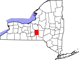 | |
| Towns | ||
| Villages | ||
| CDPs | ||