Cordón del Azufre
| Cordón del Azufre | |
|---|---|
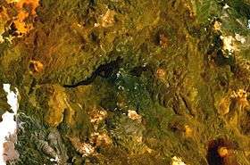 NASA Landsat composite image | |
| Highest point | |
| Elevation | 5,481 m (17,982 ft) [1] |
| Coordinates | 25°20′S 68°30′W / 25.333°S 68.500°W [2] |
| Geography | |
| Location | Argentina, Chile[1] |
| Parent range | Andes |
| Geology | |
| Age of rock | 0.3 ± 0.3 mya[3] |
| Mountain type | Complex volcano[1] |
| Last eruption | Unknown[1] |
Cordón del Azufre is a small, inactive complex volcano located in the Central Andes, at the border of Argentina and Chile.[1] The centre contains a series of craters and lava flows[4] covering a surface area of 60 square kilometres (23 sq mi).[5] A western component with four craters aligned in a north–south direction on a 5-kilometre-long (3.1 mi) ridge forms the oldest part. The eastern component is formed by lava flows and craters in Argentina, and the youngest part la Moyra volcano in the western component generated a lava flow that advanced 6 kilometres (3.7 mi) westwards. Weakly porphyritic Andesite and dacite form the rocks of the volcano.[5][3] No activity, including fumarolic activity, has been recorded at Cordón del Azufre,[6] but the appearance (dark and pristine) and radiometric age (0.3 ± 0.3 mya K-Ar on the most recent flow) of the lava flows suggest a recent age.[3][5]
Geographic context
It is located 300 kilometres (190 mi) east of the Chile Trench within the Puna where the volcanic arc intersects a probably deep seated structural area named the Archibarca corridor.[4] Since the Eocene,[7] underlying convergence and subduction of the Nazca plate at a speed of 6–7 centimetres per year (2.4–2.8 in/year) result in the volcanic activity of the Central Volcanic Zone (CVZ), the activity of fault zones and active deformation south of 23° S.[2] Several large calderas lie in the CVZ,[8] some of which (Galan, La Pacana) have erupted volumes of over 1,000 cubic kilometres (240 cu mi).[9] The area is uninhabited and remote.[3]
Ground deformation
Observations of this volcano and neighbouring Lastarria indicate that they are part of an actively deforming system, named by Pritchard and Simons (2002) the Lazufre system with an axis length of 70 kilometres (43 mi). The modelled centre of deformation is closer to Azufre than Lastarria.[10] Sometimes Cerro Bayo Gorbea is also associated to this complex.[9] This inflation started in the late 1990s and is probably due to the accumulation of volcanic fluids (hydrothermal or magmatic) beneath the volcanic system.[2] The precise date when the uplift started is unclear, because satellite observation of the area is scarce.[8] The start of the uplift may be related to an earthquake in Chile in 1998, but this is questionable.[6] Aftershocks of the 1995 Antofagasta earthquake may be responsible instead.[11] Between 1998 and 2000 the long axis of deformation amounted to 35 kilometres (22 mi), with a later increase to 50 kilometres (31 mi).[7] In 2008 the area had already reached a diametre of c. 45 kilometres (28 mi) and surface area of 1,100 square kilometres (420 sq mi).[11] In 2015 deformation was observed over a surface of 2,000 square kilometres (770 sq mi), at depths 2–18 kilometres (1.2–11.2 mi) and with speeds of 3 centimetres per year (1.2 in/year) until 2010. This uncertainty is largely because estimates trade off between depth, pressure and shape of the deformation.[12] Research in 2016 indicated that the uplift dome has a diametre of 60–70 kilometres (37–43 mi).[13] Since 2005 uplift speeds of 3.5 centimetres per year (1.4 in/year) have been observed with InSAR and a magma flux rate of 14,000,000–17,000,000 cubic metres per year (16,000,000–19,000,000 cu ft/Ms) has been inferred.[10][14] Other research has indicated an inflation rate of 12,500,000–148,000,000 cubic metres per year (14,000,000–165,600,000 cu ft/Ms), comparable with other plutons in the area.[9] One estimate in 2009 indicated a depth 12–15 kilometres (7.5–9.3 mi).[8] Another estimate in 2016 indicated a chamber depth of 18 kilometres (11 mi).[13]
Research in 2009 indicated that the deforming area has increased by about 8 kilometres per year (0.16 mi/Ms) laterally and covered almost 800 square kilometres (310 sq mi) (area uplifted by 1 centimetre (0.39 in) or more). The researchers concluded that sill fluid dynamics may explain the pattern of uplift and growth in the uplifting area but without major changes in the magma flux rate.[2] Other data indicate that no lateral expansion may be taking place.[8] A study in 2014 indicated that the source of the deformation is most likely elliptical and has a volume of 400 cubic kilometres (96 cu mi).[9] The deformation pattern may be controlled by local tectonic stress patterns.[4] There are several Pleistocene volcanoes around the uplift region, which may be supplied from the sill.[13]
This deformation system is among the largest on Earth.[15] It has been compared to deformation occurring at Uturuncu volcano, but the deformation source beneath Lazufre has not been imaged due to resolution limitations.[12] The size of the deformation area is comparable with the size of calderas such as Long Valley and Yellowstone.[8] Likewise, such deformation patterns are mainly found in active caldera systems and in the case of Lazufre may be caused by the refilling of a magma chamber.[8] The hydrothermal system of Lastarria may be influenced by the uplift,[10] but it's not likely that hydrothermal effects are responsible for the Lazufre deformation.[11] It is not clear whether this deformation is a signal of a future volcanic eruption, but monitoring has been recommended[3] as it may be at risk of a major silicic eruption.[16] Research published in 2016 indicated that the uplift has been ongoing since at least 400,000 years, based on the deformation of lava flows and volcanoes erupted within this time period. Depending on the highly uncertain estimates for the volume of the magma chamber, a modest overpressue may be sufficient to cause the roof of the chamber to fail and an eruption to start.[13]
See also
References
- 1 2 3 4 5 "Cordon del Azufre". Global Volcanism Program. Smithsonian Institution.
- 1 2 3 4 Anderssohn, Jan; Motagh, Mahdi; Walter, Thomas R.; Rosenau, Matthias; Kaufmann, Hermann; Oncken, Onno (October 2009). "Surface deformation time series and source modeling for a volcanic complex system based on satellite wide swath and image mode interferometry: The Lazufre system, central Andes". Remote Sensing of Environment. 113 (10): 2062–2075. doi:10.1016/j.rse.2009.05.004.
- 1 2 3 4 5 Froger, J.-L.; Remy, D.; Bonvalot, S.; Legrand, D. (March 2007). "Two scales of inflation at Lastarria-Cordon del Azufre volcanic complex, central Andes, revealed from ASAR-ENVISAT interferometric data". Earth and Planetary Science Letters. 255 (1–2): 148–163. doi:10.1016/j.epsl.2006.12.012.
- 1 2 3 Ruch, J.; Walter, T.R. (September 2010). "Relationship between the InSAR-measured uplift, the structural framework, and the present-day stress field at Lazufre volcanic area, central Andes". Tectonophysics. 492 (1–4): 133–140. doi:10.1016/j.tecto.2010.06.003.
- 1 2 3 Trumbull, R.B; Wittenbrink, R; Hahne, K; Emmermann, R; Büsch, W; Gerstenberger, H; Siebel, W (March 1999). "Evidence for Late Miocene to Recent contamination of arc andesites by crustal melts in the Chilean Andes (25–26°S) and its geodynamic implications". Journal of South American Earth Sciences. 12 (2): 135–155. doi:10.1016/S0895-9811(99)00011-5.
- 1 2 Pritchard, M. E.; Simons, M. (February 2004). "An InSAR-based survey of volcanic deformation in the central Andes". Geochemistry, Geophysics, Geosystems. 5 (2): n/a–n/a. doi:10.1029/2003GC000610.
- 1 2 Ruch, J.; Manconi, A.; Zeni, G.; Solaro, G.; Pepe, A.; Shirzaei, M.; Walter, T. R.; Lanari, R. (21 November 2009). "Stress transfer in the Lazufre volcanic area, central Andes". Geophysical Research Letters. 36 (22). doi:10.1029/2009GL041276.
- 1 2 3 4 5 6 Pearse, Jill; Lundgren, Paul (28 March 2013). "Source model of deformation at Lazufre volcanic center, central Andes, constrained by InSAR time series". Geophysical Research Letters. 40 (6): 1059–1064. doi:10.1002/grl.50276.
- 1 2 3 4 Remy, D.; Froger, J. L.; Perfettini, H.; Bonvalot, S.; Gabalda, G.; Albino, F.; Cayol, V.; Legrand, D.; Saint Blanquat, M. De (September 2014). "Persistent uplift of the Lazufre volcanic complex (Central Andes): New insights from PCAIM inversion of InSAR time series and GPS data". Geochemistry, Geophysics, Geosystems. 15 (9): 3591–3611. doi:10.1002/2014GC005370.
- 1 2 3 Henderson, S. T.; Pritchard, M. E. (May 2013). "Decadal volcanic deformation in the Central Andes Volcanic Zone revealed by InSAR time series". Geochemistry, Geophysics, Geosystems. 14 (5): 1358–1374. doi:10.1002/ggge.20074.
- 1 2 3 Ruch, J.; Anderssohn, J.; Walter, T.R.; Motagh, M. (July 2008). "Caldera-scale inflation of the Lazufre volcanic area, South America: Evidence from InSAR". Journal of Volcanology and Geothermal Research. 174 (4): 337–344. doi:10.1016/j.jvolgeores.2008.03.009.
- 1 2 Spica, Zack; Legrand, Denis; Iglesias, Arturo; Walter, Thomas R.; Heimann, Sebastian; Dahm, Torsten; Froger, Jean-Luc; Rémy, Dominique; Bonvalot, Sylvain; West, Michael; Pardo, Mario (July 2015). "Hydrothermal and magmatic reservoirs at Lazufre volcanic area, revealed by a high-resolution seismic noise tomography". Earth and Planetary Science Letters. 421: 27–38. doi:10.1016/j.epsl.2015.03.042.
- 1 2 3 4 Perkins, Jonathan P.; Finnegan, Noah J.; Henderson, Scott T.; Rittenour, Tammy M. (August 2016). "Topographic constraints on magma accumulation below the actively uplifting Uturuncu and Lazufre volcanic centers in the Central Andes". Geosphere. 12 (4): 1078–1096. doi:10.1130/GES01278.1.
- ↑ Feigl, K. L.; Le Mevel, H.; Tabrez Ali, S.; Cordova, L.; Andersen, N. L.; DeMets, C.; Singer, B. S. (6 December 2013). "Rapid uplift in Laguna del Maule volcanic field of the Andean Southern Volcanic zone (Chile) 2007–2012". Geophysical Journal International. 196 (2): 885–901. doi:10.1093/gji/ggt438.
- ↑ Budach, Ingmar; Brasse, Heinrich; Díaz, Daniel (March 2013). "Crustal-scale electrical conductivity anomaly beneath inflating Lazufre volcanic complex, Central Andes". Journal of South American Earth Sciences. 42: 144–149. doi:10.1016/j.jsames.2012.11.002.
- ↑ Champenois, J.; Pinel, V.; Baize, S.; Audin, L.; Jomard, H.; Hooper, A.; Alvarado, A.; Yepes, H. (28 August 2014). "Large-scale inflation of Tungurahua volcano (Ecuador) revealed by Persistent Scatterers SAR interferometry". Geophysical Research Letters. 41 (16): 5821–5828. doi:10.1002/2014GL060956.