Coopers Creek, New Zealand
| Coopers Creek | |
|---|---|
| Rural Area | |
|
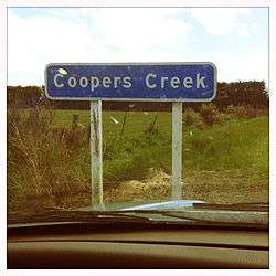
A sign on the edge of Coopers Creek. | |
 Coopers Creek | |
| Coordinates: 43°17′05″S 172°06′27″E / 43.284764°S 172.107369°ECoordinates: 43°17′05″S 172°06′27″E / 43.284764°S 172.107369°E | |
| Country |
|
| Region | Canterbury |
| Territorial authority | Waimakariri District |
| Electorates |
|
| Elevation (as at 43°13′48″S 172°07′05″E / 43.23°S 172.118°E) | 955 m (3,133 ft) |
| Time zone | NZST (UTC+12) |
| • Summer (DST) | NZDT (UTC+13) |
| Postcode | 7495 |
| Area code(s) | 03 |
Coopers Creek is a small rural community in the Waimakariri District, New Zealand. It has only eight roads, and no shops. It has a number of mountains and walking tracks.[2] In 1901, Coopers Creek had a population of 168.[3]
Climate
The average temperature in summer is 16.2 °C, and in winter is 5.9 °C.[4]
| Month | Normal temperature |
|---|---|
| January | 16.8 °C |
| February | 16.3 °C |
| March | 14.6 °C |
| April | 11.6 °C |
| May | 8.3 °C |
| June | 5.8 °C |
| July | 5.3 °C |
| August | 6.5 °C |
| September | 8.9 °C |
| October | 11.2 °C |
| November | 13.3 °C |
| December | 15.5 °C |
References
- ↑ http://www.elections.org.nz/mapping/
- ↑ "Oxford Forest walking tracks". Department of Conservartion. Retrieved 27 November 2013.
- ↑ "COOPER'S CREEK". THE CYCLOPEDIA OF NEW ZEALAND. Retrieved 28 November 2013.
- ↑ "Weather statistics for Coopers Creek, Canterbury (New Zealand)". yr.no. Retrieved 27 November 2013.
This article is issued from Wikipedia - version of the 5/13/2016. The text is available under the Creative Commons Attribution/Share Alike but additional terms may apply for the media files.