Coombe, Kingston upon Thames
| Coombe | |
 Coombe |
|
| Population | 20,108 (2011 Census. Coombe Hill and Vale Wards)[1][2] |
|---|---|
| OS grid reference | TQ208703 |
| London borough | Kingston |
| Ceremonial county | Greater London |
| Region | London |
| Country | England |
| Sovereign state | United Kingdom |
| Post town | KINGSTON UPON THAMES |
| Postcode district | KT2 |
| Dialling code | 020 |
| Police | Metropolitan |
| Fire | London |
| Ambulance | London |
| EU Parliament | London |
| London Assembly | South West |
Coordinates: 51°25′08″N 0°15′51″W / 51.41885°N 0.26415°W
Coombe is a historic neighbourhood within the Royal Borough of Kingston upon Thames in London, England.
Location
Coombe lies east of the Norbiton area of Kingston upon Thames. The neighbourhood was part of the former Municipal Borough of Malden and Coombe prior to local government re-organisation in 1965. It now shares borders with the boroughs of Merton, Sutton, Wandsworth and Richmond. To the north lies Richmond Park; to the east, Wimbledon Common.
History
Coombe centres on what was originally Coombe House,[3] a large residence built in the 1750s.[4] The house, now demolished, was located at the southwest corner of the intersection of present-day Coombe Lane (A238) and Traps Lane.[5] Its red brick boundary walls can still be seen on the west side of Traps Lane.[6]
The neighbourhood has a long history. Roman coins and other ancient remains have been found in the area around Warren Road.[7][8] Coombe appears in Domesday Book as Cumbe. It was held partly by Hunfrid (Humfrey) the Chamberlain and partly by Ansgot the Interpreter. Its domesday assets were: 1½ hides; 4 ploughs, 12 acres (49,000 m2) of meadow, herbage worth 4 hogs. It rendered £8.[9]
The Neville name has long been associated with the neighbourhood. In 1215 King John gave Coombe to Hugh de Nevill, and the area was known as Coombe Nevill by 1260. At the beginning of the 14th century the manor was held by William de Nevill.[4][10] The 1911 Ordnance Survey map identified an estate known as Coombe Nevile at the intersection of George and Warren Roads and owned by Commander L. Chetwynd.[8] The present-day cul-de-sac known as Coombe Neville is in the same location. Neville Avenue is a short distance away, south of Coombe Lane.
16th century records speak of a gallows in Coombe, most likely near what is now Kingsnympton Park estate;[7] this was reputedly the scene of public executions.
In the early 1700s a public house known as the Fox and Coney was established at the intersection of George Road and Kingston Hill (A308). It was rebuilt in 1728 and soon thereafter was renamed the George and Dragon, operating as such until 1985, when it became the Kingston Lodge Hotel.[11][12]
By 1761 Coombe was owned by John Spencer, 1st Earl Spencer,[13] an ancestor of Diana, Princess of Wales and her son Prince William.
Coombe Warren was a wild woodland on the ridge known as Coombe Hill. It was used for hunting and public fairs. 'The Coombe Wood Highwayman', Jerry Abershaw, frequented the area in the late 1700s. Being based at the "Bald Face Stag" pub, he sheltered in the woods. An 1835 map placed Coombe Warren in an area now bisected by Warren Road between Kingston Hill (A308) and Coombe Lane (A238).[14] Portions of the Warren are now covered by the Coombe Hill estate and Coombe Wood Golf Course.[15]
In 1822 the Admiralty opened a semaphore station in the Warren, which was part of the semaphore line from London to Portsmouth. The station has disappeared, but survived in the name of "Telegraph Cottage."
At the time of the 1865 Ordnance Survey, the area west of Warren Road remained largely open country. By 1911 two golf courses were in place, as were a number of large estates located along George Road, including Coombe Croft (now Rokeby School for Boys), Coombe Ridge (now Holy Cross Preparatory School), Coombe Court, Coombe End, Ballard Coombe and Fairview.[16]
- For further information on education in Coombe, Kingston upon Thames see the main Royal Borough of Kingston upon Thames article.
Numerous German bombs struck Coombe during World War II.[17][18]
Today
Coombe is a prestigious residential location, and house prices in the area are commonly into the millions. It includes the Coombe Hill estate. Once the site of now-demolished Coombe Warren, a 19th century property built by architect George Devey, Coombe Hill estate today consists of Coombe Hill Road and cul-de-sacs such as Greenwood Park and Devey Close; and neighborhoods along Warren Road, George Road and Golf Club Drive.
Notable buildings
Grade II-listed buildings and ancient monuments in Coombe include:
- Three Tudor-era structures built as a system for supplying water to Hampton Court Palace from springs in Coombe: Coombe Conduit on Coombe Lane West, Ivy Conduit on the grounds of Holy Cross Preparatory School on George Road, Gallows Conduit on the grounds of Hampton Spring house on George Road.;[19][20][21]
- Warren House on Warren Road, constructed in the 1860s for banker Hugh Hammersley and extended in 1884-1886 by the architect George Devey;[22] and
- Cedar Court on Coombe Hill Road, built on its present site in 1911-12 incorporating timbers from a late medieval timber-framed building from Colchester (probably the Perseverance Inn, demolished in 1910)[23]
Notable residents and visitors
- Coombe House was once owned by British politician Robert Jenkinson (Prime Minister, 1812-1827), and later by Prince Adolphus, Duke of Cambridge, great-great-grandfather of Queen Elizabeth II.[4][13]
- British politician George Glyn lived in Warren House.
- John Galsworthy, author of The Forsyte Saga and winner of the 1932 Nobel Prize In Literature, was born in a house on Kingston Hill which was later named after him.[13] Today, it houses an elderly care centre.
- William Ewart Gladstone, British Prime Minister and Chancellor of the Exchequer, spent extended periods as a house-guest of friends in Coombe.
- Coombe Park, one of the more affluent private roads in Coombe, is home to television personality Jimmy Tarbuck and tennis player Annabel Croft.
- Rolling Stones guitarist Ronnie Wood used to live in a Victorian-era home known as Holmwood[24] on Kingston Hill, located opposite the entrance of Coombe Park and near the Galsworthy House.
- One of Saddam Hussein's daughters had a house in Golf Club Drive for a number of years.
- Elisabeth Murdoch lived in Coombe for several years.
- Dwight D. Eisenhower, when Supreme Allied Commander during World War II, based in Bushy Park, lived at "Telegraph Cottage" in Coombe, which was adjacent to the golf course which he used at weekends.[25]
- Dame Nellie Melba lived in a house here for many years.
- Sir Wilfrid Sheldon, KCVO, a prominent consulting paediatrician and physician paediatrician to The Household of Queen Elizabeth II,[26][27] lived on Edgecombe Close after his retirement in 1967.
- Sir Leonard "Len" Hutton, English cricketer, lived on Coombe Neville in the late 1960s.
Gallery
 House, Coombe Hill Road
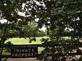 Coombe Wood Golf Club
 Warren Road looking north from Coombe Neville
 Coombe Wood Road
 Warren House, a conference centre on Warren Road
 Rokeby School, formerly Coombe Croft, George Road, Coombe
See also
Other listed buildings in Coombe
Maldens and Coombe Heritage Society
Malden & Coombe Residents' Association Ltd.
| Wikimedia Commons has media related to Coombe, Kingston upon Thames. |
References
- ↑ "Kingston Ward population 2011(Coombe Hill)". Neighbourhood Statistics. Office for National Statistics. Retrieved 11 October 2016.
- ↑ "Kingston Ward population 2011(Coombe Vale)". Neighbourhood Statistics. Office for National Statistics. Retrieved 11 October 2016.
- ↑ "List of Conservation Areas: Coombe House". Royal Borough of Kingston upon Thames. Kingston Council. Retrieved 19 February 2016.
- 1 2 3 "A History of the County of Surrey, volume 3". British History Online. Victoria County History, London, 1911.
- ↑ "1816 Ordnance Survey map". Maldens & Coombe Heritage Society. Retrieved 9 March 2015.
- ↑ "Garden and Boundary Walls to Cimero, Thatchers and Wansbeck, Kingston upon Thames". British Listed Buildings. Retrieved 9 March 2015.
- 1 2 Hawkins, Duncan. "Roman Kingston-upon-Thames: a landscape of rural settlements" (PDF).
- 1 2 Old Ordnance Survey Maps: Coombe & Norbiton, 1911 (1913 ed.). Alan Godfrey Maps, Leadgate, Consett DH8 7PW.
- ↑ Surrey Domesday Book Archived 23 December 2004 at the Wayback Machine.
- ↑ "The Coombe Estate" (PDF). Malden & Coombe Residents Association Ltd. Retrieved 27 September 2014.
- ↑ Kingston Museum and Kingston History Society, "The George and Dragon Public House, Kingston Hill (1728-1985)", April 23, 2016
- ↑ 1865 Ordnance Survey map.
- 1 2 3 Oliver, Richard. Narrative to Old Ordnance Survey Map 1911.
- ↑ Gent, L.E. "The Manor of Coombe or Coombe Nevill (1979)". Malden and Coombe Heritage Society. Kingston upon Thames Archaeological Society. Retrieved 4 January 2015.
- ↑ Palladian Estates - Coombe Hill Archived 11 December 2009 at the Wayback Machine.
- ↑ 1911 Ordnance Survey map.
- ↑ "Malden and Coombe Bomb Map". Kingston Museum and Heritage Service. Retrieved 11 March 2015.
- ↑ "Bombs dropped in the ward of Coombe Hill". Bomb Sight. Retrieved 11 March 2015.
- ↑ "Coombe Conduit House". British Listed Buildings.
- ↑ "Gallows Conduit House". British Listed Buildings. Retrieved 11 March 2015.
- ↑ "Ivy Conduit House". British Listed Buildings. Retrieved 11 March 2015.
- ↑ "Warren House, Kingston upon Thames". www.britishlistedbuildings.co.uk. Retrieved 18 January 2013.
- ↑ "Cedar Court". British Listed Buildings..
- ↑ Wood, Ron (November 2008). Ronnie: The Autobiography (Paper ed.). New York: St. Martin's Griffin. p. 296. ISBN 978-0-312-53102-7.
- ↑ "Dwight D Eisenhower Memorial Commission". Eisenhowermemorial.org. Retrieved 2012-03-02.
- ↑ "Sir Wilfrid Percy Henry Sheldon". RCP Munks Roll. Royal College of Physicians of London. Retrieved 4 March 2015.
- ↑ "Obituary, Sir Wilfrid Sheldon". British Medical Journal. 287: 918–919. 24 September 1983. doi:10.1136/bmj.287.6396.918. Retrieved 4 March 2015.
| Next station upwards | Admiralty Semaphore line 1822 | Next station downwards |
| Putney Heath | Coombe Warren | Cooper's Hill |
| Districts | 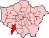 | |
|---|---|---|
| Attractions | ||
| Bridges and tunnels | ||
| Parks and open spaces | ||
| Constituencies | ||
| Rail stations | ||
| Places of worship | ||
| Sport | ||
| Other topics | ||