Coolah, New South Wales
| Coolah New South Wales | |
|---|---|
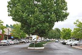 Main street | |
|
Coolah | |
| Coordinates | 31°50′0″S 149°43′0″E / 31.83333°S 149.71667°ECoordinates: 31°50′0″S 149°43′0″E / 31.83333°S 149.71667°E |
| Population | 910 (2006 census)[1] |
| Postcode(s) | 2843 |
| Location | |
| LGA(s) | Warrumbungle Shire |
| State electorate(s) | Barwon |
| Federal Division(s) | Parkes |
Coolah is a town in the central western part of New South Wales, Australia in Warrumbungle Shire. At the 2006 census, Coolah had a population of 910.[1]
On the northeastern side of the area is the Liverpool Range with the Coolah Tops National Park. Most of the region is agricultural with sheep and cattle raising and crops grown along the Talbragar River and Coolaburragundy River valleys.
History
The Coolah area was first settled by pastoralists around 1840.
Coolah Post Office opened on 1 January 1849.[2]
Coolah was served by a branch railway from March 1920 until May 1975.[3]
Cadbury Schweppes introduced a citrus-flavored energy drink in the US in 2006 named Coolah Energy. The text on the packaging for this product refers to the Australian Cadbury Schweppes product Solo as its inspiration, along with the lifestyle of the inhabitants of the town of Coolah.
Coolah is the location of the first Australian memorial commemorating The Battle of Long Tan. A total of 18 trees were planted along Coolah's Vietnam Memorial Avenue, one for each Australian soldier killed during the battle.
Industry
From the Coolah Energy drink can:
“ Coolah is a village in Australia where everyone's got a little more energy. They paint. Play rugby. Sing. Throw darts. Dance. And they drink Solo, the beverage with a lemon tang that was the inspiration for Coolah Energy. We added Australian Boronia, Taurine and B-Vitamins to make this one bonzer drink. So pop the top and give it a bash! Welcome to the land of Coolah and enjoy our man-juice. ”
People
- Lisa Messenger, entrepreneur and author
References
| Wikimedia Commons has media related to Coolah, New South Wales. |
- 1 2 Australian Bureau of Statistics (25 October 2007). "Coolah (L) (Urban Centre/Locality)". 2006 Census QuickStats. Retrieved 2008-11-28.
- ↑ Premier Postal History. "Post Office List". Premier Postal Auctions. Retrieved 2011-05-26.
- ↑ A Short History of the Craboon to Coolah Branch Line Preston, R.G. Australian Railway Historical Society Bulletin, October, 1976 pp213-225