Confederation Park, Calgary
| Confederation Park | |
|---|---|
|
Confederation Park | |
| Location |
|
| Coordinates | 51°04′27″N 114°05′16″W / 51.07409°N 114.08770°WCoordinates: 51°04′27″N 114°05′16″W / 51.07409°N 114.08770°W |
| Area | 160 ha (400 acres) |
| Operated by | City of Calgary |
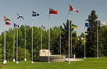
Confederation Park is an urban park in northwest Calgary, Alberta.
It is developed over an area of 160 hectares (400 acres),[1] between the neighbourhoods of Mount Pleasant, Capitol Hill, Collingwood and Highland Park. 10th Street West bisects the park from north to south.

The park has picnic tables, toboggan hills, cycle paths, tennis courts and baseball diamonds. The park is also a popular destination for couples having wedding pictures taken. The park adjoins the Queens Park Cemetery on the east side by the baseball diamond and tennis courts near Highland Park. There is cross country skiing both in the park and at the golf course during the winter. Any time of the year the park can be used for geocach searches.
Adjacent to the park is the Confederation Golf Course[2] In winter the golf course is open for cross country skiing and the park hosts the Lions Club Christmas Light Display in December and January.
References
- ↑ City of Calgary (March 2007). "Confederation Park". Archived from the original on 2007-09-30. Retrieved 2007-05-22.
- ↑ City of Calgary (January 2010). "Confederation Golf Course". Retrieved 2010-01-02.
 |
Collingwood | Nose Hill Park Rosemont |
Cambrian Heights | |
| Charleswood | |
Queens Park Village | ||
| ||||
| | ||||
| Banff Trail | Capitol Hill | Mount Pleasant |
| Landmarks | |
|---|---|
| Attractions | |
| Venues | |
| Parks | |
| Malls | |
| Recreation | |