Comodoro Pierrestegui Airport
| Comodoro Pierrestegui Airport Aeropuerto de Concordia "Comodoro Pierrestegui" | |||||||||||
|---|---|---|---|---|---|---|---|---|---|---|---|
| IATA: COC – ICAO: SAAC | |||||||||||
| Summary | |||||||||||
| Operator | Municipality of Concordia | ||||||||||
| Serves | |||||||||||
| Location | Monseñor Rosch and Suboficial Principal Tesce (C.P. 3200), Concordia | ||||||||||
| Elevation AMSL | 34 m / 112 ft | ||||||||||
| Coordinates | 31°17′49″S 57°59′48″W / 31.29694°S 57.99667°WCoordinates: 31°17′49″S 57°59′48″W / 31.29694°S 57.99667°W | ||||||||||
| Map | |||||||||||
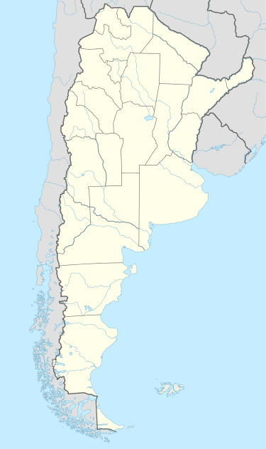
 COC Location of the airport in Argentina | |||||||||||
| Runways | |||||||||||
| |||||||||||
Concordia "Comodoro Pierrestegui" Airport (Spanish: Aeropuerto de Concordia "Comodoro Pierrestegui") (IATA: COC, ICAO: SAAC), also known as Concordia Airport, is a domestic airport serving Concordia, Entre Ríos, Argentina. It is located 13 kilometres (8.1 mi) north of the city.[1]
The airport covers an area of 94 hectares (0.36 sq mi; 230 acres) and has a 257-square-metre (2,770 sq ft) terminal.[1]
Accidents and incidents
- 15 November 1975: On approach to the airport inbound from Buenos Aires, an Aerolíneas Argentinas Fokker F28-1000, tail number LV-LOB, struck tree tops 4 kilometres (2.5 mi) short of the runway, causing the nosegear to contact the ground first, shearing off both the nose and the nosegear. There were no reported fatalities, but the aircraft was damaged beyond repair and was written off.[5]
See also
 Argentina portal
 Aviation portal
- Aerolíneas Argentinas accidents and incidents
- List of airports in Argentina
References
- 1 2 3 "Aeropuerto de Concordia "Comodoro Pierrestegui"" [Concordia "Comodoro Pierrestegui" Airport]. Organismo Regulador del Sistema Nacional de Aeropuertos (ORSNA) (in Spanish). Archived from the original on 12 February 2012.
- ↑ Airport information for SAAC at World Aero Data. Data current as of October 2006.
- ↑ Airport information for Comodoro Pierrestegui Airport at Great Circle Mapper. Source: DAFIF (effective October 2006).
- ↑ Airport information for Concordia "Comodoro Pierrestegui" Airport at Search (for) Travel website.
- ↑ Accident description for LV-LOB at the Aviation Safety Network. Retrieved on 23 March 2012.
External links
This article is issued from Wikipedia - version of the 12/4/2016. The text is available under the Creative Commons Attribution/Share Alike but additional terms may apply for the media files.