Como, Minneapolis
| Como | |
|---|---|
| Neighborhood | |
| Nickname(s): Southeast Como | |
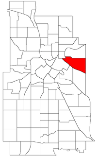 Location of Como within the U.S. city of Minneapolis | |
| Country | United States |
| State | Minnesota |
| County | Hennepin |
| City | Minneapolis |
| Community | University |
| Area[1] | |
| • Total | 1.123 sq mi (2.91 km2) |
| Population (2010)[2] | |
| • Total | 6,288 |
| • Density | 5,600/sq mi (2,200/km2) |
| Time zone | CST (UTC-6) |
| • Summer (DST) | CDT (UTC-5) |
| ZIP code | 55414 |
| Area code(s) | 612 |
| Historical population | |||
|---|---|---|---|
| Census | Pop. | %± | |
| 1980 | 5,083 | — | |
| 1990 | 5,617 | 10.5% | |
| 2000 | 5,691 | 1.3% | |
| 2010 | 6,288 | 10.5% | |
Como is a neighborhood within the University community of Minneapolis. It is sometimes referred to as Southeast Como, since it is in Southeast Minneapolis, and possibly to differentiate it from the Como neighborhood in neighboring Saint Paul. Its boundaries are East Hennepin Avenue to the north, 33rd Avenue Southeast (the eastern city limit) to the east, the Southeast Industrial Area to the south, and Interstate 35W to the west.
Como features many amenities for its residents: Van Cleve Park Community Center, the Como Student Community Co-op, the University Childcare Center, Dar Al-Farooq mosque, SE Christian Church, and the Como Evangelical Free Church. The #3 busline is convenient to all who live in Como and provides easy transportation to Downtown Minneapolis, all of the University of Minnesota Twin Cities campuses, and Downtown St. Paul. The high-traffic business roads, industry, abandoned industrial sites, and active railroads that surround Como contrast sharply with the residential character of the neighborhood. The housing stock consists of modest early 20th-century bungalows and Victorian and twenties-era homes mixed with a scattering of newer duplexes and single family homes. Some areas (e.g. along Como, 15th and Hennepin Avenues) have post-60's two-story walk-up apartment buildings.
Commercial activity is focused on Como and East Hennepin Avenues. The neighborhood is served by two convenience grocery stores (including one with a laundromat and deli) and a number of small service businesses, including a hardware store, a barber, a dentist, two coffee houses, three bar/restaurants, a diner, a video rental shop, an electronics repair shop, a resale shop, three printers, a car parts store, several auto repair garages, and several gas stations.
Governance
The Southeast Como neighborhood is located in Ward 2 and is currently represented by Cam Gordon. It also falls into the 2nd Police Precinct.
Trivia
- Como Avenue, which forms the spine of the residential neighborhood was originally a Territorial Road laid out in 1851, called the Willow River Road (Willow River is today's Hudson, WI).
- Later, when St. Paul named Lake Como and it became a popular recreational spot, the section of the WillowRiver/Hudson Road that led to the lake from Minneapolis became known as the Como Road.
- The first residential blocks were platted in 1882 by James Tallmadge Elwell.
- Maria Sanford, the first female professor at the U of M, lived in the neighborhood and was active in the community church.
- General Mills built their research laboratory here in 1930 and created Cheerioats, which is known as Cheerios today. In the early 1950s, GM's mechanical division invented the Ryan Flight Recorder, more famously known as the "black box".
Coordinates: 44°59′06″N 93°13′08″W / 44.9850°N 93.2190°W[3]
References
- ↑ "Como neighborhood in Minneapolis, Minnesota (MN), 55414 detailed profile". City-Data. 2011. Retrieved 2013-11-12.
- ↑ "Minneapolis Neighborhood Profile: Como" (PDF). Minnesota Compass. October 2011. Retrieved 2013-11-12.
- ↑ Como, Minneapolis, MN. Google Earth. Retrieved 2011-03-09.
External links
 |
Beltrami | Mid-City Industrial Area | | |
| Marcy-Holmes | |
Saint Paul, Minnesota | ||
| ||||
| | ||||
| University | Prospect Park |