Community College (MBTA station)
COMMUNITY COLLEGE | |||||||||||
|---|---|---|---|---|---|---|---|---|---|---|---|
 Looking north (outbound) along the island platform; unused express platform is at right | |||||||||||
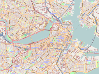
| Location | Austin Street near Rutherford Avenue, Charlestown | ||||||||||
| Coordinates | 42°22′25″N 71°04′13″W / 42.3737°N 71.0702°WCoordinates: 42°22′25″N 71°04′13″W / 42.3737°N 71.0702°W | ||||||||||
| Owned by | Massachusetts Bay Transportation Authority | ||||||||||
| Line(s) | |||||||||||
| Platforms | 2 island platforms (one unused) | ||||||||||
| Tracks | 3 | ||||||||||
| Construction | |||||||||||
| Bicycle facilities | 5 spaces | ||||||||||
| Disabled access | Yes | ||||||||||
| History | |||||||||||
| Opened | April 7, 1975 | ||||||||||
| Traffic | |||||||||||
| Passengers (2009) | 3,695 (weekday average boardings)[1] | ||||||||||
| Services | |||||||||||
| |||||||||||
| Location | |||||||||||
 | |||||||||||
Community College station is a rapid transit station on the MBTA Orange Line, located in Charlestown, Massachusetts (a neighborhood of Boston). It is located off Austin Street near New Rutherford Avenue (MA-99), under the double-decked elevated structure carrying Interstate 93 to the Zakim Bunker Hill Bridge. The station is named for the adjacent Bunker Hill Community College, the main population the station serves.[2]
Like all Orange Line stations, Community College is fully wheelchair accessible.
Station layout
| L2 Platforms |
Southbound | ← Orange Line toward Forest Hills (North Station) |
| Island platform, doors will open on the left | ||
| Center track (Northbound) | → Orange Line toward Oak Grove (Sullivan) → | |
| Island platform, not in service | ||
| Northbound | No regular service | |
| L1 Concourse |
Lobby | Fare barriers |
| G | Street level | Exit |
Location and connections

Community College station is one of the few stops on the Orange Line without at least one MBTA bus connection.[3] The station was built without a busway, as much of the surrounding area has a relatively low demand for bus service. The area north and west of the station is covered by the MBTA Commuter Rail Maintenance Facility, an abandoned freight yard, and the Inner Belt industrial park, while the area south of the station is occupied by major highway ramps connecting the I-93 elevated highway with the Tobin Bridge and Route 1.
The primary catchment area for the station is Bunker Hill Community College and the neighborhood of Charlestown which lie just to the east. However, a large portion of Charlestown ridership is collected instead by the 92 and 93 buses, which do not connect directly to Community College station. Instead, they run between Haymarket and Sullivan Square along historic trolley routings. The 92 formerly served Community College beginning in December 1975, but it was returned to its historic routing by December 1977.[4] Community College is the closest MBTA station to the Charlestown Navy Yard where MBTA Boat F4 Inner Harbor Ferry service docks.
Passengers can also access the East Cambridge area (including the Cambridgeside Galleria Mall) located west of the station via the John F. Gilmore Bridge, which carries Austin Street. Lechmere is the primary Green Line station for the East Cambridge area and is the terminus for several bus routes, but Community College is a short walk away for those desiring Orange Line connections.
History
For much of the 19th century, the four major northside railroads (the Fitchburg, Boston & Lowell, Boston & Maine, and Eastern) did not share any trackage on the approach to Boston. (Not until North Union Station in 1893 did they share a depot). At that time, Charlestown was separated from East Cambridge by a large cove. The Fitchburg crossed the B&M and the Eastern at Prison Point (then the site of a substantial state prison), near the modern location of Community College station. The Fitchburg and B&M had substantial freight depots nearby, while the Fitchburg's Charlestown station was located slightly to the west, near where the Commuter Rail Maintenance Facility now stands.[5]


The Charlestown Elevated section of the Boston Elevated Railway's Main Line opened in June 1901, with three elevated stations in Charlestown. The Thompson Square station was located one-third of a mile east of the current station along Austin Street at Main Street, while the City Square station was located half a mile south along Rutherford Avenue at Chelsea Street. In 1917, the elevated was slated to be replaced with a more permanent subway line along the same Main Street routing, but this project was canceled by the US's entry into World War I.[6]
Unlike the Washington Street Elevated, which was built as the same time with a similar design, the Charlestown El was located very near Boston Harbor and the Mystic River tidal estuary, and was thus continually exposed to accelerated corrosion caused by salt air. The elevated was also unpopular with many local residents, as it was noisy and blocked out sunlight to Main Street. In the 1960s, it was determined that a replacement elevated would not be wise to build, and that a full-length replacement tunnel would be too expensive.
Instead, the Haymarket North Extension project consisted of a tunnel segment from Haymarket through a new underground stop at North Station, then under the Charles River to a portal near Community College. From there the extension was built along the Haverhill Line commuter rail right of way, lowering land acquisition difficulties. Community College station was built to replace the two elevated stops nearby in Charlestown. The new route opened to Sullivan Square on April 7, 1975.[4] The Main Line had previously been renamed as the Orange Line in 1967, as part of a systemwide rebranding by the newly formed MBTA.
Like the Sullivan Square and Wellington stations, Community College was built with a second island platform serving the outbound track plus a third express track. This extra infrastructure was to be used for the Orange Line's planned extension to Reading to replace commuter rail service on the line. (Continuing commuter rail service to Andover and Haverhill was to be via the Wildcat Branch). However, the Orange Line extension was cut short to Oak Grove due to local opposition in Melrose, and no express service ever ran. The second platform is open for outbound passengers at busy Sullivan Square and Wellington to speed boarding, but at less-busy Community College it sits unused.
Around 2005, the station received modifications to make it fully handicapped accessible.[7] Shaft framework was installed for the second platform, but no elevator machinery was installed.
References
- ↑ "Ridership and Service Statistics" (PDF). Massachusetts Bay Transportation Authority. 2010. Retrieved October 28, 2012.
- ↑ "Community College Station". Charlestown Patch. Retrieved 12 May 2013.
- ↑ "Subway Orange Line". Massachusetts Bay Transportation Authority. Retrieved 12 May 2013.
- 1 2 Belcher, Jonathan (23 March 2013). "Changes to Transit Service in the MBTA district" (PDF). NETransit. Retrieved 12 May 2013.
- ↑ "Boston". Atlas of the World. Rand McNally. 1891. Retrieved 14 May 2013.
- ↑ Stone, Kenneth (21 March 2011). "What if the El Came Down in 1917?". Charlestown Patch. Retrieved 12 May 2013.
- ↑ "Accessibility Projects at the MBTA" (PDF). Massachusetts Bay Transportation Authority. March 2005. Retrieved 12 May 2013.
External links
| Wikimedia Commons has media related to Community College (MBTA station). |