Comanche County, Oklahoma
| Comanche County, Oklahoma | ||
|---|---|---|
 Comanche County Courthouse | ||
| ||
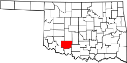 Location in the U.S. state of Oklahoma | ||
 Oklahoma's location in the U.S. | ||
| Founded | July 8, 1901 | |
| Seat | Lawton | |
| Largest city | Lawton | |
| Area | ||
| • Total | 1,084 sq mi (2,808 km2) | |
| • Land | 1,069 sq mi (2,769 km2) | |
| • Water | 14 sq mi (36 km2), 1.3% | |
| Population (est.) | ||
| • (2015) | 124,648 | |
| • Density | 116/sq mi (45/km²) | |
| Congressional district | 4th | |
| Time zone | Central: UTC-6/-5 | |
| Website |
www | |

Comanche County is a county located in the U.S. state of Oklahoma. As of the 2010 census, the population was 124,098,[1] making it the fourth-most populous county in Oklahoma. Its county seat is Lawton.[2] The county was created in 1901 as part of Oklahoma Territory.[3] It was named for the Comanche tribe.[4]
Comanche County is included in the Lawton, OK Metropolitan Statistical Area.
Built on former reservation lands of the Comanche, Kiowa, and Apache in Indian Territory, Comanche County was open for settlement on August 16, 1901 by lottery. The region has three cities and seven towns as well as the Fort Sill military installation and Wichita Mountains Wildlife Refuge. The landscape of the county is typical of the Great Plains with flat topography and gently rolling hills, while the areas in the north are marked by the Wichita Mountains. Interstate 44 and three major US Highways serve the county by ground, while the Lawton-Fort Sill Regional Airport serves the county by air.
Comanche County's economy is largely based in the government sector which consist of half of the county's Gross Domestic Product. The governance of the county is led by a three commission board, which are elected in four year staggered terms. The county is served by several school districts and Cameron University in education as well as three hospitals for health care.
History

The land that is present day Oklahoma was first settled by prehistoric American Indians including the Clovis 11500 BCE, Folsom 10600 BCE and Plainview 10000 BCE cultures. Western explorers came to the region in the 16th century with Spanish explorer Francisco Vásquez de Coronado visiting in 1541. Most of the region during this time was settled by the Wichita and Caddo people. Around the 1700s, two tribes from the North, the Comanches and Kiowas, migrated to the Oklahoma and Texas region.[5]
For most of the 18th century, the Oklahoma region was under French control as Louisiana. In 1803, the Louisiana Purchase by Thomas Jefferson brought the area under United States control. In 1830, Congress passed the Indian Removal Act, which removed American Indian tribes and relocated them to Indian Territory. The southern part of the territory was originally assigned to the Choctaw and Chickasaw until 1867 when the Medicine Lodge Treaty allotted the southwest portion of the Choctaw and Chickasaw’s lands to the Comanche, Kiowa, and Apache tribes.[5][6]
Fort Sill was established in 1869 by Major General Philip Sheridan who was leading a campaign in Indian Territory to stop raids into Texas by American Indian tribes.[7] In 1874, the Red River War broke out in the region when the Comanche, Kiowa and Southern Cheyenne left their Indian Territory reservation. Attrition and skirmishes by the US Army finally forced the return of the tribes back to Indian Territory in June 1875.[7]
In 1891, the United States Congress appointed a commission to meet with the tribal leaders and come to an agreement allowing white settlement in the region. Years of controversy and legal maneuvering ensued before President William McKinley issued a proclamation on July 4, 1901, that gave the federal government control over 2,000,000 acres (8,100 km2) of surplus Indian land.[8][9]
Three 320-acre (1.3 km2) sites in Kiowa, Caddo and Comanche Counties were selected for county seats with Lawton designated as the Comanche County seat. Non-Indian settlement was opened through an auction of lots beginning on August 6, 1901.[10] In December 1906, the south regions of the county reserved for grazing land reserved for American Indian livestock, Big Pasture, were open for settlement.[4][11]
In 1910, the western portion of Comanche County and southern part of Kiowa County were used to create the short lived county of Swanson. After a lawsuit brought by Comanche County, Swanson County was dissolved by the Supreme Court on June 27, 1911.[12] In 1912, the southern portion of Comanche County, which at the time extended to the Red River, were used to create the new county of Cotton County.[11]
Geography

According to the U.S. Census Bureau, the county has a total area of 1,084 square miles (2,810 km2), of which 1,069 square miles (2,770 km2) is land and 14 square miles (36 km2) (1.3%) is water.[13]
Comanche County lies in an area that is typical of the Great Plains with prairie, few trees, and generally flat topography with gently rolling hills.[14] The north region of the county consists of the Wichita Mountains including Mount Scott and Mount Pinchot the area's highest peaks.[15]
The area consists mostly of Permian Post Oak Conglomerate limestone on the northern sections of the county. In the south sections of the county, Permian Garber Sandstone is commonly found with some Hennessey Group shale. Area creeks including East Cache Creek and West Cache Creek contain deposits of Quaternary alluvium. To the northwest, the Wichita Mountains consist primarily of Wichita Granite Group from the Cambrian era.[16]
There are three cities in Comanche County. The largest, Lawton is located in the center of the county and is the county seat.[17] According to the US census, the population of Lawton was 96,867 in 2010, which is 78 percent of the county's population. Cache is located to the west of Lawton on US Highway 62 and has a population of 2,796. In the northeast, Elgin is located along Interstate 44 and has a population of 2,156. Several towns dot the county including: Fletcher, Sterling in the northeast, Medicine Park in the north central region, Indiahoma in the west, Geronimo in the southeast, and Chattanooga and Faxon in the southern regions of the county.[18] Also located in Comanche County is Fort Sill. The 90,000 acre instillation is home to the US Army Field Artillery Training Center and the Air Defense Artillery.[19]
Protected areas in Comanche County include the 59,020 acre Wichita Mountains Wildlife Refuge. Established in 1901 the refuge is one of the 546 wildlife refuges throughout the United States to provide a natural habitat for native grazing animals like the Bison, Elk, and Texas longhorn cattle.[20]
Adjacent counties
- Kiowa County (northwest)
- Tillman County (southwest)
- Cotton County (south)
- Stephens County (southeast)
- Grady County (northeast)
- Caddo County (north)
Climate
Comanche County lies in a dry subtropical climate (Köppen climate classification Cfa), with frequent variations in weather daily, except during the constantly hot and dry summer months. Frequent strong winds, usually from the south or south-southeast during the summer, help to lessen the hotter weather. Northerly winds during the winter can occasionally intensify cold periods.[21]
The average mean temperature for the southwest Oklahoma is 61.9 °F (16.6 °C). The summers can be extremely hot with an average 21 days with temperatures 100 °F (37.8 °C) and above.[22] The winter months are typically mild, though there can be periods of extreme cold. The area averages 8 days that fail to rise above freezing.[22] The region receives about 31.6 inches (800 mm) of precipitation[22] and less than 3 inches (80 mm) of snow annually.[21]
Typically in late April through early June, Comanche County is prone to severe weather which can include tornadoes.[23] Notably in 1957, a F4 tornado and again in 1979 a F3 tornado struck the southern region of Lawton.[24]
Demographics
| Historical population | |||
|---|---|---|---|
| Census | Pop. | %± | |
| 1910 | 41,489 | — | |
| 1920 | 26,629 | −35.8% | |
| 1930 | 34,317 | 28.9% | |
| 1940 | 38,988 | 13.6% | |
| 1950 | 55,165 | 41.5% | |
| 1960 | 90,803 | 64.6% | |
| 1970 | 108,144 | 19.1% | |
| 1980 | 112,456 | 4.0% | |
| 1990 | 111,486 | −0.9% | |
| 2000 | 114,996 | 3.1% | |
| 2010 | 124,098 | 7.9% | |
| Est. 2015 | 124,648 | [25] | 0.4% |
| U.S. Decennial Census[26] 1790-1960[27] 1900-1990[28] 1990-2000[29] 2010-2013[1] | |||
As of the census of 2010, there were 124,098 people, 44,982 households, and 30,303 families residing in the county. The population density was 116 people per square mile (45/km²). There were 50,739 housing units at an average density of 47 per square mile (18/km²). The racial makeup of the county was 64.5% White, 17.5% Black or African American, 5.9% Native American, 2.2% Asian, 0.6% Pacific Islander, 3.0% from other races, and 6.5% from two or more races. 11.2% of the population were Hispanic or Latino of any race (7.0% Mexican, 2.4% Puerto Rican, 0.3% Spanish, 0.2% Panamanian).[30]
There were 44,982 households out of which 36.5% had children under the age of 18 living with them, 48.2% were married couples living together, 14.5% had a female householder with no husband present, and 32.6% were non-families. 27.1% of all households were made up of individuals and 7.8% had someone living alone who was 65 years of age or older. The average household size was 2.53 and the average family size was 3.07.
In the county, the population was spread out with 25.1% under the age of 18, 13.6% from 18 to 24, 30.1% from 25 to 44, 23.3% from 45 to 64, and 10.2% who were 65 years of age or older. The median age was 31.3 years. For every 100 females there were 106.2 males. For every 100 females age 18 and over, there were 107.3 males.
The median income for a household in the county was $43,817, and the median income for a family was $51,564. Males had a median income of $37,423 versus $31,913 for females. The per capita income for the county was $21,048. About 14.3% of families and 17.6% of the population were below the poverty line, including 29.4% of those under age 18 and 8.1% of those age 65 or over.
Politics
| Voter Registration and Party Enrollment as of January 15, 2016[31] | |||||
|---|---|---|---|---|---|
| Party | Number of Voters | Percentage | |||
| Democratic | 23,816 | 47.19% | |||
| Republican | 18,360 | 36.38% | |||
| Unaffiliated | 8,291 | 16.43% | |||
| Total | 50,467 | 100% | |||
| Year | Republican | Democratic |
|---|---|---|
| 2012 | 58.52% 17,664 | 41.48% 12,521 |
| 2008 | 58.77% 20,127 | 41.23% 14,120 |
| 2004 | 63.78% 21,170 | 36.22% 12,022 |
| 2000 | 58.31% 17,103 | 40.81% 11,971 |
Law and government
Comanche County has a county commission comprising three members elected by district. Commissioners from each district serve four-year staggered terms in partisan elections. Boundaries are set once every 10 years following the federal census. The Board is responsible for inspecting and approving county programs and facilities, supervise the performance county officials, maintaining the county infrastructure, as well as overseeing the financial affairs of the county.[33] In 2011, the commissioners were District 1 Gail Turner, District 2 Ron Kirby, and District 3 Don Hawthorne.[34][35][36] In addition to the county commissioners, other elected county officials include: District Attorney, County Sheriff, Treasurer, Assessor, County Clerk, and Court clerk.[37]
At the federal level, Lawton lies in Oklahoma 4th Congressional district, represented by Tom Cole.[38] In the State Senate, the county is represented by District 31 (Don Barrington) and 32 (Randy Bass).[39][40] In the House, District 50 (Dennis Johnson), 62 (T.W. Shannon), 63 (Don Armes), 64 (Ann Coody), 65 (Joe Dorman) covers the county.[41]
Economy
Comanche County's economy is primarily centered on government, manufacturing and retail trade industries. The Lawton MSA has a Gross Domestic Product of $4.89 Billion in 2010 with half (2.66 Billion) in the Government sector. Private industries accounted for 2.23 Billion in GDP in which Manufacturing (451 Million), Real estate and rental and leasing (305 Million), and Retail Trade (255 Million) were the largest fields.[42] In May 2010, it was estimated there were 41,720 people employed. The largest occupation fields included, the Office and Administrative Support Occupations field which had 6,760 employed, the Food Preparation and Serving Related Occupations which employed 4,630, and the Sales and Related Occupations which had 4,150 employed.[43]
Media
The Lawton Constitution is the only daily newspaper published in the county and has a circulation of 30,000. In addition the Fort Sill newspaper, The Cannoneer, is published weekly primarily for military personnel as well as the newspaper The Cameron Collegian whose main audience is Cameron University students.[44] Additionally, Okie Magazine is a monthly magazine that focuses on news and entertainment in the Southwest Oklahoma area.[45] Fletcher News publishes online news of northeastern Comanche County, including Fletcher, Elgin and Sterling, at http://www.fletcher-news.com.html.
Radio stations in Lawton include, two AM Stations KXCA 1050 and KKRX 1380 as well as several FM stations including, NPR affiliate KCCU 89.3, KZCD 94.1, KMGZ 95.3, KJMZ 97.9, KBZQ 99.5, KLAW 101.3 and KVRW 107.3[44]
Comanche County is located in the Wichita Falls and Lawton Media Market which encompasses 154,450 households with a television, making it the 149th largest in the nation according to Nelson Media Research in 2009-2010.[46] KSWO-TV channel 7, an ABC affiliate, is the only broadcast television station in the area that provides local news.[47] All other major stations including, KFDX-TV 3 (NBC), KAUZ-TV (CBS), and KJTL-TV (Fox) are based in Wichita Falls.
Transportation
Comanche County is primarily served by Interstate 44, designated as the H. E. Bailey Turnpike. It connects the county to Oklahoma City to the northeast and to Wichita Falls, Texas to the south. The county is also connected by US Highway 62, which connects to the regional towns of Altus to the west and Anadarko to the north. Other major thoroughfares include US Highway 277 and 281, which parallels the H. E. Bailey Turnpike to Wichita Falls to the south and leads to regional towns of Anadarko and Chickasha, respectively, to the north.
Several State Highways cross the county including, State Highway 7 which connects Lawton to Duncan. State Highway 17 starts at US Highway 62 and connects the city of Elgin to the town of Sterling and leads to Rush Springs in Grady County. State Highway 36 connects the towns of Chattanooga to Faxon and has its eastern terminus at Interstate 44. State Highway 49 enters the county from Kiowa County and becomes unsigned through the Wichita Wildlife refuge heading east. Leaving the refuge it becomes signed and leads through Medicine Park to its eastern terminus at Interstate 44. State Highway 58 connects to Carnegie in Caddo County to State Highway 49 near Medicine Park. State Highway 115 leads from Mountain View in Kiowa County through Meers to the Wichita Mountain Refuge. There it becomes unsigned as it leads to the south. Exiting the refuge, it becomes signed and leads to its southern terminus north of Cache on US Highway 62.[18]
Lawton Area Transit System (LATS) provides public transit locally for Lawton and Fort Sill. LATS main terminal is located near the Lawton Public Library and provides five major routes throughout the city.[48]
By air, Comanche County is served by the Lawton-Fort Sill Regional Airport (LAW, KLAW). At present, it offers daily American Eagle flights to Dallas/Fort Worth International Airport and is also used for military transport.[49][50]
Education and healthcare
The county has ten independent school districts.[51] The largest is Lawton Public Schools which had 16,398 in 2009. The district operates two pre-kindergarten centers, twenty-six elementary schools, four middle schools, and three high schools – Eisenhower, Lawton, and MacArthur.[52] Other major school districts in the area include Cache Public Schools and Elgin Public Schools. Cache Public Schools had an enrollment of 1,648 and consists of five schools.[51][53] Elgin Public Schools had an enrollment of 16,98 and three schools.[51] Other public school districts in the region include, Bishop Chattanooga, Fletcher, Flower Mound, Geronimo, Indiahoma, and Sterling.[51]
Comanche County includes several private schools.[54] The largest is Lawton Christan School with an enrollment of 426 students in 2009.[55] Lawton Academy of Arts & Science offers classes from PK-12 and had an enrollment of 115.[54] St. Mary's Catholic School offers classes for elementary and middle school.[56] Trinity Christian Academy offers classes from K-3 through the 8th grade.[57]
There is one university in Comanche County, Cameron University. Cameron is the largest four year, state-funded university, in southwest Oklahoma, offering more than 50 degree programs in areas of Business, Education, Liberal Arts and Science and Technology.[58] Founded in 1909, Cameron has an average fall enrollment of 6,000 students with 70 endowed faculty positions.[59]
Comanche County is also served by the Great Plains Technology Center, which is part of the Oklahoma Department of Career and Technology Education System. Great Plains provides occupational education, training, and development opportunities to area residents.[60]
Comanche County has three major hospitals in the area. The largest, Comanche County Memorial Hospital, is a 283-bed non-profit hospital that employs 250 physicians.[61] Southwestern Medical Center is a 199-bed hospital with a staff of 150 physicians.[62] In addition, the US Public Health Lawton Indian Hospital is located in the city to provide health services for the large American Indian population. It has 26 beds with a staff of 23 physicians.[63]
Communities
- Bethel
- Cache
- Chattanooga
- Elgin
- Faxon
- Fletcher
- Geronimo
- Indiahoma
- Lawton (county seat)
- Medicine Park
- Meers
- Pumpkin Center
- Sterling
Notable residents
Notable residents include country singers: Bryan White,[64] Kelly Willis,[65] and Leon Russell,[66] Grammy nominated jazz trombonist Conrad Herwig,[67] and Flaming Lips drummer Steven Drozd.[68] Notable authors include Pulitzer Prize winning author N. Scott Momaday,[69] poet Don Blanding,[70] and Hugo Award winner, C. J. Cherryh.[71]
Politicians from Comanche County include: US Senator Thomas Gore, US Representatives: Scott Ferris, L. M. Gensman, Toby Morris, and Elmer Thomas.[11] Other politicians include Democratic State Senator Randy Bass[72] and former US Ambassador to Czechoslovakia Julian Niemczyk.
Other notable residents include: World War II Comanche Code Talker Charles Chibitty,[73] World War II Nurse and POW Col. Rosemary Hogan,[74] Academy Award winning actress Joan Crawford,[75] World War II ace Robert S. Johnson,[76] three time NBA champion Stacey King,[77] former NBA All-Star Michael Ray Richardson,[78] Miss America 2007 Lauren Nelson,[79] infamous University of Oklahoma quarterback Charles Thompson,[80] NFL Pro Bowlers Will Shields[81] and Jammal Brown[82]
Quanah Parker built his final residence in the town of Cache, Comanche County.
See also
References
- 1 2 "State & County QuickFacts". United States Census Bureau. Retrieved November 8, 2013.
- ↑ "Find a County". National Association of Counties. Archived from the original on 2011-05-31. Retrieved 2011-06-07.
- ↑ "Oklahoma: Individual County Chronologies". Oklahoma Atlas of Historical County Boundaries. The Newberry Library. Retrieved February 23, 2015.
- 1 2 Linda D. Wilson, "Comanche County." Encyclopedia of Oklahoma History and Culture. Accessed September 18, 2011,
- 1 2 Oklahoma Department of Libraries. "Oklahoma Almanac 2005 - Oklahoma History" (pdf). pp. 687–691. Retrieved 2011-04-25.
- ↑ Kappler, Charles (1903). Indian Affairs: Laws and treaties, Volume 2. Washington D.C.: Government Printing Office. p. 755.
- 1 2 Fort Sill, Globalsecurity.org (accessed May 23, 2010).
- ↑ Lone Wolf v. Hitchcock, 187 U.S. 553 (1903).
- ↑ Kappler, Charles (1904). Indian Affairs: Laws and treaties, Volume 1. Washington D.C.: Government Printing Office. p. 1012.
- ↑ Kutchta, Howard (2001). Lawton, a centennial history, 1901-2001. Bell Books. p. 7,8.
- 1 2 3 Oklahoma Historical Society. "Comanche County". Retrieved 2011-09-18.
- ↑ "Chronicles of Oklahoma Swanson County". Retrieved 2011-09-18.
- ↑ "2010 Census Gazetteer Files". United States Census Bureau. August 22, 2012. Retrieved February 19, 2015.
- ↑ "Oklahoma's Climate: an Overview" (pdf). University of Oklahoma. Retrieved 2011-09-17.
- ↑ US Fish and Wildlife Service. "Frequently Asked Questions". Retrieved 2011-09-17.
- ↑ Oklahoma Geological Survey. "Reconnaissance of the Water Resources of the Lawton Quadrangle, Southwestern Oklahoma" (pdf). Retrieved 2011-09-17.
- ↑ National Association of Counties. "Places in Comanche County, OK". Retrieved 2011-09-17.
- 1 2 Official State Highway Map (Map) (2010 ed.). Oklahoma Department of Transportation.
- ↑ Global Security. "Fort Sill". Retrieved 2011-09-18.
- ↑ US Fish and Wildlife Service. "Wichita Mountains Wildlife Refuge". Retrieved 2011-09-18.
- 1 2 "Oklahoma's Climate: an Overview" (pdf). University of Oklahoma. Retrieved 2011-09-22.
- 1 2 3 "Climatography of the United States NO. 20 1971–2000:Lawton, OK" (PDF). National Oceanic and Atmospheric Administration. Retrieved 2011-09-22.
- ↑ Rodger Edwards, Storm Prediction Center. "Tornado Climatology". Retrieved 2011-09-22.
- ↑ National Weather Service - Norman. "Comanche County, OK Tornadoes (1875–2009)". Retrieved 2011-09-22.
- ↑ "County Totals Dataset: Population, Population Change and Estimated Components of Population Change: April 1, 2010 to July 1, 2015". Retrieved July 2, 2016.
- ↑ "U.S. Decennial Census". United States Census Bureau. Archived from the original on April 22, 2013. Retrieved February 19, 2015.
- ↑ "Historical Census Browser". University of Virginia Library. Retrieved February 19, 2015.
- ↑ Forstall, Richard L., ed. (March 27, 1995). "Population of Counties by Decennial Census: 1900 to 1990". United States Census Bureau. Retrieved February 19, 2015.
- ↑ "Census 2000 PHC-T-4. Ranking Tables for Counties: 1990 and 2000" (PDF). United States Census Bureau. April 2, 2001. Retrieved February 19, 2015.
- ↑ "Archived copy". Archived from the original on 2014-12-18. Retrieved 2016-05-07.
- ↑ "Archived copy" (PDF). Archived from the original (PDF) on 2016-03-29. Retrieved 2016-02-19.
- ↑ "Dave Leip's Atlas of U.S. Presidential Elections". Retrieved 2016-03-11.
- ↑ Comanche County, Oklahoma. "Board of Commissioners". Retrieved 2010-06-18.
- ↑ Comanche County, Oklahoma. "District 1". Retrieved 2011-03-20.
- ↑ Comanche County, Oklahoma. "District 2". Retrieved 2011-03-20.
- ↑ Comanche County, Oklahoma. "District 3". Retrieved 2011-03-20.
- ↑ National Association of Counties. "Comanche County, OK". Retrieved 2011-09-30.
- ↑ "2002 Congressional Districts". Oklahoma House of Senate. Archived from the original on 2010-05-28. Retrieved 2011-09-17.
- ↑ "Senate District 31" (pdf). Oklahoma Senate. Retrieved 2011-09-17.
- ↑ "Senate District 32" (PDF). Oklahoma Senate. Archived from the original (pdf) on 2010-05-27. Retrieved 2011-09-17.
- ↑ "House Districts by County" (pdf). Oklahoma House of Representatives. Retrieved 2011-09-17.
- ↑ Bureau of Labor and Statistics. "Gross Domestic Product by Metropolitan Statistical Area - Lawton MSA". Retrieved 2011-09-19.
- ↑ Bureau of Labor and Statistics. "May 2010 Metropolitan and Nonmetropolitan Area Occupational Employment and Wage Estimates Lawton, OK". Retrieved 2011-09-19.
- 1 2 Lawton Fort Sill Chamber of Commerce. "Communications". Retrieved 2011-09-23.
- ↑ MondoTimes. "Okie Magazine". Retrieved 2010-11-11.
- ↑ Nelson Media. "Local Television Market Universe Estimates" (pdf). Retrieved 2011-09-23.
- ↑ KSWO-TV. "About KSWO-TV". Retrieved 2011-09-23.
- ↑ Lawton Area Transit System. "RIDE LATS". Retrieved 2010-05-24.
- ↑ Lawton Metropolitan Area Airport Authority. "American/American Eagle Airlines". Retrieved 2011-04-03.
- ↑ AirNav. "Lawton-Fort Sill Regional Airport". Retrieved 2010-05-24.
- 1 2 3 4 National Center for Education Statistics. "search for public school districts". Retrieved 2011-09-18.
- ↑ Lawton Public Schools. "Schools". Retrieved 2010-05-30.
- ↑ Cache Public Schools. "School Sites". Retrieved 2011-09-19.
- 1 2 National Center for Education Statistics. "Search for Private Schools". Retrieved 2011-09-18.
- ↑ Lawton Christian Schools. "About Us". Retrieved 2010-05-14.
- ↑ St. Mary's Catholic School of Lawton. "Home". Archived from the original on 2011-07-16. Retrieved 2011-04-25.
- ↑ Trinity Christian Academy. "Student Application". Archived from the original on 2012-03-22. Retrieved 2011-04-04.
- ↑ Cameron University. "Academic Information". Archived from the original on 2010-05-27. Retrieved 2010-05-30.
- ↑ Cameron University. "CU Fast Facts". Retrieved 2010-04-23.
- ↑ Great Plain Technology Center. "About GPTC". Retrieved 2010-04-23.
- ↑ "About US". Comanche County Memorial Hospital. Archived from the original on 2011-02-25. Retrieved 2011-05-05.
- ↑ Capella Healthcare. "Lawton, Ok". Retrieved 2011-04-27.
- ↑ Indian Health Services. "Lawton Service Unit". Retrieved 2011-04-03.
- ↑ Bryan White. "About Bryan White". Archived from the original on 2010-05-16. Retrieved 2010-05-30.
- ↑ Kelly Willis (I) at the Internet Movie Database
- ↑ Country Music Television. "Leon Russell". Retrieved 2010-05-30.
- ↑ Conrad Herwig. "Press Materials". Retrieved 2011-04-25.
- ↑ Chancellor, Jennifer (February 16, 2010). "In his element: Drozd in tune as a master teacher" (PDF). Tulsa World. Tulsa Oklahoma. Retrieved 2010-05-30.
- ↑ Steed, Patricia L. "Momaday, Navarre Scott," Encyclopedia of Oklahoma History and Culture, 2009. Accessed March 28, 2015.
- ↑ Goins, Charles; Goble, Danney; Morris, John W. (2006). Historical Atlas of Oklahoma. Norman, Oklahoma: University of Oklahoma Press. p. 232.
- ↑ Everett, Dianna. "Cherry, Caroline Janice," Encyclopedia of Oklahoma History and Culture, 2009. Accessed March 28, 2015.
- ↑ Oklahoma State Senate. "Senator Randy Bass - District 32". Retrieved 2010-05-30.
- ↑ Holley, Joe (July 26, 2005). "Comanche Code Talker Charles Chibitty Dies". The Washington Post. Washington DC. Retrieved 2010-05-30.
- ↑ Attalla, Meghan Iman. "Hogan, Rosemary," Encyclopedia of Oklahoma History and Culture, Oklahoma Historical Society, 2009. Accessed March 28, 2015.
- ↑ Wilson, Linda D. "Crawford, Joan," Encyclopedia of Oklahoma History and Culture, Oklahoma Historical Society, 2009. Accessed March 28, 2015.
- ↑ Air University. "Robert S. Johnson". Retrieved 2010-05-30.
- ↑ Basketball Reference. "Stacey King NBA & ABA Statistics". Retrieved 2010-05-30.
- ↑ "Where is Micheal Ray Richardson?". 2011-08-17.
- ↑ Lauren Nelson at the Internet Movie Database
- ↑ "SPORTS PEOPLE: FOOTBALL; Thompson Released". The New York Times. New York City, NY. February 16, 1989. Retrieved 2010-07-07.
- ↑ Nebraska Athletics Official Web Site. "Retired Jersey: #75". Retrieved 2010-05-30.
- ↑ Pro Football Reference. "Jammal Brown". Retrieved 2011-03-20.
External links
| Wikimedia Commons has media related to Comanche County, Oklahoma. |
- Comanche County
- City of Lawton
- Fort Sill Military Reservation
- Encyclopedia of Oklahoma History and Culture - Comanche County
- Oklahoma Digital Maps: Digital Collections of Oklahoma and Indian Territory
 |
Kiowa County | Caddo County | Grady County | |
| |
||||
| ||||
| | ||||
| Tillman County | Cotton County | Stephens County |
Municipalities and communities of Comanche County, Oklahoma, United States | ||
|---|---|---|
| Cities | | |
| Towns | ||
| Unincorporated communities | ||
| Footnotes | ‡This populated place also has portions in an adjacent county or counties | |
Coordinates: 34°40′N 98°28′W / 34.66°N 98.46°W