Collins, Wisconsin
| Collins | |
|---|---|
| Census-designated place | |
|
Collins post office | |
 Collins Location within the state of Wisconsin | |
| Coordinates: 44°05′08″N 87°58′58″W / 44.08556°N 87.98278°WCoordinates: 44°05′08″N 87°58′58″W / 44.08556°N 87.98278°W | |
| Country | United States |
| State | Wisconsin |
| County | Manitowoc |
| Area[1] | |
| • Total | 0.496 sq mi (1.28 km2) |
| • Land | 0.496 sq mi (1.28 km2) |
| • Water | 0 sq mi (0 km2) |
| Elevation | 814 ft (248 m) |
| Population (2010)[2] | |
| • Total | 164 |
| Time zone | Central (CST) (UTC-6) |
| • Summer (DST) | CDT (UTC-5) |
| ZIP code | 54207 |
| Area code(s) | 920 |
| GNIS feature ID | 1563267[3] |
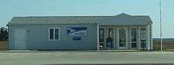
Collins is an unincorporated census-designated place in the town of Rockland, Manitowoc County, Wisconsin, United States, in the east central part of the state. Its zip code is 54207, although its post office is being studied for closure.[4] As of the 2010 census, its population is 164.[5] The Collins Marsh Wildlife Area is located east of the community.[6] Wisconsin Highway 32 ran through the community; the route later became Wisconsin Highway 67 before it became County Highway W. County Highway JJ and the Wisconsin Central Ltd. railroad runs east-west through the community. Collins has an area of 0.496 square miles (1.28 km2), all of it land.
Notable people
- Martin Rappel, farmer, politician, and businessman, lived in the town and was involved with the Collins State Bank in Collins.[7]
Images
-

Looking east at downtown Collins
-

Welcome sign
-

Looking north at DOT sign and the community
-
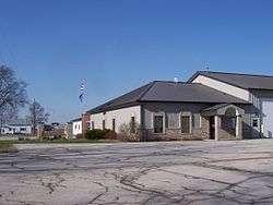
Town of Rockland town hall in Collins
Notes
- ↑ "US Gazetteer files: 2010, 2000, and 1990". United States Census Bureau.
- ↑ "American FactFinder". United States Census Bureau. Archived from the original on 2013-09-11.
- ↑ "Collins". Geographic Names Information System. United States Geological Survey.
- ↑ "Expanded Access study list: Wisconsin". United States Postal Service. Retrieved 26 November 2011.
- ↑ "American FactFinder". U.S. Census Bureau. Retrieved 29 March 2011.
- ↑ Collins Marsh Wildlife Area
- ↑ 'Wisconsin Blue Book 1917,' Biographical Sketch of Martin Rappel, pg. 535
Municipalities and communities of Manitowoc County, Wisconsin, United States | ||
|---|---|---|
| Cities | 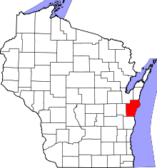 | |
| Villages | ||
| Towns | ||
| CDP | ||
| Unincorporated communities |
| |
| Footnotes | ‡This populated place also has portions in an adjacent county or counties | |