Collegio Teutonico

The Collegio Teutonico (German College), historically often referred to by its Latin name Collegium Germanicum, is one of the Pontifical Colleges of Rome. It was established in 1399 and maintained at the Vatican for the education of future ecclesiastics of the Roman Catholic Church of German nationality. The German College is now divided into two separate colleges.
Pontificio Collegio Teutonico di S. Maria dell’ Anima
The Pontificio Collegio Teutonico di S. Maria dell’ Anima was created in 1399 when Theodoric of Niem founded a hospice for German pilgrims. A confraternity in aid of the suffering souls in purgatory was soon after formed, and in 1499 the first stone of the beautiful church, Santa Maria dell'Anima, was laid, near the Santa Maria della Pace. In 1859 this pia opera was reorganized; a college of chaplains to officiate in the church was established; the chaplains were to remain only two or at the most three years, and at the same time were to continue their studies. They devote themselves chiefly to canon law with a view to employing their knowledge in the service of their respective dioceses; and they receive living and tuition gratis. Other priests also are admitted who come to Rome at their own expense for the purpose of study. At present there are 8 chaplains and about 10 other priests residing there. The college continues to assist poor Germans who come to Rome, either to visit the holy places or in search of occupation.
Collegio Teutonico del Campo Santo

The Collegio Teutonico del Campo Santo was established by Christian archeologist Anton de Waal in 1876 to receive priests belonging to the German Empire or German provinces of Austria, who remained there for two or, at the most, three years pursuing their studies and officiating in the Church of Santa Maria della Pietà in Camposanto dei Teutonici near St. Peter's. The revenues of the Campo Santo and the chaplaincies that have been founded devote themselves to the study of Christian archeology or Church history. In 1888 the Roman institute of the Görres Society (Görresgesellschaft) was established in the Campo Santo Teutonico; together they publish a quarterly review, the "Römische Quartalschrift fur christliche Archäologie und Kirchengeschichte". The site of the Campo Santo dei Tedeschi goes back to the days of Charlemagne and was then called the Schola Francorum. In the course of time the German residents in Rome were buried in the church of the Schola, then called S. Salvatore in Turri. In 1454 a confraternity was established, and in addition the guilds of German bakers and cobblers had their quarters there. In 1876, owing to the altered conditions of modern times (see: Kulturkampf), the institute was put to its present purpose .
Location
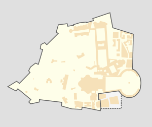
The collegio is located in Italy and is one of the properties which form part of the territory of Holy See but which are located outside the confines of Vatican City boundaries.
It is one of the properties of the Holy See which are regulated by the 1929 Lateran Treaty signed with the Kingdom of Italy. As such, it has extraterritorial status.
Ratlines
Bishop Alois Hudal was rector of the Pontificio Istituto Teutonico Santa Maria dell'Anima.[1] After the end of the war in Italy, Hudal became active in ministering to German-speaking prisoners of war and internees then held in camps throughout Italy. In December 1944 the Vatican Secretariat of State received permission to appoint a representative to "visit the German-speaking civil internees in Italy", a job assigned to Hudal.
Hudal used this position to aid the escape of wanted Nazi war criminals,[2] activity about which he was later unashamedly open.
Associated individuals of note
- Alois Hudal
- Franz Joseph Dölger
- Prince Georg of Bavaria – is buried there.
- Duchess Charlotte Frederica of Mecklenburg-Schwerin – is buried there.
See also
References
External links
-
 Media related to Santa Maria dell'Anima at Wikimedia Commons
 - Media related to Santa Maria della Pietà (Campo Santo) at Wikimedia Commons
- Roman institute of the Society of Görres
Coordinates: 41°54′05″N 12°27′16″E / 41.90139°N 12.45444°E