College Hill West Historic District
|
College Hill West Historic District | |
|
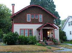
The district's Horace and Nellie Francis House (ca. 1924) in 2013 | |
|
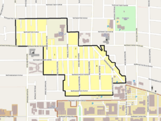
The College Hill West Historic District boundaries in Corvallis | |
| Location | Corvallis, Oregon, roughly bounded by NW Johnson and Polk avenues, Arnold Way, and 36th Street |
|---|---|
| Coordinates | 44°34′15″N 123°17′09″W / 44.570966°N 123.285750°WCoordinates: 44°34′15″N 123°17′09″W / 44.570966°N 123.285750°W |
| Area | Approx. 71 acres (29 ha)[1] |
| Built | 1905–1945[1] |
| Built by | K. C. Reitsma, John D. Stokes, George Abraham, Charles Heckert, W. B. McCallum, J. Thomsen, G. S. LaDow, H. E. Nordeen, others[1] |
| Architect | C. Heilman, John Virginius Bennes, R. D. Kennedy, others[1] |
| Architectural style | American Foursquare, Bungalow, Craftsman, Colonial Revival, Tudor Revival, Norman Farmhouse, Minimal Traditional, others[1] |
| NRHP Reference # | 02000827 |
| Added to NRHP | August 1, 2002 |
The College Hill West Historic District comprises a primarily residential neighborhood in Corvallis, Oregon, United States.[1]
The district was listed on the National Register of Historic Places in 2002.[2]
See also
- National Register of Historic Places listings in Benton County, Oregon
- John Bexell House
- J. Leo Fairbanks House (Corvallis, Oregon)
- College Hill High School
References
- 1 2 3 4 5 6 Wright, Sally; Heald, Leslie (August 1, 2001), National Register of Historic Places Registration Form: College Hill West Historic District (PDF), retrieved December 10, 2014.
- ↑ National Park Service (September 6, 2002), Weekly List of Actions Taken on Properties: 8/26/02 through 8/30/02, retrieved December 10, 2014.
External links
 Media related to College Hill West Historic District at Wikimedia Commons
- National Register of Historic Places photographic file
| Lists by county |  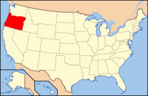 | |
|---|---|---|
| Portland lists | ||
| Other lists |
| |
This article is issued from Wikipedia - version of the 11/24/2016. The text is available under the Creative Commons Attribution/Share Alike but additional terms may apply for the media files.