Col de la Schlucht
| Col de la Schlucht | |
|---|---|
|
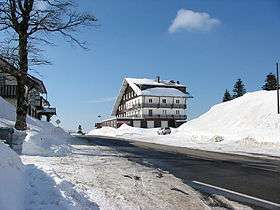
The Col de la Schlucht at the end of winter, March 2006 | |
| Elevation | 1,139 m (3,737 ft)[1] |
| Traversed by | D417 |
| Location | Haut-Rhin / Vosges, France |
| Range | Vosges Mountains |
| Coordinates | 48°3′50″N 7°1′21.6″E / 48.06389°N 7.022667°ECoordinates: 48°3′50″N 7°1′21.6″E / 48.06389°N 7.022667°E |
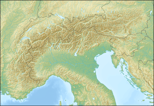 Col de la Schlucht Location of Col de la Schlucht | |
The Col de la Schlucht (elevation 1,139 m (3,737 ft)) is a mountain pass in the Vosges Mountains of France. The pass takes its name from the German word "Schlucht", meaning "gorge" or "ravine". It connects Munster (Haut-Rhin) with Gérardmer (Vosges) (east – west) and is also crossed by the Route des Crêtes (north – south). The climb over the pass has been used several times in the Tour de France cycle race.
History
Between 1871 and 1918, the pass was a border crossing between Lorraine (France) and Alsace, which had been ceded to Germany under the Treaty of Frankfurt.
Prior to World war I, the pass could be accessed via two separate tramway lines, from Gérardmer (opened 1904) and Munster (opened 1907) respectively. Both lines were abandoned at the outbreak of the war; that from Munster was never re-opened, whereas the line from Gérardmer continued in service until 1940.
Facilities
From the pass, it is possible to access the Sentier des Roches, a footpath along the edge of the ridge to Hohneck. This is considered to be one of the most impressive (and dangerous) Alsatian mountain paths.[2][3][4]
There is also a ski-lift up Montabey; from the top of the ski-lift, there is a summer luge run back down to the pass.[5][6][7]
Details of the climbs
From the west, the climb starts at Le Kertoff, 4 km (2 mi) before Gérardmer. From here, the climb is 17.0 km (10.6 mi) long gaining 531 m (1,742 ft) in height at an average gradient of 3.1%. The steepest section is at 6.7%.[8] This was the climb used in the 2009 Tour de France.[9]
The climb from the east starts at Munster from where there are 18.0 km (11.2 mi) to the summit, gaining 759 m (2,490 ft) in height. The overall average gradient is 4.2%, which is maintained fairly steadily throughout the climb.[10]
From La Bresse (south-west), the ascent via D34 is 16.2 km (10.1 mi) long climbing 494 m (1,621 ft) at an average gradient of 3.0%. This climb passes the Col des Feignes (954 m (3,130 ft)) en route, after which there are 2 km (1 mi) at between 7 and 8%.[11]
From Fraize (north-west), the climb is 21.0 km (13.0 mi) at an average of 3.0%, gaining 652 m (2,139 ft) in height.[12]
The summit can also be accessed via Route des Crêtes from the Col du Bonhomme (north) or the Col du Grand Ballon (south).[5]
Tour de France
The climb over the pass was first used on stage 20 of the 1931 Tour de France, when the summit was crossed by a group of riders,[13] although André Leducq was the first across the line after the descent into Colmar.[14]
Appearances in the Tour de France (since 1947)
Since World War II, the col has been crossed eight times, either as a Category 2 or Category 3 climb.[9]
| Year | Stage | Category | Start | Finish | Leader at the summit |
|---|---|---|---|---|---|
| 2014 | 9 | 2 | Gérardmer | Mulhouse | |
| 2009 | 13 | 2 | Vittel | Colmar | |
| 2005 | 8 | 2 | Pforzheim | Gérardmer | |
| 1992 | 11 | 2 | Strasbourg | Mulhouse | |
| 1973 | 5 | 2 | Nancy | Mulhouse | |
| 1970 | 9 | 2 | Saarlouis | Mulhouse | |
| 1969 | 5 | 3 | Nancy | Mulhouse | |
| 1961 | 6 | 3 | Strasbourg | Belfort | |
References
- ↑ IGN map
- ↑ "Le Sentier des Roches – Hohneck" (in French). www.alsacerando.com. Retrieved 3 August 2012.
- ↑ "A l'Attaque du Mythique Sentier des Roches" (in French). www.vosges-palatinat.com. Retrieved 3 August 2012.
- ↑ "Le Sentier des Roches ... au Col de la Schlucht". Marche – Passion (in French). www.marche-passion.fr. Retrieved 3 August 2012.
- 1 2 "Route des Cretes, Vosges". French Moments. Retrieved 1 August 2012.
- ↑ "Summer Luge at 'Col de la Schlucht'". www.yourtour.com. Retrieved 3 August 2012.
- ↑ "Summer sledge in Col de la Schlucht". www.labresse.net. Retrieved 3 August 2012.
- ↑ "Col de la Schlucht: Le Kertoff". www.climbbybike.com. Retrieved 1 August 2012.
- 1 2 "Le col de la Schlucht dans le Tour de France depuis 1947" (in French). ledicodutour. Retrieved 1 August 2012.
- ↑ "Col de la Schlucht: Munster". www.climbbybike.com. Retrieved 1 August 2012.
- ↑ "Col de la Schlucht: La Bresse". www.climbbybike.com. Retrieved 1 August 2012.
- ↑ "Col de la Schlucht: Fraize". www.climbbybike.com. Retrieved 1 August 2012.
- ↑ Woodland, Les (2003). The Yellow Jersey Companion to the Tour de France. Yellow Jersey Press. p. 265. ISBN 0-224-06318-9.
- ↑ "Etape 20: Belfort - Colmar". 2ème Tour de France (in French). www.memoire-du-cyclisme.net. Archived from the original on 24 January 2012. Retrieved 1 August 2012.
External links
| Wikimedia Commons has media related to Col de la Schlucht. |
- Official website (French)
- Tramway de Gérardmer on French Wikipedia (French)
- Tramway de Munster à la Schlucht on French Wikipedia (French)
- Sentier des Roches on German Wikipedia (German)
- Col de la Schlucht on Google Maps (Tour de France classic climbs)