Cohoe, Alaska
| Cohoe, Alaska | |
|---|---|
| CDP | |
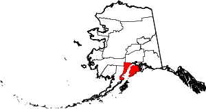
 Location of Cohoe, Alaska | |
| Coordinates: 60°18′5″N 151°17′45″W / 60.30139°N 151.29583°W | |
| Country | United States |
| State | Alaska |
| Borough | Kenai Peninsula |
| Government | |
| • Borough mayor | Mike Navarre[1] |
| • State senator | Gary Stevens (R) |
| • State rep. | Paul Seaton (R) |
| Area | |
| • Total | 72.6 sq mi (188.1 km2) |
| • Land | 69.7 sq mi (180.6 km2) |
| • Water | 2.9 sq mi (7.5 km2) |
| Elevation | 56 ft (17 m) |
| Population (2000) | |
| • Total | 1,168 |
| Time zone | Alaska (AKST) (UTC-9) |
| • Summer (DST) | AKDT (UTC-8) |
| Area code(s) | 907 |
| FIPS code | 02-16420 |
| GNIS feature ID | 1412828 |
Cohoe is a census-designated place (CDP) in Kenai Peninsula Borough, Alaska, United States. At the 2000 census the population was 1,168.
Geography
Cohoe is located at 60°18′5″N 151°17′45″W / 60.30139°N 151.29583°W (60.301277, -151.295952).[2]
According to the United States Census Bureau, the CDP has a total area of 72.6 square miles (188 km2), of which, 69.7 square miles (181 km2) of it is land and 2.9 square miles (7.5 km2) of it (3.99%) is water.
Demographics
As of the census[3] of 2000, there were 1,168 people, 445 households, and 295 families residing in the CDP. The population density was 16.7 people per square mile (6.5/km²). There were 630 housing units at an average density of 9.0/sq mi (3.5/km²). The racial makeup of the CDP was 90.15% White, 0.26% Black or African American, 4.54% Native American, 0.60% Asian, 0.17% Pacific Islander, 0.60% from other races, and 3.68% from two or more races. 1.71% of the population were Hispanic or Latino of any race.
There were 445 households out of which 34.6% had children under the age of 18 living with them, 56.4% were married couples living together, 5.6% had a female householder with no husband present, and 33.7% were non-families. 26.7% of all households were made up of individuals and 6.3% had someone living alone who was 65 years of age or older. The average household size was 2.61 and the average family size was 3.20.
In the CDP the population was spread out with 31.3% under the age of 18, 4.5% from 18 to 24, 28.4% from 25 to 44, 28.2% from 45 to 64, and 7.7% who were 65 years of age or older. The median age was 39 years. For every 100 females there were 117.1 males. For every 100 females age 18 and over, there were 108.0 males.
The median income for a household in the CDP was $38,542, and the median income for a family was $44,167. Males had a median income of $40,125 versus $26,154 for females. The per capita income for the CDP was $19,059. About 8.0% of families and 12.1% of the population were below the poverty line, including 9.9% of those under age 18 and 7.9% of those age 65 or over.
References
- ↑ 2015 Alaska Municipal Officials Directory. Juneau: Alaska Municipal League. 2015. p. 9.
- ↑ "US Gazetteer files: 2010, 2000, and 1990". United States Census Bureau. 2011-02-12. Retrieved 2011-04-23.
- ↑ "American FactFinder". United States Census Bureau. Archived from the original on 2013-09-11. Retrieved 2008-01-31.
Coordinates: 60°18′05″N 151°17′45″W / 60.301277°N 151.295952°W