Codolet
For the troubadour, see Codolen.
| Codolet | ||
|---|---|---|
|
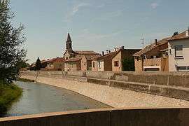
A general view of Codolet | ||
| ||
 Codolet | ||
|
Location within Occitanie region  Codolet | ||
| Coordinates: 44°07′37″N 4°42′10″E / 44.1269°N 4.7028°ECoordinates: 44°07′37″N 4°42′10″E / 44.1269°N 4.7028°E | ||
| Country | France | |
| Region | Occitanie | |
| Department | Gard | |
| Arrondissement | Nîmes | |
| Canton | Bagnols-sur-Cèze | |
| Intercommunality | Cèze Sud | |
| Government | ||
| • Mayor (2008–2014) | Serge Boissin | |
| Area1 | 5.17 km2 (2.00 sq mi) | |
| Population (2008)2 | 691 | |
| • Density | 130/km2 (350/sq mi) | |
| Time zone | CET (UTC+1) | |
| • Summer (DST) | CEST (UTC+2) | |
| INSEE/Postal code | 30084 / 30200 | |
| Elevation |
27–50 m (89–164 ft) (avg. 34 m or 112 ft) | |
|
1 French Land Register data, which excludes lakes, ponds, glaciers > 1 km² (0.386 sq mi or 247 acres) and river estuaries. 2 Population without double counting: residents of multiple communes (e.g., students and military personnel) only counted once. | ||
.svg.png)
Codolet is a commune in the Gard department in southern France.
Population
| Historical population | ||
|---|---|---|
| Year | Pop. | ±% |
| 1962 | 381 | — |
| 1968 | 393 | +3.1% |
| 1975 | 386 | −1.8% |
| 1982 | 433 | +12.2% |
| 1990 | 458 | +5.8% |
| 1999 | 558 | +21.8% |
| 2008 | 691 | +23.8% |
See also
References
External links
| Wikimedia Commons has media related to Codolet. |
- Official site (French)
This article is issued from Wikipedia - version of the 11/7/2016. The text is available under the Creative Commons Attribution/Share Alike but additional terms may apply for the media files.