Coëtivy Airport
| Coëtivy Airport | |||||||||||
|---|---|---|---|---|---|---|---|---|---|---|---|
| IATA: none – ICAO: FSSC | |||||||||||
| Summary | |||||||||||
| Airport type | Private | ||||||||||
| Operator | Unknown | ||||||||||
| Location | Coëtivy Island, Seychelles | ||||||||||
| Elevation AMSL | 10 ft / 3 m | ||||||||||
| Coordinates | 07°08′28.27″S 056°16′25.35″E / 7.1411861°S 56.2737083°E | ||||||||||
| Map | |||||||||||
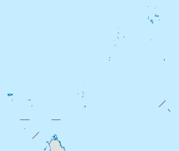 Co Location of airport in Seychelles | |||||||||||
| Runways | |||||||||||
| |||||||||||
Coëtivy Airport (ICAO: FSSC) is an airport serving Coëtivy Island in the Seychelles.[1]
The island is located 290 kilometres (180 mi) south of Mahe. Along with Île Platte, the nearest neighbor 171 kilometres (106 mi) northwest, it comprises the Southern Coral Group of the Outer Islands.
Facilities
The airport resides at an elevation of 10 feet (3 m) above mean sea level. It has one runway designated 13/31 with a concrete surface measuring 1,400 by 24 metres (4,593 ft × 79 ft).[1]
References
- 1 2 3 Airport information for FSSC from DAFIF (effective October 2006)
External links
This article is issued from Wikipedia - version of the 11/27/2016. The text is available under the Creative Commons Attribution/Share Alike but additional terms may apply for the media files.