Clintonville, Wisconsin
| Clintonville, Wisconsin | |
|---|---|
| City | |
|
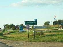
downtown Clintonville | |
 Location of Clintonville, Wisconsin | |
| Coordinates: 44°37′27″N 88°45′29″W / 44.62417°N 88.75806°WCoordinates: 44°37′27″N 88°45′29″W / 44.62417°N 88.75806°W | |
| Country | United States |
| State | Wisconsin |
| County | Waupaca |
| Area[1] | |
| • Total | 4.46 sq mi (11.55 km2) |
| • Land | 4.40 sq mi (11.40 km2) |
| • Water | 0.06 sq mi (0.16 km2) |
| Elevation[2] | 814 ft (248 m) |
| Population (2010)[3] | |
| • Total | 4,559 |
| • Estimate (2012[4]) | 4,502 |
| • Density | 1,036.1/sq mi (400.0/km2) |
| Time zone | Central (CST) (UTC-6) |
| • Summer (DST) | CDT (UTC-5) |
| Area code(s) | 715 & 534 |
| FIPS code | 55-15725[5] |
| GNIS feature ID | 1563198[2] |
| Website |
clintonvillewi |


Clintonville is a city in Waupaca County, Wisconsin, United States. The population was 4,559 at the 2010 census. The area that became Clintonville was first settled in March, 1855.[6]
History and settlement
In March, 1855 Norman Clinton and his family U. P. Clinton, Boardman Luman, and Mandy settled along the bank of the Pigeon River. They built the first establishment that grew into the city of Clintonville. The home they built was constructed of poles covered with hemlock boughs. It was used until a more suitable home built of logs could be constructed. They had drinking water from two large springs located on the bank of the river “Whose delicious water had flowed unmolested since the creation of the Universe.”
In March 2012, mysterious booms were heard by some in the city.[7] The U.S. Geological Survey detected a 1.5 magnitude microearthquake nearby on March 21 that geophysicists said might have produced the sounds.[8]
Geography
Clintonville is located at 44°37'27" North, 88°45'29" West (44.624051, -88.758073).[9]
According to the United States Census Bureau, the city has a total area of 4.46 square miles (11.55 km2), of which, 4.40 square miles (11.40 km2) is land and 0.06 square miles (0.16 km2) is water.[1]
Transportation
Major highways
| | U.S. 45 Southbound US 45 routes to New London. Northbound, US 45 routes to Wittenberg. |
| | WIS 156 travels eastbound to WIS 29. |
| | WIS 22 travels north to Shawano and runs south concurrent with US 45 to Waupaca. |
Airport
Demographics
| Historical population | |||
|---|---|---|---|
| Census | Pop. | %± | |
| 1880 | 573 | — | |
| 1890 | 1,466 | 155.8% | |
| 1900 | 1,653 | 12.8% | |
| 1910 | 1,747 | 5.7% | |
| 1920 | 3,275 | 87.5% | |
| 1930 | 3,572 | 9.1% | |
| 1940 | 4,134 | 15.7% | |
| 1950 | 4,657 | 12.7% | |
| 1960 | 4,778 | 2.6% | |
| 1970 | 4,600 | −3.7% | |
| 1980 | 4,567 | −0.7% | |
| 1990 | 4,351 | −4.7% | |
| 2000 | 4,736 | 8.8% | |
| 2010 | 4,559 | −3.7% | |
| Est. 2015 | 4,455 | [10] | −2.3% |
2010 census
As of the census[3] of 2010, there were 4,559 people, 2,002 households, and 1,154 families residing in the city. The population density was 1,036.1 inhabitants per square mile (400.0/km2). There were 2,227 housing units at an average density of 506.1 per square mile (195.4/km2). The racial makeup of the city was 95.6% White, 0.3% African American, 1.1% Native American, 0.4% Asian, 0.9% from other races, and 1.7% from two or more races. Hispanic or Latino of any race were 3.3% of the population.
There were 2,002 households of which 29.5% had children under the age of 18 living with them, 41.4% were married couples living together, 10.0% had a female householder with no husband present, 6.2% had a male householder with no wife present, and 42.4% were non-families. 36.9% of all households were made up of individuals and 17.6% had someone living alone who was 65 years of age or older. The average household size was 2.24 and the average family size was 2.92.
The median age in the city was 39.3 years. 24.4% of residents were under the age of 18; 8.1% were between the ages of 18 and 24; 24.6% were from 25 to 44; 24% were from 45 to 64; and 18.9% were 65 years of age or older. The gender makeup of the city was 47.6% male and 52.4% female.
2000 census
As of the census[5] of 2000, there were 4,736 people, 2,010 households, and 1,228 families residing in the city. The population density was 1,120.7 people per square mile (432.3/km²). There were 2,147 housing units at an average density of 508.1 per square mile (196.0/km²). The racial makeup of the city was 97.00% White, 0.23% African American, 0.53% Native American, 0.25% Asian, 0.00% Pacific Islander, 0.99% from other races, and 0.99% from two or more races. 2.15% of the population were Hispanic or Latino of any race.
There were 2,010 households out of which 28.6% had children under the age of 18 living with them, 47.4% were married couples living together, 9.8% had a female householder with no husband present, and 38.9% were non-families. 34.2% of all households were made up of individuals and 18.8% had someone living alone who was 65 years of age or older. The average household size was 2.30 and the average family size was 2.93.
In the city the population was spread out with 24.5% under the age of 18, 8.1% from 18 to 24, 26.4% from 25 to 44, 19.0% from 45 to 64, and 22.0% who were 65 years of age or older. The median age was 39 years. For every 100 females there were 87.4 males. For every 100 females age 18 and over, there were 83.2 males.
The median income for a household in the city was $33,947, and the median income for a family was $40,602. Males had a median income of $32,260 versus $22,192 for females. The per capita income for the city was $16,353. 9.5% of the population and 7.4% of families were below the poverty line. Out of the total population, 11.5% of those under the age of 18 and 13.3% of those 65 and older were living below the poverty line.
Religion
St. Paul Lutheran Church is a church of the Wisconsin Evangelical Lutheran Synod in Clintonville.[12]
Businesses
The Four Wheel Drive Auto Company
The Four Wheel Drive Auto Company, more often known as Four Wheel Drive or just FWD, was founded in 1909 in Clintonville, Wisconsin as the Badger Four-Wheel Drive Auto Company by Otto Zachow and William Besserdich. Zachow and Besserdich developed and built the first successful four-wheel drive (4x4) car, the "Battleship," in 1908. Its success led to the founding of the company. "Badger" was dropped from the name in 1910, and the name was changed to FWD Corporation in 1958.
Fire truck manufacturing
Clintonville is home to the US Seagrave Fire Apparatus Plant.
Wisconsin Central Airlines
Clintonville's Municipal Airport is historically recognized as the 1944 birthplace of Wisconsin Central Airlines, which evolved to become North Central Airlines and later Republic Airlines. In 1986, Northwest Orient Airlines purchased Republic and was known simply as Northwest Airlines. In 2008, Northwest was merged into Delta Air Lines.
Media
The Clintonville Chronicle, established in 2009, covers Clintonville news and is the recognized newspaper for the City of Clintonville.
Notable residents
- Dick Bennett, basketball coach
- Fred Hess, legislator
- Jean Hundertmark, legislator and 2006 Republican nominee for Lieutenant Governor
- Mike Jirschele, baseball
- J. Elmer Lehr, legislator
- William Lorge, legislator
- George W. Meggers, legislator
- William Frederick Meggers, physicist
- Otto L. Olen, legislator
- Frank J. Olmsted, legislator
- Daniel V. Speckhard, diplomat
- Julius Spearbraker, legislator
References
- 1 2 "US Gazetteer files 2010". United States Census Bureau. Archived from the original on 2012-06-26. Retrieved 2012-11-18.
- 1 2 "US Board on Geographic Names". United States Geological Survey. 2007-10-25. Retrieved 2008-01-31.
- 1 2 "American FactFinder". United States Census Bureau. Retrieved 2012-11-18.
- ↑ "Population Estimates". United States Census Bureau. Archived from the original on 2013-06-17. Retrieved 2013-06-24.
- 1 2 "American FactFinder". United States Census Bureau. Archived from the original on 2013-09-11. Retrieved 2008-01-31.
- ↑ Hyde, F. M. "History of City and State in Brief". Clintonville Tribune. Retrieved March 12, 2014.
- ↑ Dinesh Ramde (March 21, 2012). "Wis. town longs for relief from mysterious booms". The Guardian. AP. Retrieved March 23, 2012.
- ↑ Jessie Van Berkel (March 23, 2012). "Data point to earthquakes causing mysterious Wis. booms". USA Today. Retrieved March 23, 2012.
- ↑ "US Gazetteer files: 2010, 2000, and 1990". United States Census Bureau. 2011-02-12. Retrieved 2011-04-23.
- ↑ "Annual Estimates of the Resident Population for Incorporated Places: April 1, 2010 to July 1, 2015". Retrieved July 2, 2016.
- ↑ "Census of Population and Housing". Census.gov. Archived from the original on May 11, 2015. Retrieved June 4, 2015.
- ↑ "St. Paul Lutheran Church".
External links
Municipalities and communities of Waupaca County, Wisconsin, United States | ||
|---|---|---|
| Cities | 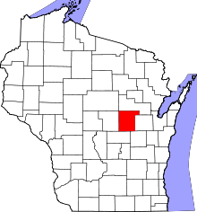 | |
| Villages | ||
| Towns | ||
| CDPs | ||
| Unincorporated communities | ||
| Ghost towns | ||
| Footnotes | ‡This populated place also has portions in an adjacent county or counties | |