Geography of Kuwait

Kuwait is situated in Southwest Asia, bordering the Persian Gulf, between Iraq and Saudi Arabia. Kuwait was a prosperous trade center for many centuries, Kuwait came to greater international prominence in the post-World War II era largely because of its strategic location at the head of the Persian Gulf and oil revenues.
Since 2007, Kuwait has been partially governed by Sabah Al-Sabah and his designated successor, Jaber Al-Sabah, the Prime Minister and Crown Prince. In the postwar period, these men have supported the strengthening of democratic participation in decision making, as provided for in the Constitution.
Kuwait is located at the far northwestern corner of the Persian Gulf. Kuwait is 17,820 square kilometres in size. At its most distant points, it is about 200 kilometers north to south, and 170 kilometers east to west.
Boundaries

As previously mentioned, Kuwait borders the Persian Gulf with 195 kilometers of coast. Within its territory are nine islands, two of which, Bubiyan (the largest) and Warbah, are largely uninhabited but strategically important. Due to the Iraq-Kuwait war (see Invasion of Kuwait), many people left their homes on islands, like Faylakah, and have since not returned to their homes.
Kuwait's most prominent geographic feature is Kuwait Bay (Jun al Kuwayt), which indents the shoreline for about forty kilometers, providing natural protection for the port of Kuwait, and accounts for nearly one half the country's shoreline.
To the south and west, Kuwait shares a long border of 250 kilometers with Saudi Arabia. The boundary between Kuwait and Saudi Arabia was set by the Treaty of Al Uqayr in 1922, which also established the Saudi–Kuwaiti neutral zone of 5,700 square kilometers between the two nations. In 1966, Kuwait and Saudi Arabia agreed to divide the neutral zone; the partitioning agreement making each country responsible for administration in its portion was signed in December 1969. The resources in the area, now known as the Divided Zone, are not affected by the agreement. The oil from onshore and offshore fields continues to be shared equally between the two countries.
The third side of the triangle-shaped nation is the 240 kilometers of historically contested border between Kuwait and Iraq. Although the Iraqi government, which had first asserted a claim to rule Kuwait in 1938, recognized the borders with Kuwait in 1963 (based on agreements made earlier in the century), it continued to press Kuwait for control over Bubiyan and Warbah islands through the 1960s and 1970s.
In August 1990, Iraq invaded Kuwait and, shortly thereafter, formally incorporated the entire country into Iraq. Under United Nations (UN) Security Council Resolution 687, after the restoration of Kuwaiti sovereignty in 1991, a UN commission undertook formal demarcation of the borders on the basis of those agreed to in 1963. The boundary was demarcated in 1992, but Iraq refuses to accept the commission's findings.
Recent events from 2008 to the present day have seen the positive advancement of maritime border relations with Iraq with the development of the Khawr Abd Allah (KAA) Protocols. The non-legally binding KAA Protocols were developed and mediated between the heads of the Kuwaiti and Iraqi navies by Major David Hammond Royal Marines, the British naval lawyer and legal advisor to Combined Task Force 158. This included the production of the KAA Interoperability Admiralty Chart by Major Hammond and which was subsequently distributed to both countries, having been produced by the United Kingdom Hydrographic Office.
In November 2008, the KAA Protocols were historically signed at Kuwait Naval Base having been verbally agreed onboard HMS Chatham (F87) in May 2008. The signing meeting saw the first formal meeting of the heads of respective navies since before the 1991 Gulf War. Subsequently, the success of the non-legally binding protocols was reported to the US Congress on January 9, 2009 in the Measuring Stability and Security in Iraq Report.
Climate

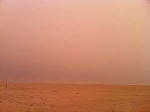
Kuwait has an arid climate. Kuwait has a huge temperature difference between winter and summer. Rainfall in the nation varies from 75 to 150 millimeters (2.95 to 5.91 in) a year. Actual rainfall has ranged from 120 millimeters (4.72 in) a year to as much as 600 millimeters (23.6 in). In summer, average daily high temperatures range from 42 to 48 °C (108 to 118 °F); the highest ever temperature recorded in Kuwait was 54.0 °C (129.2 °F) at Mitribah on 21 July, 2016 which is the highest recorded temperature in Asia and also the third highest in the world.[1] Mitribah temperatures until mid 2010 were affected by overexposure conditions and the station was later fixed.
The summers are quite long, punctuated mainly by dramatic dust storms in March and April when northwesterly winds cover the cities in sand. In the late summer, which is more humid. By the end of October all of the hot weather is over, and colder winter weather sets in, dropping temperatures to as low as −6 °C (21 °F) at night. On the other hand, daytime temperature is between 10–17 °C (50–63 °F). In this time, there are brief but strong thunderstorms. Frost occurs when the temperatures drop below 5 °C (41 °F).
Kuwait's winter is colder than in other Persian Gulf countries, such as Bahrain, Qatar or United Arab Emirates. Kuwait experiences colder weather because it is situated farther north, and because of cold winds blowing from upper Iraq and Iran. In Kuwait, precipitation usually occurs from October until April (mostly in November).
Area boundaries
- Area
-
- Total: 17,818 km²
- Land: 17,818 km²
- Water: 0 km²
- Area—comparative
- Slightly smaller than New Jersey, and Fiji
- Land boundaries
-
- Total: 475 km
- Border countries: Iraq 254 km, Saudi Arabia 221 km
- Coastline
- 499 km
- Maritime claims
-
- Territorial sea: 12 nmi (22.2 km; 13.8 mi)
- Elevation extremes
-
- Lowest point: Persian Gulf 0 m
- Highest point: Mutla Ridge 306 m
Resources and land use
- Natural resources
- Petroleum, fish, shrimp, natural gas
- Land use
-
- Arable land: 0.6%
- Permanent crops: 0.3%
- Permanent pasture: 7.6%
- Forest: 0.4%
- Other: 91.1% (2011)
- Irrigated land
- 86 km² (2007)
- Total renewable water resources
- 0.02 km3 (2011)
- Freshwater withdrawal (domestic/industrial/agricultural)
-
- Total: 0.91 km3/yr (47%/2%/51%)
- Per capita: 441.2 m3/yr (2005)
Environmental concerns
- Natural hazards
- Sudden cloudbursts are common from October to April - they bring heavy rain which can damage roads and houses; sandstorms and dust storms occur throughout the year, but are most common between March and August
- Environment—current issues
- Limited natural fresh water resources; some of world's largest and most sophisticated desalination facilities provide much of the water; air and water pollution; desertification
- Environment—international agreements
-
- Party to: Biodiversity, Climate Change, Climate Change-Kyoto Protocol, Desertification, Endangered Species, Environmental Modification, Hazardous Wastes, Law of the Sea, Ozone Layer Protection
- Signed, but not ratified: Marine Dumping
- Geography—note
- Strategic location at head of Persian Gulf
References
- ↑ "Upgraded HWRF and GFDL Hurricane Models Excelled During Hurricane Arthur". Weather Underground. USA: Dr. Jeff Masters. 11 July 2014. Archived from the original on January 17, 2013. Retrieved 13 July 2014.
 This article incorporates public domain material from the Library of Congress Country Studies website http://lcweb2.loc.gov/frd/cs/.
- This article incorporates public domain material from the CIA World Factbook website https://www.cia.gov/library/publications/the-world-factbook/index.html.
Kuwait articles | |||
|---|---|---|---|
| History |  | ||
| Geography | |||
| Politics | |||
| Economy | |||
| Culture | |||
| |||