Cleawox Lake
| Cleawox Lake | |
|---|---|
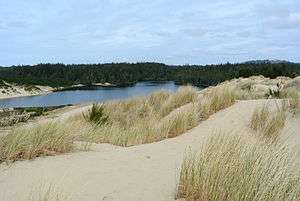 Panorama of the lake | |
| Location | Near Pacific Ocean coast in Lane County, Oregon |
| Coordinates | 43°55′52″N 124°06′51″W / 43.93111°N 124.11417°WCoordinates: 43°55′52″N 124°06′51″W / 43.93111°N 124.11417°W |
| Type | Natural, permanent, oligotrophic |
| Primary inflows | seepage |
| Primary outflows | none identified |
| Catchment area | 1.6 square miles (4.1 km2) |
| Basin countries | United States |
| Surface area | 87 acres (35 ha) |
| Average depth | 17 feet (5.2 m) |
| Max. depth | 48 feet (15 m) |
| Water volume | 1,500 acre feet (1,900,000 m3) |
| Residence time | 4 months |
| Shore length1 | 5.2 miles (8.4 km) |
| Surface elevation | 75 feet (23 m) |
| References | [1][2][3] |
| 1 Shore length is not a well-defined measure. | |

Cleawox Lake (klē’ ə woks),[4] is a body of water dammed by sand dunes along the Pacific Ocean coast of the U.S. state of Oregon.[1] The lake is about 3 miles (5 km) south of Florence along U.S. Route 101.[1] Sharing the lakeshore are private properties as well as Oregon Dunes National Recreation Area and Jessie M. Honeyman Memorial State Park, which also partly fronts on Woahink Lake.[1] Cleawox is derived from the Siuslaw name for the lake.[4]
Geology
Cleawox Lake is a submerged remnant of the headwaters of a small coastal stream that existed before the most recent ice age. The lake formed after melting glaciers caused a rise in sea level that drowned the lower reaches of the stream. Sediments from the sluggish stream formed sand dunes, behind which the lake was dammed. The dunes, estimated to be advancing northward at 15 to 20 feet (4.6 to 6.1 m) a year, are encroaching on the lake.[1]
Watershed
Covering only 1.6 square miles (4.1 km2), Cleawox Lake's drainage basin is separate from the nearby Woahink–Siltcoos watershed to the east and south. Water enters Cleawox from small surface streams and by seepage, and no surface outflow has been identified. Soils are sandy and well-drained and support mainly pines and shrubs. Although the lake is saltier than most other coastal lakes in Oregon, it is also more transparent.[1]
About 2 miles (3 km) of the lakeshore borders Oregon Dunes National Recreation Area, and about 1 mile (1.6 km) borders Honeyman State Park. The rest borders private property, including vacation homes and girl scout Camp Cleawox.[1]
Recreation
Park visitors use the lake for swimming, canoeing, and fishing for warm-water species and rainbow and coastal cutthroat trout.[1] In the state park, picnic tables have been set up in sight of the water.[5] No overnight camping is allowed next to the lake,[1] but nearby areas of the state park have many campsites.[5]
See also
References
- 1 2 3 4 5 6 7 8 9 Johnson, Daniel M.; Petersen, Richard R.; Lycan, D. Richard; Sweet, James W.; Neuhaus, Mark E., and Schaedel, Andrew L. (1985). Atlas of Oregon Lakes. Corvallis: Oregon State University Press. p. 170. ISBN 0-87071-343-4.
- ↑ "Cleawox Lake". Geographic Names Information System. United States Geological Survey. November 28, 1980. Retrieved April 21, 2012.
- ↑ "Atlas of Oregon Lakes: Cleawox Lake (Lane County)". Portland State University. 1985–2012. Retrieved April 21, 2012.
- 1 2 Bright, William (2004). Native American Placenames of the United States. Norman: University of Oklahoma Press. p. 111. ISBN 0-8061-3576-X.
- 1 2 Bannan, Jan (2002). Oregon State Parks (2nd ed.). Seattle: The Mountaineers Books. pp. 56–57. ISBN 0-89886-794-0.
External links
 Media related to Cleawox Lake at Wikimedia Commons