Claycomo, Missouri
| Claycomo, Missouri | |
|---|---|
| Village | |
 Location of Claycomo, Missouri | |
| Coordinates: 39°12′2″N 94°29′22″W / 39.20056°N 94.48944°WCoordinates: 39°12′2″N 94°29′22″W / 39.20056°N 94.48944°W | |
| Country | United States |
| State | Missouri |
| County | Clay |
| Area[1] | |
| • Total | 2.55 sq mi (6.60 km2) |
| • Land | 2.55 sq mi (6.60 km2) |
| • Water | 0 sq mi (0 km2) |
| Elevation | 807 ft (246 m) |
| Population (2010)[2] | |
| • Total | 1,430 |
| • Estimate (2012[3]) | 1,455 |
| • Density | 560.8/sq mi (216.5/km2) |
| Time zone | Central (CST) (UTC-6) |
| • Summer (DST) | CDT (UTC-5) |
| ZIP code | 64119 |
| Area code(s) | 816 |
| FIPS code | 29-14554[4] |
| GNIS feature ID | 0715915[5] |
| Website | http://www.claycomo.org/ |
Claycomo is a village in Clay County, Missouri, United States. The village’s name is a portmanteau of "Clay, Co" (Clay County), and "Mo" (Missouri).[6] The population was 1,430 at the 2010 census. Ford Motor Company has an assembly plant in Claycomo. Kansas City Assembly is responsible for building the Ford F-150 pickup trucks and the Ford Transit vans.
Geography
Claycomo is located at 39°12′2″N 94°29′22″W / 39.20056°N 94.48944°W (39.200507, -94.489404).[7]
According to the United States Census Bureau, the village has a total area of 2.55 square miles (6.60 km2), all of it land.[1]
Demographics
| Historical population | |||
|---|---|---|---|
| Census | Pop. | %± | |
| 1950 | 808 | — | |
| 1960 | 1,423 | 76.1% | |
| 1970 | 1,841 | 29.4% | |
| 1980 | 1,671 | −9.2% | |
| 1990 | 1,668 | −0.2% | |
| 2000 | 1,267 | −24.0% | |
| 2010 | 1,430 | 12.9% | |
| Est. 2015 | 1,468 | [8] | 2.7% |
2010 census
As of the census[2] of 2010, 1,430 people, 672 households, and 369 families resided in the village. The population density was 560.8 inhabitants per square mile (216.5/km2). The 759 housing units averaged 297.6 per square mile (114.9/km2). The racial makeup of the village was 95.1% White, 0.8% African American, 0.4% Native American, 0.6% Asian, 0.1% Pacific Islander, 1.7% from other races, and 1.3% from two or more races. Hispanics or Latinos of any race were 5.0% of the population.
Of the 672 households, 21.1% had children under the age of 18 living with them, 35.7% were married couples living together, 12.4% had a female householder with no husband present, 6.8% had a male householder with no wife present, and 45.1% were not families. About 38.2% of all households were made up of individuals, and 13.1% had someone living alone who was 65 years of age or older. The average household size was 2.13 and the average family size was 2.75.
The median age in the village was 45 years. Around 16.6% of residents were under the age of 18, 8.2% were between the ages of 18 and 24, 25.1% were from 25 to 44, 32.6% were from 45 to 64, and 17.6% were 65 years of age or older. The gender makeup of the village was 52.0% male and 48.0% female.
2000 census
As of the census[4] of 2000, 1,267 people, 596 households, and 345 families resided in the village. The population density was 506.0 people per square mile (195.7/km²). The median income for a household in the village was $39,271, and for a family was $44,861. Males had a median income of $29,531 versus $23,990 for females. The per capita income for the village was $20,000. About 4.3% of families and 4.7% of the population were below the poverty line, including 10.6% of those under age 18 and 5.7% of those age 65 or over.
References
- 1 2 "US Gazetteer files 2010". United States Census Bureau. Archived from the original on 2012-01-24. Retrieved 2012-07-08.
- 1 2 "American FactFinder". United States Census Bureau. Retrieved 2012-07-08.
- ↑ "Population Estimates". United States Census Bureau. Archived from the original on 2013-06-17. Retrieved 2013-05-30.
- 1 2 "American FactFinder". United States Census Bureau. Archived from the original on 2013-09-11. Retrieved 2008-01-31.
- ↑ "US Board on Geographic Names". United States Geological Survey. 2007-10-25. Retrieved 2008-01-31.
- ↑ "Clay County Place Names, 1928–1945 (archived)". The State Historical Society of Missouri. Archived from the original on 24 June 2016. Retrieved 19 September 2016.
- ↑ "US Gazetteer files: 2010, 2000, and 1990". United States Census Bureau. 2011-02-12. Retrieved 2011-04-23.
- ↑ "Annual Estimates of the Resident Population for Incorporated Places: April 1, 2010 to July 1, 2015". Retrieved July 2, 2016.
- ↑ "Census of Population and Housing". Census.gov. Archived from the original on May 11, 2015. Retrieved June 4, 2015.
Kansas City metropolitan area's cities and counties | ||
|---|---|---|
| Central city | 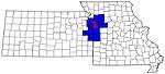 | |
| Largest cities (over 100,000 in 2000) | ||
| Medium-sized cities (10,000 to 100,000 in 2000) | ||
| Smaller Cities (between 5,000 and 9,900 in 2010) | ||
| Counties | ||
Municipalities and communities of Clay County, Missouri, United States | ||
|---|---|---|
| Cities | 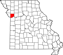 | |
| Villages | ||
| Townships |
| |
| Unincorporated communities | ||
| Footnotes | ‡This populated place also has portions in an adjacent county or counties | |