Clarks Knob
| Clarks Knob | |
|---|---|
 Clarks Knob | |
| Highest point | |
| Elevation | 2,316 ft (706 m) NAVD 88[1] |
| Coordinates | 40°2′52″N 77°45′2″W / 40.04778°N 77.75056°WCoordinates: 40°2′52″N 77°45′2″W / 40.04778°N 77.75056°W [1] |
| Geography | |
 Clarks Knob Location of Clarks Knob | |
| Location | Franklin County, Pennsylvania, U.S. |
| Parent range | Blue Mountain [2] |
| Topo map | USGS Roxbury (PA) Quadrangle [2] |
| Climbing | |
| Easiest route | Drive up gravel road [1] |
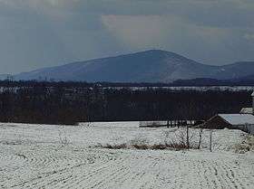
Clarks Knob is a summit in Franklin County, Pennsylvania.[3] It is the highest point on Blue Mountain, the eastern front range of Pennsylvania's Ridge and Valley Appalachians region.[2]
Geography
Clarks Knob's northeast-southwest running summit ridge forms the boundary of the Susquehanna River and Potomac River drainages.[2] It stands over 1,600 feet (488 m) above the town of Chambersburg and the Great Appalachian Valley. This mountain is protected within the Buchanan State Forest.[2]
References
- 1 2 3 "Clarks Knob". NGS data sheet. U.S. National Geodetic Survey. Retrieved 2009-02-08.
- 1 2 3 4 5 "Clarks Knob, Pennsylvania". Peakbagger.com. Retrieved 2009-02-07.
- ↑ "Clarks Knob". Geographic Names Information System. United States Geological Survey. Retrieved 2009-02-08.
This article is issued from Wikipedia - version of the 6/1/2015. The text is available under the Creative Commons Attribution/Share Alike but additional terms may apply for the media files.