Clarks Hill, Indiana
| Clarks Hill | |
|---|---|
| Town | |
|
Storefronts at the corner of White and Division streets. | |
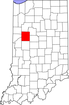 Tippecanoe County's location in Indiana | |
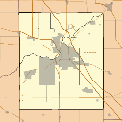 Clarks Hill Location in Tippecanoe County | |
| Coordinates: 40°14′49″N 86°43′26″W / 40.24694°N 86.72389°WCoordinates: 40°14′49″N 86°43′26″W / 40.24694°N 86.72389°W | |
| Country | United States |
| State | Indiana |
| County | Tippecanoe |
| Township | Lauramie |
| Area[1] | |
| • Total | 0.27 sq mi (0.70 km2) |
| • Land | 0.27 sq mi (0.70 km2) |
| • Water | 0 sq mi (0 km2) |
| Elevation[2] | 820 ft (250 m) |
| Population (2010)[3] | |
| • Total | 611 |
| • Estimate (2012[4]) | 637 |
| • Density | 2,263.0/sq mi (873.7/km2) |
| Time zone | EST (UTC-5) |
| • Summer (DST) | EDT (UTC-4) |
| ZIP code | 47930 |
| Area code(s) | 765 |
| FIPS code | 18-12898[5] |
| GNIS feature ID | 449638 |

Clarks Hill is a town in Lauramie Township, Tippecanoe County, Indiana, United States.[6] The population was 611 at the 2010 census.
It is part of the Lafayette, Indiana Metropolitan Statistical Area.
History
The Clarks Hill post office has been in operation since 1853.[7]
Geography
Clarks Hill is located at 40°14′49″N 86°43′26″W / 40.24694°N 86.72389°W (40.247036, -86.723863)[8] in Lauramie Township, at an elevation of 820 feet (250 m).
According to the 2010 census, Clarks Hill has a total area of 0.27 square miles (0.70 km2), all land.[1]
Demographics
| Historical population | |||
|---|---|---|---|
| Census | Pop. | %± | |
| 1900 | 539 | — | |
| 1910 | 463 | −14.1% | |
| 1920 | 435 | −6.0% | |
| 1930 | 428 | −1.6% | |
| 1940 | 381 | −11.0% | |
| 1950 | 493 | 29.4% | |
| 1960 | 654 | 32.7% | |
| 1970 | 741 | 13.3% | |
| 1980 | 653 | −11.9% | |
| 1990 | 716 | 9.6% | |
| 2000 | 680 | −5.0% | |
| 2010 | 611 | −10.1% | |
| Est. 2015 | 677 | [9] | 10.8% |

2010 census
As of the census[3] of 2010, there were 611 people, 230 households, and 164 families residing in the town. The population density was 2,263.0 inhabitants per square mile (873.7/km2). There were 270 housing units at an average density of 1,000.0 per square mile (386.1/km2). The racial makeup of the town was 97.9% White, 0.2% African American, 0.3% Native American, and 1.6% from two or more races. Hispanic or Latino of any race were 1.1% of the population.
There were 230 households of which 40.4% had children under the age of 18 living with them, 51.3% were married couples living together, 14.3% had a female householder with no husband present, 5.7% had a male householder with no wife present, and 28.7% were non-families. 24.8% of all households were made up of individuals and 5.6% had someone living alone who was 65 years of age or older. The average household size was 2.66 and the average family size was 3.16.
The median age in the town was 36.2 years. 29.3% of residents were under the age of 18; 8.3% were between the ages of 18 and 24; 26.3% were from 25 to 44; 26% were from 45 to 64; and 10% were 65 years of age or older. The gender makeup of the town was 50.6% male and 49.4% female.
2000 census
As of the census[5] of 2000, there were 680 people, 241 households, and 188 families residing in the town. The population density was 2,474.5 people per square mile (972.4/km²). There were 260 housing units at an average density of 946.1 per square mile (371.8/km²). The racial makeup of the town was 92.09% White, 6.15% African American, 0.44% Native American, 0.15% Asian, 0.74% from other races, and 0.44% from two or more races. Hispanic or Latino of any race were 1.03% of the population.
There were 241 households out of which 44.4% had children under the age of 18 living with them, 60.2% were married couples living together, 12.9% had a female householder with no husband present, and 21.6% were non-families. 17.8% of all households were made up of individuals and 7.9% had someone living alone who was 65 years of age or older. The average household size was 2.82 and the average family size was 3.18.
In the town the population was spread out with 33.1% under the age of 18, 8.8% from 18 to 24, 30.9% from 25 to 44, 19.1% from 45 to 64, and 8.1% who were 65 years of age or older. The median age was 31 years. For every 100 females there were 91.0 males. For every 100 females age 18 and over, there were 97.8 males.
The median income for a household in the town was $35,893, and the median income for a family was $40,268. Males had a median income of $30,208 versus $22,368 for females. The per capita income for the town was $12,773. About 5.1% of families and 10.1% of the population were below the poverty line, including 14.9% of those under age 18 and 6.1% of those age 65 or over.
References
- 1 2 "G001 - Geographic Identifiers - 2010 Census Summary File 1". United States Census Bureau. Retrieved 2015-07-14.
- ↑ "US Board on Geographic Names". United States Geological Survey. 2007-10-25. Retrieved 2008-01-31.
- 1 2 "American FactFinder". United States Census Bureau. Retrieved 2012-12-11.
- ↑ "Population Estimates". United States Census Bureau. Archived from the original on 2013-06-17. Retrieved 2013-06-25.
- 1 2 "American FactFinder". United States Census Bureau. Archived from the original on 2013-09-11. Retrieved 2008-01-31.
- ↑ "Clarks Hill, Indiana". Geographic Names Information System. United States Geological Survey. Retrieved 2016-07-25.
- ↑ "Tippecanoe County". Jim Forte Postal History. Archived from the original on September 9, 2005. Retrieved July 25, 2016.
- ↑ "US Gazetteer files: 2010, 2000, and 1990". United States Census Bureau. 2011-02-12. Retrieved 2011-04-23.
- ↑ "Annual Estimates of the Resident Population for Incorporated Places: April 1, 2010 to July 1, 2015". Retrieved July 2, 2016.
- ↑ "Census of Population and Housing". Census.gov. Archived from the original on May 11, 2015. Retrieved June 4, 2015.
Municipalities and communities of Tippecanoe County, Indiana, United States | ||
|---|---|---|
| Cities | ||
| Towns | ||
| Townships | ||
| CDPs | ||
| Other unincorporated communities |
| |
| Ghost towns | ||
| Footnotes | ‡This populated place also has portions in an adjacent county or counties | |