Clark-Fulton
| Clark-Fulton | |
|---|---|
| Neighborhoods of Cleveland | |
|
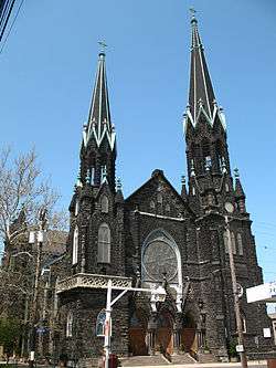
St. Michael the Archangel Church at 3114 Scranton Road is on the National Register of Historic Places. | |
| Country | United States |
| State | Ohio |
| County | Cuyahoga County |
| City | Cleveland |
| Population (2000) | |
| • Total | 18,185 |
| Demographics | |
| • White | 38% |
| • Black | 15% |
| • Hispanic | 46% |
| • Asian | 1% |
| Time zone | EST (UTC-5) |
| • Summer (DST) | EDT (UTC-4) |
| ZIP Codes | parts of 44109,44102 and 44113 |
| Area code(s) | 216 |
| Median income | $24,842 |
| Source: 2000 U.S. Census, City Planning Commission of Cleveland [1] | |
Clark-Fulton is a neighborhood on the west side of Cleveland, Ohio. It is bounded roughly by Clark Avenue to the north, Scranton Road to the east, Daisy Avenue and I-71 to the south, and W.48th Street on the west. Clark-Fulton has one of highest concentrations of Puerto Ricans, and Hispanics overall, in the city.
References
- ↑ "Clark-Fulton Neighborhood Fact Sheet" (PDF). Cleveland City Planning Commission. Retrieved July 19, 2011.
External links
- Stockyard, Clark-Fulton & Brooklyn Centre Neighborhood Development Office
 Media related to Clark-Fulton at Wikimedia Commons
 |
Detroit-Shoreway | Ohio City | Tremont | |
| Stockyards | |
|||
| ||||
| | ||||
| Brooklyn Centre |
Coordinates: 41°28′N 81°43′W / 41.467°N 81.717°W
This article is issued from Wikipedia - version of the 10/9/2016. The text is available under the Creative Commons Attribution/Share Alike but additional terms may apply for the media files.