Clarinda, Iowa
| Clarinda, Iowa | |
|---|---|
| City | |
 | |
| Motto: "Honor the Past...Imagine the Future"[1] | |
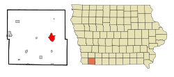 Location of Clarinda, Iowa | |
| Coordinates: 40°44′15″N 95°2′9″W / 40.73750°N 95.03583°WCoordinates: 40°44′15″N 95°2′9″W / 40.73750°N 95.03583°W | |
| Country |
|
| State |
|
| County | Page |
| Area[2] | |
| • Total | 5.22 sq mi (13.52 km2) |
| • Land | 5.19 sq mi (13.44 km2) |
| • Water | 0.03 sq mi (0.08 km2) |
| Elevation | 1,043 ft (318 m) |
| Population (2010)[3] | |
| • Total | 5,572 |
| • Estimate (2012[4]) | 5,483 |
| • Density | 1,073.6/sq mi (414.5/km2) |
| Time zone | Central (CST) (UTC-6) |
| • Summer (DST) | CDT (UTC-5) |
| ZIP code | 51632 |
| Area code(s) | 712 |
| FIPS code | 19-13575 |
| GNIS feature ID | 0455425 |
| Website | City of Clarinda, Iowa Website |
Clarinda is a city in and the county seat of Page County, Iowa, United States.[5] The population was 5,572 in the 2010 census, a decline from the 5,690 population in the 2000 census.[6][7]
History
Clarinda was founded in 1851, and incorporated on December 8, 1866.[8] Many stories are told of such notables as Jesse James frequently passing through.
The town is named for Clarinda Buck, who according to legend carried water to the surveyors while Page County was first being surveyed.[9]
The best known national firm in Clarinda for many decades was Berry's Seed Company, a mail order farm seed distribution business founded in 1885 at Clarinda by A. A. Berry. Berry's Seed Company diversified into retail stores in the 1950s, but the stores were sold off over the following decade, and today the company, known as Berry's Garden Center, operates from its one remaining retail outlet in Danville, Illinois.[10]
In 1943 during World War II, an internment camp designed for 3,000 prisoners of war with sixty barracks and a 150-bed hospital was built in Clarinda. German prisoners were the first to arrive at Camp Clarinda, followed in 1945 by Italian and Japanese POWs.[11]
Camp Clarinda was located by what today is the town's municipal airport, Schenck Field (named for aviator/farmer Ray Schenck, who built the original Clarinda Airport on the location).
Early in its history, Clarinda was served by railroads from 5 different directions - all were predecessors to the Chicago, Burlington, and Quincy Railroad (CB&Q). In 1946, service was lost on the east-west line and the line to Tarkio, MO, through Coin, IA. Service was maintained south of Clarinda until the 1950s and then was trimmed back to a branch serving Clarinda from the main line at Villisca, IA. This line survived a merger into the Burlington Northern but was abandoned in the 1980s. Clarinda now joins a growing list of county seats in Iowa without rail service.[12]
The southeast area of Clarinda was once dubbed "Gun Town" and remains known by that name today. A noted author wrote, "In the twenties and thirties, Clarinda seemed to be two separate towns: Guntown and Uptown. In the middle of the square was, and still is, the courthouse. The four blocks surrounding it are filled with businesses. Guntown was a town all its own. The 700 block of East Garfield was a solid block of businesses--grocery stores, barber, a Chinese restaurant, another restaurant on a corner, a rug factory, a large grocery, the Swifts packing plant, and railroad tracks with freight depot and roundhouse to turn trains around."[13]
Geography
Clarinda is located at 40°44′15″N 95°2′9″W / 40.73750°N 95.03583°W (40.737599, -95.035928)[14] along the West Nodaway River just north of the confluence of the East Nodaway River.
According to the United States Census Bureau, the city has a total area of 5.22 square miles (13.52 km2), of which, 5.19 square miles (13.44 km2) is land and 0.03 square miles (0.08 km2) is water.[2]
Demographics
| Historical population | |||
|---|---|---|---|
| Census | Pop. | %± | |
| 1860 | 427 | — | |
| 1870 | 1,022 | 139.3% | |
| 1880 | 2,011 | 96.8% | |
| 1890 | 3,262 | 62.2% | |
| 1900 | 3,276 | 0.4% | |
| 1910 | 3,832 | 17.0% | |
| 1920 | 4,511 | 17.7% | |
| 1930 | 4,962 | 10.0% | |
| 1940 | 4,905 | −1.1% | |
| 1950 | 5,086 | 3.7% | |
| 1960 | 5,901 | 16.0% | |
| 1970 | 5,420 | −8.2% | |
| 1980 | 5,458 | 0.7% | |
| 1990 | 5,104 | −6.5% | |
| 2000 | 5,690 | 11.5% | |
| 2010 | 5,572 | −2.1% | |
| Est. 2015 | 5,418 | [15] | −2.8% |
2010 census
As of the census[3] of 2010, there were 5,572 people, 1,928 households, and 1,153 families residing in the city. The population density was 1,073.6 inhabitants per square mile (414.5/km2). There were 2,180 housing units at an average density of 420.0 per square mile (162.2/km2). The racial makeup of the city was 89.2% White, 5.6% African American, 1.1% Native American, 1.5% Asian, 0.1% Pacific Islander, 0.8% from other races, and 1.7% from two or more races. Hispanic or Latino of any race were 3.2% of the population.
There were 1,928 households of which 26.1% had children under the age of 18 living with them, 45.3% were married couples living together, 10.2% had a female householder with no husband present, 4.4% had a male householder with no wife present, and 40.2% were non-families. 35.3% of all households were made up of individuals and 18% had someone living alone who was 65 years of age or older. The average household size was 2.19 and the average family size was 2.80.
The median age in the city was 40 years. 21.1% of residents were under the age of 18; 8.9% were between the ages of 18 and 24; 26.4% were from 25 to 44; 25.6% were from 45 to 64; and 18% were 65 years of age or older. The gender makeup of the city was 57.6% male and 42.4% female.
2000 census
As of the census[17] of 2000, there were 5,690 people, 2,017 households, and 1,246 families residing in the city. The population density was 1,096.1 people per square mile (423.3/km²). There were 2,188 housing units at an average density of 421.5 per square mile (162.8/km²). The racial makeup of the city was 92.02% White, 4.62% African American, 0.65% Native American, 1.09% Asian, 0.04% Pacific Islander, 0.51% from other races, and 1.07% from two or more races. Hispanic or Latino of any race were 1.41% of the population.
There were 2,017 households out of which 27.5% had children under the age of 18 living with them, 49.4% were married couples living together, 9.8% had a female householder with no husband present, and 38.2% were non-families. 34.7% of all households were made up of individuals and 18.0% had someone living alone who was 65 years of age or older. The average household size was 2.21 and the average family size was 2.83.
Age spread: 22.1% under the age of 18, 9.3% from 18 to 24, 29.8% from 25 to 44, 19.5% from 45 to 64, and 19.3% who were 65 years of age or older. The median age was 38 years. For every 100 females there were 121.7 males. For every 100 females age 18 and over, there were 122.2 males.
The median income for a household in the city was $35,871, and the median income for a family was $43,654. Males had a median income of $35,061 versus $23,635 for females. The per capita income for the city was $15,136. About 9.9% of families and 16.3% of the population were below the poverty line, including 18.2% of those under age 18 and 6.6% of those age 65 or over.
Economy
NSK-AKS (a subsidiary of the Japanese corporation NSK Ltd.) operates a manufacturing plant in Clarinda that produces ball and roller bearings.[18][19]
Lisle Corporation, which makes hand tools and garage creepers for auto mechanics, was founded in Clarinda in 1903.
A large mental health center, the Clarinda Treatment Complex, is located on the north edge of the city. It was established in 1884 as the third mental asylum in the state of Iowa. It continues operation today and treats sex offenders, the mentally ill, alcoholics, drug addicts, and the criminally insane.
Clarinda Academy is a private prep school that is home to 250 boys and girls from all over the country. CA employs over 200 employees and was founded in 1992.
Sports
Clarinda is the home of the Clarinda A's, a summer amateur baseball team. The team won the 1981 National Baseball Congress championship. It has sent several players on to the major leagues, notably hall of famer Ozzie Smith, who regularly returns to Clarinda for special events.[20]
Iowa Western Community College fielded Nationally Ranked junior college baseball teams from 1982 through 1984. Compiling a record of 119 wins and 26 losses during that time, the IWCC Bluejays were nationally ranked as high as 9th in the nation in 1982, ranked 4th in 1983 and the 1984 team was ranked 6th nationally and went to the National Junior College World Series in Grand Junction, Colorado. Coach Jeff DuPre's teams had a total of 10 players drafted during the three-year span and had players continue their college careers at schools such has Arizona State, Nebraska, Illinois, South Alabama, Jacksonville, Louisiana Tech, Grand Canyon State and South Carolina/Aiken. The 1982 to 1984 span also produced 6 All-American players, with George Gonzalez being First Team All American in 1982. The 1982 team set a Junior College record at the time with a .390 batting avaerage. When the IWCC Bluejays went to the 1984 NJCAA World Series they were the smallest school ever to qualify.
Arts and culture
Clarinda Picture Gallery
Education
Clarinda is home to a campus of Iowa Western Community College and the Clarinda Academy, a residential foster care facility that provides residential treatment and shelter care to at-risk and delinquent male and female youth from several states.
Infrastructure
Health care
In 1884, the citizens rallied to build the third mental hospital in the state of Iowa. Today, the Clarinda State Hospital is known as the Clarinda Treatment Complex and the hospital is located on the north end of the city. In 1939, the Clarinda Municipal Hospital was created. In 1997, Clarinda Municipal Hospital's name was changed by its Board of Trustees to Clarinda Regional Health Center. In January 2012, the Clarinda Regional Health Center (CRHC) moved into a new replacement hospital and clinic facility on the south edge of Clarinda. CRHC is a municipal, non-profit, Critical Access Hospital licensed for 25 in-patient beds.
State prison
Clarinda also holds a state prison called the Clarinda Correctional Facility.
Notable people
- Vernon Baker, one of 7 African-American World War II Medal of Honor recipients
- Edwin Harris Colbert, paleontologist
- William Peters Hepburn, U.S. Representative
- Norman Maclean, author of A River Runs Through It
- Marilyn Maxwell, singer
- Glenn Miller, 1940s big band leader
- Jessie Field Shambaugh, founder of 4-H
References
- ↑ "City of Clarinda, Iowa". City of Clarinda, Iowa. Retrieved September 2, 2012.
- 1 2 "US Gazetteer files 2010". United States Census Bureau. Archived from the original on 2012-01-24. Retrieved 2012-05-11.
- 1 2 "American FactFinder". United States Census Bureau. Retrieved 2012-05-11.
- ↑ "Population Estimates". United States Census Bureau. Archived from the original on 2013-06-17. Retrieved 2013-05-23.
- ↑ "Find a County". National Association of Counties. Archived from the original on 2011-05-31. Retrieved 2011-06-07.
- ↑ "Population & Housing Occupancy Status 2010". United States Census Bureau American FactFinder. Archived from the original on 2011-07-21. Retrieved 2011-08-06.
- ↑ "Data from the 2010 Census". State Data Center of Iowa. Archived from the original on 2011-07-18. Retrieved 2011-08-06.
- ↑ "Clarinda, Iowa". City-Data.com. Retrieved September 2, 2012.
- ↑ http://www.iowacounties.org/Corporate%20Opportunities/About%20Us/AboutCoGov/County%20Pages/Page.htm
- ↑ http://www.berrysgarden.com.
- ↑ Sullivan, Ken. - "POW camps - Thousands of German prisoners held during war in Iowa, Midwest". - The Gazette. - December 16, 2001. | - Kilen, Mike. - "When War Marched Into Iowa". - Des Moines Register. - September 23, 2007.
- ↑ Rand-McNally Corp. Handy Railroad Maps of the United States, 1928
- ↑ Juanita Seeley. "Gun Town, My Hometown."
- ↑ "US Gazetteer files: 2010, 2000, and 1990". United States Census Bureau. 2011-02-12. Retrieved 2011-04-23.
- ↑ "Annual Estimates of the Resident Population for Incorporated Places: April 1, 2010 to July 1, 2015". Retrieved July 2, 2016.
- ↑ "Census of Population and Housing". Census.gov. Archived from the original on May 11, 2015. Retrieved June 4, 2015.
- ↑ "American FactFinder". United States Census Bureau. Archived from the original on 2013-09-11. Retrieved 2008-01-31.
- ↑ NSK Corporation U.S. Facilities. - NSK Ltd..
- ↑ Ford, George C. - "U.S., Japanese firms share need for skilled, educated work force". The Gazette. - September 25, 1994.
- ↑ Gray, Rob. - "Smith remembers days as `Osborne' in Clarinda". - Des Moines Register. - January 20, 2002. | - Clark, Bill. - "Town proves baseball still is America's game". - Columbia Daily Tribune. - January 14, 2009.
External links
| Wikimedia Commons has media related to Clarinda, Iowa. |
- City of Clarinda, Iowa Website Portal style website, Government, Business, Library, Recreation and more
- Clarinda Chamber of Commerce
- Clarinda Economic Development Corporation
- City-Data Comprehensive statistical data and more about Clarinda
Municipalities and communities of Page County, Iowa, United States | ||
|---|---|---|
| Cities | ||
| Townships | ||
| Footnotes | ‡This populated place also has portions in an adjacent county or counties | |